DJI Mavic, Air and Mini Drones
Friendly, Helpful & Knowledgeable Community
Join Us Now

Struggling to get a 360 pano

Nerwesta

Member
Joined
Dec 20, 2017
Messages
24
Reactions
5
Age
31
Location
Brittany , France.
Hey guys , this is my second attempt to make a 360 panorama with my Mavic Pro , the first one was a real mess since it was near a coast with big waves ... see the logic ... yes I'm dumb.
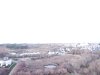
The second one though was in a clear field, and see one of the result :

I'm going out to train myself with the settings, but I'd have to say this is very hard to get some cute photos when you're a newbie on it ( willing to learn !!! ) my old Phantom was Ok doing this all on Auto mode with RAWs.

When I see those kind of Panoramas in websites such as :

Banner Mountain Lookout Tower, Nevada City, CA [v6c]

I'm really wondering if I have the same drone , really , since I just bought it recently I'm hoping this is just a lack of experience in term of Photography and nothing else concerning the hardware or stuff...

And of course, thanks for your help for pointing out my mistakes on that, especially on attached files. I'm going out to see if I can inprove those things by myself. I've watched some tuto videos , could be useful :p

PS : I'll do another topic concerning my photos , not the 360 pano mode, because I'm also not totally happy on it , this is kinda stressful when I see some very cute footage from you guys here.
 

Attachments

  • PANO0024.JPG
    PANO0024.JPG
    5 MB · Views: 72
  • PANO0012.JPG
    PANO0012.JPG
    3.7 MB · Views: 76
Last edited:
Hey guys , here is a little final view of my mistakes , that's a little bit frustrating.

1519916506-rate.jpg


1519916601-rate2.jpg


As you can see I have a strange render when I upload it on a 360° website , also it seems that Lightroom didn't like stitiching my first and last image ( the sun in my back )
The screens were taken in 360cities , but I got the same render in Momento360.
About the sun, I guess that's a UAV + Pilot problem about exposure and stuff , but since the 360 pano is an automated mode ... I don't really know.

The original pano ( I resized it to get it light for the web ) :

originalpanolight.jpg

Thanks for lighting me up , thanks for your help :) Have a good day.
 
Last edited:
So, if I understand your posts - it sounds like you are uploading the individual images to these sites and letting the sites do the stitching...? You would be waaaaay better off stitching them yourself and then editing the final version in something like Lightroom or Photoshop.

The "Banner Mountain" pano you referenced above is mine. I'm glad you like it. That was shot using Litchi, stitched using the best stitching program out there, Autopano Giga, and finally touched up in Photoshop. The key here is to use a good stitching program like Autopano Giga or PTGui. That Banner Mountain shot did not stitch well - initially. There was a section of the horizon that was always off. In Autopano Giga I was able to individually adjust the frames to bring them into alignment.

My point is that some of the best panos require some work a a good stitching program.
 
Hello Qoncussion and thanks for your reply.
Sorry I wasn't very clear on my post, I'm using Photoshop Lightroom to stitch the photos taken together, here came my original pano from there in the bottom of my message , which is in my opinion not very good especially when you're looking at the horizon.

Yes I liked your panorama so much just like other taken from a Mavic Pro , I found an interesting one in that forum but I lost the link , a pilot made a Panorama using Dji GO Pano Mode stitiching with Lightroom , then another in the same location using Litchi which was a little bit better.
In the end the Dji GO one was nearly perfect in my opinion, far from what I've done yet.

So to answer about your useful advice , I'm using a Mavic Pro with Dji GO Pano Mode , Photoshop Lightroom to stitch , so I guess those tools are very fine, frustrating me even more about what i've done wrong ... :p

Thanks for your help
 
While I am not a Lightroom user, I really dislike the stitching that Photoshop does. It gets it wrong almost every time. I would imagine that the stitching engine is similar in LR. From the images you posted above (post #2), LR did a really bad job of blending the exposures across images. Many people here use Microsoft ICE ~which is a free stitching program. You might want to try that.

Also, the perspective is off. You probably need to select an option to tell it that it is a *spherical* pano. Finally, a true 360 pano actually measures 360x180. That's a 2:1 ratio. Meaning ~the first thing you want to do after stitching the images together is to resize the canvas. Your final image must measure out at 2:1; so if your pano is 20,000 pixels wide, you must extend the canvas to make the height 10,000 pixels high. This does not mean stretching the image. Instead, you're just going to add some dead-space to the top of the pano.

Here's the problem when shooting from a platform, such as a drone, which (in our case) can only shoot 30° above the horizon... The Mavic's camera can only look *up* 30° above the horizon, before it starts taking photos of your props. So 30° above 90° (90 being shooting straight forward) is 120° from the ground (nadir) up... leaving 60° of unphotographed sky, to the zenith (the point directly overhead). So you have to compensate for that by stretching the canvas (not the image itself) height to equal half of the width.

Here's one (NOT my best work) where I didn't really care about filling in the sky, so I just threw some psychedelic artwork at the top of it... But I think it shows my point:

Bear Valley Sunset [2017 12 12]
 
Since you have me discussing this with you (and good luck getting me to shut up) :) ~ here are more test panos that I've been doing - just (like you) to try and get better at it.

Here, I mounted a GoPro on top of the Mavic and shot the sky... So this is a true 360x180:

Jackass Flats Hydraulic Mining, Nevada City, California

At the same location as the image above, I shot this last week. The sky was clear blue - not a single cloud in sight. So I cut out the sun, from the original pano, removed the sky (entirely), and used the gradient tool in PS to match the colors of the sky that was in the original pano, to extend the sky up to 180°. Then I just added the sun back in over the new sky and blended it to match the fake sky colors:

Bear Valley - Clear Blue Day in February 2018

If you're anything like me ~these panos become kind of addictive. They can be a challenge - but when you get it right - they can be pretty awesome.
 
Well yes you're right I guess they both use the same engine , I'm not very experienced in Lightroom tho but there are plenty articles that say it's engine is fine.

Best Program for Stitching Panoramas: Photoshop, Lightroom, or Ice?

I'll give Microsoft ICE a try then.


Also, the perspective is off. You probably need to select an option to tell it that it is a *spherical* pano.

Here is what I got from my own Lightroom before the process.
Shall I uncheck " Auto-Crop " ? I just saw a guy from Youtube who was actually checking it.

1519931151-panoramasettings.jpg


However I guess I'm missing something important on my process , and you pointed it out there.

Finally, a true 360 pano actually measures 360x180. That's a 2:1 ratio. Meaning ~the first thing you want to do after stitching the images together is to resize the canvas. Your final image must measure out at 2:1; so if your pano is 20,000 pixels wide, you must extend the canvas to make the height 10,000 pixels high. This does not mean stretching the image. Instead, you're just going to add some dead-space to the top of the pano.


My image is 18743x6973 so I guess that's the main issue here !!! :D

Here's the problem when shooting from a platform, such as a drone, which (in our case) can only shoot 30° above the horizon...

I read a couple of weeks ago that "problem" in our case , filling the sky in black or something like that would be a good workaround at the moment , but forgot it when I was stitching my photos.
Of course I could just make it more beautiful to see using Photoshop with some brushs, but ...

Since I can't even have a proper 360° panorama from my photos I would say :

"One step at a time."

I wish we had a tutorial for "How to make a proper 360°" from experienced panoramas users like you on this forum , it could help a lot of Mavic pilots including me.
As far as I know I didn't see such a thread like that on this website, googled a lot too , and ended to watch some Youtube videos but it was too fuzzy for me.

And here is what I was talking about on my older post , finally got the link of that thread :

360 degree pano.....Litchi vs DJIgo


Thanks for helping !
 
Last edited:
  • Like
Reactions: Qoncussion
Since you have me discussing this with you (and good luck getting me to shut up) :)

Ahah thanks for helping anyway , your panoramas are giving me a lot of motivation to at least do in the same way , much appreciated.
As I was stated before , I'm focusing to have at least a good 360° pano before trying to enhance that black hole from above.
But I must say you did a good work here ! Really :)
Oh and I forgot to say, you got some nice landscapes to shoot panoramas , lucky you :D
 
Last edited:
pspanorama

Ok so with your help I figured to have a clean 360 panorama.
But the quality itself sounds a little bit blurry for me ..
I had to resize my panorama from 20000x10000 px to 8000x4000 in order to save it from Photoshop.

Which resolution do you normally use ?

Thank you so much.
 
If you take your panorama in optimum conditions I reckon It is far easier to stitch it with MS ICE than in Lightroom. By optimum I mean when the sun is near the Zenith so out of shot and not with the horizon full of ocean. Run your images through ICE, then extend the canvas to 2:1 in photoshop and you should have an excellent pano with minimum fuss. If you are on a PC grab a copy of FSPViewer which is an excellent free and fast offline viewer to check your results prior to posting them online.
 
OTOH if you want zero fuss and you fly with IOS devices grab the free Hangar360 app and it does everything for you including posting the completed 360 online.
 
pspanorama

Ok so with your help I figured to have a clean 360 panorama.
But the quality itself sounds a little bit blurry for me ..
I had to resize my panorama from 20000x10000 px to 8000x4000 in order to save it from Photoshop.

Which resolution do you normally use ?

Thank you so much.
20,000 x 10,000 is my standard resolution - it makes a big difference - as you've seen - once it has been uploaded. If the PS file gets too big, you can always remove any unused layers. Even as low as 16k x 8k yields decent results.
 
Qoncussion what is the appeal of using 360cities to host your panos? Your panos are really good, but IMO the 360cities site swamps them with ads and really takes away from them. Have you looked at using kuula.co instead? It is free to use for public posts and seemingly less ad driven. If you pay a subscription you can post unlisted panos too and gain various other features like interactive linked panos.

This guy Hawaii Resolution has posted some great stuff there. Done simply with DJIGo, stitched with Autopano and then tweaked in PS & LR.

Makapuʻu is the extreme eastern end of the Island of Oʻahu in the Hawaiian Islands, comprising the remnant of a ridge that rises 647 feet (197 m) above the sea

Mine are no where near his standard but I have been able to get pretty good results simply using DJiGo to capture, PTGui to stitch and then a quick tweak in PS and LR

Mount Litptrap 19Jan 2018 <- Tiny Planet

Mount Litptrap 19Jan 2018 <-regular view

This one was stitched in ICE which did not do such a good job of the horizon but I am more than happy with it.

BellPoint
 
If you take your panorama in optimum conditions I reckon It is far easier to stitch it with MS ICE than in Lightroom. By optimum I mean when the sun is near the Zenith so out of shot and not with the horizon full of ocean. Run your images through ICE, then extend the canvas to 2:1 in photoshop and you should have an excellent pano with minimum fuss. If you are on a PC grab a copy of FSPViewer which is an excellent free and fast offline viewer to check your results prior to posting them online.


Yeah I fully understand what you said , the sunset wasn't the perfect playground for a begginner like me , I'll give it a try earlier in the day when the sun is still high.
Thanks for your advice :)

20,000 x 10,000 is my standard resolution - it makes a big difference - as you've seen - once it has been uploaded. If the PS file gets too big

I assume you save your file in .tif format ? Whenever I do that I get a download error from 360cities and PS doesn't allow me to extract a file this big in Jpg , for mysterious reasons.
I'm currently blocked with that silly 8192x4096 and obviously not happy with it ...


This one was stitched in ICE which did not do such a good job of the horizon but I am more than happy with it.

BellPoint


It's just awesome ! :eek:
 
I assume you save your file in .tif format ? Whenever I do that I get a download error from 360cities and PS doesn't allow me to extract a file this big in Jpg , for mysterious reasons.
I'm currently blocked with that silly 8192x4096 and obviously not happy with it ...
Unfortunately, no... JPG only. I live in the mountains where our internet speed (especially upload speed) is so slow and unreliable, that it would be faster for me to copy my files to a flash drive and walk them over to wherever I'm trying to post.
 
Forget Adobe tools for 360 stitching, they aren't made to be 360-aware so won't ever care about the 2 edges matching. They will also not take into account that the horizon must be centered even if that means potentially missing content on top, they'll just do with what they have and the alignment is whatever comes of it (that's what causes the "V" mess in your 2nd post).

What I usually do is shoot DNG, take that into LR and do a pano merge (yes it sounds strange after what I just said above :p ) but only so I can make global adjustments on the merged image (levels, clarity, vibrance...) as I like. I then copy those settings onto all the individual DNGs, export them as JPG and discard the merged image.
Then load all of the JPGs in PtGui, which typically makes a great job first try with no adjustments necessary. Export that.
Then if it looks like it might work I load the result into Photoshop and attempt a content-aware fill for the missing sky. If not too detailed it will work, just cause a line again becasue of PS having no idea about 360 but since that's high up it's not too bad and anyway better than nothing.

Original below is 18748 x 9374 Pixels (175.74 MPixels) but sized down to 16k x 8k which is the max supported by the site... which compresses quite visibly too, significant loss of quality.

Manually processed 360
 
Last edited:
  • Like
Reactions: Qoncussion
Yeah the Kuula site is max 16384 to be precise as I use it so much it is committed to memory..

MS-ICE is much simpler than PTGUI when it works and it is totally free. You just right click your image set in MS explorer and click the context menu send to the context menu "Stitch using MS composition editor" and about three clicks later you have your stitched pano. So simple. But my fall back is definitely PTGUI. It has a fair learning curve though.

Kuula is a terrific hosting site as it has lots of features.

Is allows you to nest all sorts of media within a Pano and link multiple Panos into a tour like this one
(MS ICE stitched BTW)

The Headwaters - Virtual Tour

Which forms part of a collection

The Headwaters - Collection
 
  • Like
Reactions: Aww@Mavic
PTGUI has been a 3-click process for me everytime so far too.

But indeed, ICE seems to work great as well, had never really tried. Except that it doesn't seem to want to align the horizon for 360 either requiring to reprocess the result for display in the common programs. Nothing bad, a couple of clicks before attempting a fill, but still...

Seems to make 20480px wide images so bumps up the size to 210MP, nice for boasting :p
 
Last edited:
Unfortunately, no... JPG only. I live in the mountains where our internet speed (especially upload speed) is so slow and unreliable, that it would be faster for me to copy my files to a flash drive and walk them over to wherever I'm trying to post.


Well , gimme a high fives. :D I'm currently living in a small city in France and we just got fiber connection installed few days ago , in 2k18 :D
So I have to deal with my incredibly low internet speed at least for a month.


̶I̶'̶m̶ ̶s̶t̶i̶l̶l̶ ̶l̶o̶o̶k̶i̶n̶g̶ ̶f̶o̶r̶ ̶a̶ ̶w̶o̶r̶k̶a̶r̶o̶u̶n̶d̶ ̶t̶o̶ ̶m̶a̶k̶e̶ ̶a̶ ̶l̶a̶r̶g̶e̶r̶ ̶j̶p̶g̶ ̶f̶i̶l̶e̶ ̶f̶r̶o̶m̶ ̶P̶S̶ ̶.̶.̶.̶

EDIT :

Done ! I was not used at all to make or work with large large resolution, so I was used to save using the tool " Web and Devices " , obviously it wasnt the perfect solution.
However Microsoft ICE worked perfectly on my panorama , I was really impressed for a free software.


Kuula is a terrific hosting site as it has lots of features.

Is allows you to nest all sorts of media within a Pano and link multiple Panos into a tour like this one
(MS ICE stitched BTW)

The Headwaters - Virtual Tour

Which forms part of a collection

The Headwaters - Collection

Wow so impressive , the features are actually very nice :D


Thanks for your advices guys :) Much appreciated
 
Last edited:
  • Like
Reactions: Qoncussion
Just tried MS ICE and this is the result. Not sure what when wrong. It stitched ok into DJIGO

upload_2018-3-22_16-37-42.png
 
Lycus Tech Mavic Air 3 Case

DJI Drone Deals

New Threads

Forum statistics

Threads
131,211
Messages
1,560,925
Members
160,174
Latest member
Vlad_Zherikhov