DJI Mavic, Air and Mini Drones
Friendly, Helpful & Knowledgeable Community
Join Us Now

Understanding waypoint relationship betweer agl and asl

WMartz

Member
Joined
Sep 19, 2018
Messages
10
Reactions
2
Age
81
Hello, I lost my Mavic 2 to a tree in a large northern bog and am not sure why. My 4th way point was almost 300 feet higher asl then the first waypoint so I selected 300 agl box in litchi mission hub but that was incorrect as the drone hit a tree. I attached the mission to this message to view. I flew the mavic 2 seven times on waypoint missions using Litchi before this failure and everything went just fine. Note: the terrain on the previous missions was all at the same asl distance. Thanks to anyone who could help me understand what went wrong. Crash was between points 4 and 5.
I will attach the mission as soon as I know what file extension to us.
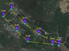
Here is the mission hub link: Mission Hub - Litchi
Bill Martz
 

Attachments

  • AGL-VS-ASL-route.gif
    AGL-VS-ASL-route.gif
    786.6 KB · Views: 49
Last edited:
I will attach the mission as soon as I know what file extension to us
Just make the mission 'public' and share the link
 
Thanks Keule. But I don't how to make it public other then on facebook thru litchi mission hub.
Bill Martz
 
Hi Keule. Did you mean uncheck private in mission hub while your mission is open then copy and paste the link in my post. If so I put the link into my fiest post and also here: Mission Hub - Litchi
Thankyou
Bill Martz
 
The link worked.

Here my thoughts:
You launched your aircraft at ground level which is at that time 0 ft. (AGL - above ground level)
Then you were flying uphill towards WP 4. The terrain is raising, the clearance between your flightpath and the terrain decreases. All your waypoints are set to 300ft. (AGL)

All your waypoints are relative to your takeoff point. At WP 4, the terrain rose, according to Google Earth, 298ft. (without vegtation) So your clearance was only roughly a few feet. Now take take vegation into account (trees) you actualy flew into one.

I hope this make sense.
 
Thx for that reply Keule, it was clear, to the point and helpful to me also. Now I am wondering why Litchi can’t utilise terrain height from perhaps google earth or similar, or have some fail safe built in. Eg. Minimum agl as seen by the drones sensors?
 
@Jerry There are apps which are terrain aware, but these rely on external sources and are not always accurate, depending on location. So, it's up to the operator to ensure that the flightpath is clear of obstacles.

If i am flying in some unknown areas,
- i always check Google Earth what i have to expect. (Terrain change, Buildings)
- prior i launch an automated flight i fly manually with the drone to look again, but more detailed (Poles, wires, trees)
- then carefully launch an automated flight, ready to cancel the mission upon any foreseen events!

Don't think if the drone has collision avoidance that it will work! Maybe the branch or wire is to thin to be detected, or the app does support that feature on a given drone.

Litchi Collision Avoidance: can be enabled or disabled on: Mavic/Phantom 4/Inspire 2/Spark only.
 
  • Like
Reactions: fonzie
Thank you Keule. I was aware of the asl (above sea level) of all the waypoints when I designed that mission in google earth to check the asl for all points. As example lets say the 1st point was 2000 asl and that if wanted to fly 300 feet above ground I would check the above ground box and set the altitude at 300 feet. At point #4 the asl was 2400 feet so I should set the flight altitude at 300 feet plus the 400 feet difference between point 1 and point 4 asl which would be 700 above ground. I did this for all points on that mission. But when I went to fly the mission I got an error message and the mission would not start. I then reset all points to 300 feet above ground level and then the mission executed but on the downside my mavic 2 flew to low and crashed into a tree between point 4 and point 5. As I understand that all points are based on the first points asl height, did I really need to know the asl at all points and add or subtract the asl height difference between of all points after point #1 and then add the 300 agl to each point?
Bill Martz
 
Bill, i can follow your thoughts.

For your next flights i recommend to use a software developed by a fellow forum member which is called 'Virtual Litchi Mission'

With that software you can fly 'virtually' your planned mission in Google Earth. Have a look at this thread: Virtual Litchi Mission

Try this and tweak your mission without endangering your drone.
 
Litchi can get terrain heights, and the profile that you linked to is using AGL data, so I'm a bit puzzled what happened. That profile is requesting 91.4 m AGL at each waypoint, and the resulting altitudes above takeoff are shown in parenthesis:

screenshot31.jpg

Exporting that profile as a kml file shows the 3-D flight path in Google Earth, and confirms the AGL setting:

screenshot30.jpg

If that is the actual profile that you uploaded it should have been fine.
 
@sar104 Isn't Litchi AGL referenced at the take off location?
Take off was at 752m MSL, Terrain was raising at WP4 to ~840m MSL and still a little bit rising up to 855m MSL between WP4 and WP5. (Google Earth)
The aircraft was flying straight at 91.4m above take-off point into elevated terrain.
 
@sar104 Isn't Litchi AGL referenced at the take off location?
Take off was at 752m MSL, Terrain was raising at WP4 to ~840m MSL and still a little bit rising up to 855m MSL between WP4 and WP5. (Google Earth)
The aircraft was flying straight at 91.4m above take-off point into elevated terrain.

Litchi can reference to takeoff or AGL. In the linked profile it was referenced to AGL (see screenshot below), as indicated in the waypoint elevations and GE KLM profile. Whether that was what ended up being uploaded to the aircraft is impossible to know, but the profile as linked should have worked.

screenshot32.jpg
 
i have an idea what might went wrong.
If the Litchi global settings had the 'enable elevation features' (EEF) checkbox disabled the flight ended in the terrain.
If that checkbox was ticked, then everything should run according to plan.

If the mission was created by EEF ON, at the home computer, but loaded and flown on site with the setting OFF then there is a mismatch in the mission.
 
Thank you sar104. I created that mission in google earth to check altitudes and finished it in litchi mission hub. That mission is the one that I uploaded into the drone. One question is "if a point in any mission is higher (msl) then the first points msl or asl (above sea level), do I have to add the amount that point is higher asl then the first point plus the agl height I want to fly"? Thanks in advance
Bill Martz

As indicated above, if you have "Above Ground" checked then the terrain elevation changes are automatically included. You can see that in the mission profile for each waypoint - for example waypoint 4 shows 91.4 (174.6), i.e. 91.4 m AGL which is 174.6 m above the takeoff point. And the exported 3-D profile shows that it worked.

I guess that it is also worth checking what you have your maximum flight altitude set to. If it was set to the default 120 m, for example, then it may have failed to achieve the programmed waypoint altitudes, and would have been at only 37 m AGL at WP4 and only 16 m AGL at the highest point between WP4 and WP5.
 
Thanks sar104. I will look at that when my new Mavic 2 arrives:).
Bill Martz

Did you have downlink from the aircraft for the flight - even if just the first part? If so then the mobile device Litchi log file should contain enough data to figure out what happened.
 
Litchi can reference to takeoff or AGL. In the linked profile it was referenced to AGL (see screenshot below), as indicated in the waypoint elevations and GE KLM profile. Whether that was what ended up being uploaded to the aircraft is impossible to know, but the profile as linked should have worked.

I like to ask a question re 'Above Ground' check-box and corresponding message just right to it. I don't see this option when designing missions in Mission Hub nor when I edit a mission in Litchi app on my CS. Is this option available based on drone model or just version of Litchi on CS (Android) doesn't support it? Sorry OP for hijacking your topic.
2018-09-19_1649.png
 
I like to ask a question re 'Above Ground' check-box and corresponding message just right to it. I don't see this option when designing missions in Mission Hub nor when I edit a mission in Litchi app on my CS. Is this option available based on drone model or just version of Litchi on CS (Android) doesn't support it? Sorry OP for hijacking your topic.
View attachment 47138

I think that this option is only available on the website interface.
 
Lycus Tech Mavic Air 3 Case

DJI Drone Deals

New Threads

Members online

Forum statistics

Threads
130,980
Messages
1,558,535
Members
159,969
Latest member
maliyindian