With DJI drones, any Enterprise drone that has the ability to receive corrections via an RTK module, the elevations in the image metadata are in ellipsoid elevations (GNSS), but it will also have the Relative to takeoff value in the Relative Elevations part of the metadata. If the Enterprise drone is not receiving corrections it will still give elevations in ellipsoid elevation, but it will be as inaccurate as a consumer type GPS elevation (cell phone, GNSS receiver not receiving corrections). Think 1-15 meters with the 1 and 15 being extremes.
This is easily proven.
Here is a map derived from a Mavic 3E that was receving corrections in NAD83(2011) with ellipsoid elevations, processed in Agisoft Metashape. Low centimeter accuracy as compared to Check Points and having the Point Cloud overlaid onto state produced, authoritative LiDAR data.
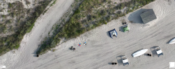
That's me on the left and in the tents are people sleeping on the beach somewhat illegaly.
Control Points were measured by an
Emlid RS2 receiving corrections in NAD83(2011) with ellipsoid elevations.
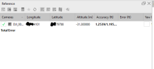
Control Point 1 on the left has an ellipsod elevation of -31.937 meters. This number is negative because in my area the ground is below the ellipsoid.
The flight height for the mission was 200ft AGL relative to the takeoff point, which was the aforementioned Control Point.
All of my images are around 28 to 29 meters above the ellipsoid as shown here in Agisoft.

This 200ft for the flight mission was obtained by the barometer and is listed as the Relative Altitude.
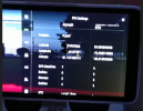
The ellipsoid elevation was obtained from the GPS Altitude
200 feet = ~ 61 meters
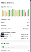
Take my takeoff spot's ellipsoid elevation of ~ -32 meters (It took off from the Control Point) and add the flight height of ~ 61 meters and we have ~29 meters which matches the elevations in my images imported into Agisoft automatically. The accuracy readings are the GNSS Standard Deviation as reported by the GNSS module receiving corrections.
I have over 100 maps that will all show this to be true.
If further proof is needed, tomorrow I will take the
Emlid Reach RS2 and either a Mavic 3E or P4RTK and compare the current position of the Multi-Constellation, Multi Band GNSS rover with images taken by either of the aforementioned drones sitting next to it and show that indeed, Enterprise drones do use GNSS for their image elevation and this is in ellipsoid elevation.
Further, I previously used a
P4PV2 to map with an installed PPK kit from BAAM. With this kit I could use the aircraft to mark Control Points by placing it on the point, having the X grid on screen, take an image of the point nadir and then factor in an offset. I would obtain the Control Point's coordinates and ellipsoid elevation from the image metadata and apply an offset to account for the location of the GNSS module on the aircraft. Using this method was compared to an
Emlid RS2 on the same Control Point and they were always within sub cm.
OP, this will not work for you since, your non-Enterprise drone uses some straight up incorrect vodoo in its reported GPS elevation/altitude.


