

I flew in an FAA Authorization zone set at 200 feet with FAA LAANC permission with my Mav 3 Pro, Avata 2 and Mini 4 Pro. My Mav 3 would go to 151 feet, no more. My Mini would go to 200 feet and my Avata 2 could go above that if I allowed it. All three drones would allow me to fly to different altitudes. All had an excellent GPS lock - like 31 satelliltes or some such number - and all had their Max Altitude set to 400 feet or more. All have current firmware and the most recent Flysafe database as confirmed by DJI support. DJI is clueless and suggest I ask the FAA why they are limiting my drone (they are not, I'm sure). Apparently my DJI Mav 3 knows it's in an authorization zone and won't fly over 150 feet for no particular reason. I even redownloaded the firmware via my computer. No change. voodoo magic, baby.
You are using an out of date browser. It may not display this or other websites correctly.
You should upgrade or use an alternative browser.
You should upgrade or use an alternative browser.
Altitude Limitation in FAA zone Wonky
- Thread starter akdrone
- Start date

- Joined
- Oct 12, 2016
- Messages
- 30,019
- Reactions
- 33,821
- Location
- Harrisburg, PA (US)
- Site
- mavichelp.com
I can't imagine what could be there but I'll try to find out how to view them. I've done so in the past but don't remember howIs there anything in the TXT flight logs that explains the limitation?
 . Uploading logs now to phantom help...not sure what I'd look for. Suggestions?
Last edited:
- Joined
- Oct 12, 2016
- Messages
- 30,019
- Reactions
- 33,821
- Location
- Harrisburg, PA (US)
- Site
- mavichelp.com
There are normally warning messages displayed when the drone is being restricted.I can't imagine what could be
You can upload your flight logs here.I've done so in the past but don't remember how
phantom help seems to be stuck uploading the txt file. It's just 880 k and it's been "loading" for several minutes. odd. It does show a picture of the area...
- Joined
- Oct 12, 2016
- Messages
- 30,019
- Reactions
- 33,821
- Location
- Harrisburg, PA (US)
- Site
- mavichelp.com
Done. Phantomhelp.com doesn't seem to be responding. The image of the area shows up but the data never seems to show up..just "loading"...I'll give it more time...
- Joined
- Oct 12, 2016
- Messages
- 30,019
- Reactions
- 33,821
- Location
- Harrisburg, PA (US)
- Site
- mavichelp.com
done. phantom help never got beyond showing the picture of the area....the data never showed upCan you attach the TXT file directly here instead? You might have to zip it first.
Attachments
- Joined
- Oct 12, 2016
- Messages
- 30,019
- Reactions
- 33,821
- Location
- Harrisburg, PA (US)
- Site
- mavichelp.com
I'm not sure what happened. It looks okay to me after I uploaded it here:
- Joined
- Oct 12, 2016
- Messages
- 30,019
- Reactions
- 33,821
- Location
- Harrisburg, PA (US)
- Site
- mavichelp.com
The following messages were recorded:
0.0s: Aircraft in Warning Zone (Airport). Fly with caution (Code: 190002).
0.6s: Set maximum flight altitude to 46 m (151 ft).
It appears you had the maximum altitude set to 46 meters prior to takeoff. If you did not set that limit, then you should try updating the FlySafe database in DJI Fly.
0.0s: Aircraft in Warning Zone (Airport). Fly with caution (Code: 190002).
0.6s: Set maximum flight altitude to 46 m (151 ft).
It appears you had the maximum altitude set to 46 meters prior to takeoff. If you did not set that limit, then you should try updating the FlySafe database in DJI Fly.

It loads the image but not any data in both Firefox and Safari on Mac OS 15.3.1. Stuck at Loading...I'm not sure what happened. It looks okay to me after I uploaded it here:
Very interesting. My max altitude was set much higher than that and the FlySafe Database is updated to the latest version. Any ideas why phantomhelp might not be responding with data ?The following messages were recorded:
0.0s: Aircraft in Warning Zone (Airport). Fly with caution (Code: 190002).
0.6s: Set maximum flight altitude to 46 m (151 ft).
It appears you had the maximum altitude set to 46 meters prior to takeoff. If you did not set that limit, then you should try updating the FlySafe database in DJI Fly.
- Joined
- Oct 12, 2016
- Messages
- 30,019
- Reactions
- 33,821
- Location
- Harrisburg, PA (US)
- Site
- mavichelp.com
I'm not able to reproduce that. Does this page display properly?Any ideas why phantomhelp might not be responding with data ?
No. The image shows up but none of the flight data shows up. It only keeps on saying "Loading" in Mac OS with both Safari and Firefox browsers. Mac and Browsers are up to date.I'm not able to reproduce that. Does this page display properly?
- Joined
- Oct 12, 2016
- Messages
- 30,019
- Reactions
- 33,821
- Location
- Harrisburg, PA (US)
- Site
- mavichelp.com
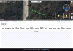
I am using both Safari 18.3 and Firefox 135 aarc64. Both up to date, on Mac OS 15.3. Attached is what I get. Loading just sits there with either browser. I have 920Mbps down and 15 up. I won't use Chrome as it conflicts with a program that is important to me.Which web browser are you using?
Attachments
I just downloaded DuckDuckGo browser and tried that. Same results. Stuck at Loading.Which web browser are you using?
- Joined
- Oct 12, 2016
- Messages
- 30,019
- Reactions
- 33,821
- Location
- Harrisburg, PA (US)
- Site
- mavichelp.com
It sounds like your local network or computer is potentially blocking access to this resource:
You should be able to see what's failing if you open the dev tools in your web browser of choice.
You should be able to see what's failing if you open the dev tools in your web browser of choice.
Similar threads
- Replies
- 4
- Views
- 350
- Replies
- 29
- Views
- 2K
- Replies
- 9
- Views
- 2K
- Replies
- 0
- Views
- 515


DJI Drone Deals
New Threads
-
 Air 3 "Forster Town" - Mid North Coast, NSW, Australia.
- Started by Squidinc
- Replies: 0
-
-

-
US will unleash 'drone dominance' by fast-tracking production
- Started by mavic3usa
- Replies: 6
-

Forum statistics
