Rouge drones and their operators....
What kind of strange person would do something like that to their drone? Very disturbing.

Rouge drones and their operators....
KI knew someone would say that, but with many years on a flight deck, skydiver and to fly a drone in this area almost everyday I can assure you around ~250ft, 300 ft tops

Apologies, slightly off topic. Many years ago when I was flying light aircraft around Florida a military jet, possibly F111, took out an old guy out pottering around in his Cessna 152 in his rightful airspace over a golf course, apparently not in very high airspace (obviously 500 min). You can image a fast impact, nothing left of the Cessna but the military pilot banged out unscathed. Not a lot was mentioned in the press after that.
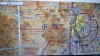
Surface Class E not associated with an airport. I have not encountered that condition anywhere.would you call center (central radar flight following)
if I want to fly in SFC class E not in vicinity of the airport to self report proposed drone flying? Would it be improper to call them up on com radio if I keep it short and sweet?
Maybe 250 feet at the most over about 100 acres of private property. Made 3-4 passes at that altitude in central North Carolina.
They do have transponders on. It is the app that doesn't show them. The last time I looked at FR24, all I saw was commercial flights. But its been a while, might have changed.It seems to me that it would be a good idea when the military is doing low level flights in the U.S. they should be required to turn on transponders to make them show up on apps like flightradar24. At least a drone driver could check for low level flights in the area. I realize that the training aircraft would be here and gone in a short time, but at least it would be possible to predict their flight path for a little while. Or maybe there would be someway to display it on the drone controller realtime.
That's what the he'll I'm talking about...thanx PhilYou are flying in a ecosystem up there. Just stay alert and fly away and descend if you hear a big dog coming. Use it as practice.
Remember if you can’t deal with it you shouldn’t fly it!
When you hear a manned aircraft stop your tasks and act accordindly.
Stay calm.
Fly the aircraft!
Like fish in a tank.
Just go with the flow.
Phil
20k + flying hours
If you can fly there, they can fly there. It's class G airspace.The choppers (military and private) fly under 250 where i live. Is there a regulation as to how low the choppers can fly?
Nice shot! I like to think in terms of this - If I turned these to a vertical position, how many could I stack up between them and ground level? It's usually a lot more than you think initially. Now it you're feeling rotor wash ... whole other story.I get pinpoint visits from military scouting aircraft when I'm out in my fields. Direct approach to where I've been flying the drone >5 mins, boomerang back. I used to flip the pilots off, now I just wave & film them. Sometimes Apaches take longer to pass nearby but they're not really curious. [Live relatively near military installations.] Can't count the similar photos like [OP] I have.
Always a fun race to see if I can descend from 392ft in time for their arrival.
Here's 4 in formation, unrelated to my drone flying (hopefully!)View attachment 34785


We use essential cookies to make this site work, and optional cookies to enhance your experience.