You are using an out of date browser. It may not display this or other websites correctly.
You should upgrade or use an alternative browser.
You should upgrade or use an alternative browser.
Auto RTH + Forward Collision Avoidance Saved my Fanny Today
- Thread starter eEridani
- Start date
@eEridani Hopefully, we all learned some things from this exchange, and all's well that ends well! Litchi allows programming a mission that will continue, even when signal is lost, which will allow you to explore areas beyond LOS, if you know the elevations and obstacles to avoid on the other side. You won't have control of the gimbal or the camera during the signal loss behind the object, but recording will still continue and be available on the drone's microSD card, upon return or recovery.
As a data point - everything regarding the drone was working normally during the LOS - full video recording continued, flight was relatively normal, and went semi-predictable. A couple of unexpected things were:
There was no 50M reversal in travel apparent on the video. Upon LOS, the drone did an abrupt 180, moved that direction a fraction of a second, then abruptly turned towards HOME, then proceeded level for a few yards and without losing speed began the glide descent.
Planned flight paths is what sounds most fun with the drone, I've been reading about Litchi and DroneLink. I have an Air 2 and run on an SC, so Maven is out, Litchi is iffy until they release something. That said - letting the drone fly about out of sight / no signal isn't what I ever plan to do; besides being problematic with the FAA. I'm enjoying the free flight aspect of drones most, and I'd go FPV if I had a 24/7 spotter who enjoyed just standing there watching me fly. But for those times I want a specific photographic approach, the other apps look promising because composing a nice video path and making it happen requires a teen gamer dexterity.
For clarity, the drone acronym "LOS" refers to Line of Sight, rather than Loss of Signal. The advantage of a Litchi planned mission is that no unexpected RTH algorithms will interfere with your intended flight, even during an unexpected signal loss, should one occur at the edge of LOS, while peeking around the mountain top. You should still have your stock RC for Litchi, so you are not entirely limited by the SC capabilities. Just more arrows in your quiver to choose from.As a data point - everything regarding the drone was working normally during the LOS - full video recording continued, flight was relatively normal, and went semi-predictable. A couple of unexpected things were:
There was no 50M reversal in travel apparent on the video. Upon LOS, the drone did an abrupt 180, moved that direction a fraction of a second, then abruptly turned towards HOME, then proceeded level for a few yards and without losing speed began the glide descent.
Planned flight paths is what sounds most fun with the drone, I've been reading about Litchi and DroneLink. I have an Air 2 and run on an SC, so Maven is out, Litchi is iffy until they release something. That said - letting the drone fly about out of sight / no signal isn't what I ever plan to do; besides being problematic with the FAA. I'm enjoying the free flight aspect of drones most, and I'd go FPV if I had a 24/7 spotter who enjoyed just standing there watching me fly. But for those times I want a specific photographic approach, the other apps look promising because composing a nice video path and making it happen requires a teen gamer dexterity.
Thanks for the LOS vs LOS vs VLOS vs ... lol. I was using the latter lexicon of LOS and VLOS. FLA's are always difficult to comprehend (favorite little acronyms, or four letter, or ...).
In the RF/HAM world LOS is generally accepted as loss of signal. My HAM license was the last thing I studied for a few years back, thus my use of that interpretation these days. Prior to that, when I was working, LOS meant Length of Service. And then there's the FAA using VLOS for visual line of sight in almost all of their documentation.
I should try harder to use real words.
Reginald E Johnson
Well-Known Member
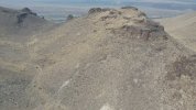
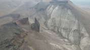
It happened to me as well but I had completely lost my Visual and I didn’t know where the Drone was and I was flying around Blind! I didn’t know how to use the inboard map at the Time! I heard beeping and I knew it was the Avoidance Sensor so I raised it up 50 more feet and pushed the RTH and the Bird came home! I invested in some good quality Cables after that because I was using some cheap Cables!So out flying, was exploring a hill that was taller than I wanted to climb, but accessible if needed, and as I was drifting around the hill I found an interesting pillar to film. I neglected to recall that RF sometimes drops when an object gets between the two radios involved. Actually, I knew it was possible, but didn't really expect it to happen here. So - my first mistake was having the audio all off. I did feel the haptic warning, but the red signal warning on the display is small and invisible to me, so I didn't see what the issue was. Hindsight shows it was a weak signal warning. The next warning was lost signal - that was obvious enough it was hard to miss. Then came the dreaded RTH notice. I was a bit frantic. My RTH altitude was set to 180, and I was on top a hill that was several hundred feet above my takeoff altitude. Rereading the manual, 11 seconds. It didn't seem that long.
So, here comes the interesting part - according to RTH protocol, the drone goes to RTH Altitude: 180. But I was flying over a hill that was 600 feet higher than the takeoff point. In theory, the drone should have descended to 180' - well into the ground. I was remembering the manual mentioning RTH Autolanding when it gets near the ground and was thinking I was going to have to hike up and recover the drone. Argh. The drone did descend, but the obstacle avoidance was set to Bypass, and it saw the ground approaching and avoided it by maintaining altitude until it could descend. Once the drone was adequately in front of the pillar, I had control again.
The entire event took about 30 seconds, but taught me a few things about the Mavic Air 2 that reinforced my instinct I needed obstacle avoidance and made me quite happy I did not buy the Mini 2. lol. And no, the back side of the rock was not that interesting, after all.
Similar threads
- Replies
- 8
- Views
- 2K
- Replies
- 24
- Views
- 2K
DJI Drone Deals
New Threads
-
Are DJI Drones Now More Available Than Before the 'Ban'?
- Started by moldorf
- Replies: 1
-
-
3 A Cyclone is about to hit Darwin, do we stay or go?
- Started by Vernon
- Replies: 7
-
-


