You are using an out of date browser. It may not display this or other websites correctly.
You should upgrade or use an alternative browser.
You should upgrade or use an alternative browser.
DJI RC Pro satellite and mixed maps
- Thread starter PhucTran
- Start date
Axelz
Active Member
- Joined
- May 29, 2017
- Messages
- 31
- Reactions
- 10
Yes, this has been the case since they "fixed" these maps disappearing with 1.6.8, bad resolution since. I reported this on the official DJI support forum. They did fix on their end [or where map source is] without issuing an app release for that version to make it work again however if I recall correctly.
so currently the satellite map problem has not been solved by DJI on rc pro?Yes, this has been the case since they "fixed" these maps disappearing with 1.6.8, bad resolution since. I reported this on the official DJI support forum. They did fix on their end [or where map source is] without issuing an app release for that version to make it work again however if I recall correctly.
Axelz
Active Member
- Joined
- May 29, 2017
- Messages
- 31
- Reactions
- 10
Correct, even with the latest rc pro firmware and dji fly app - at least in the region I am in, and looks like yours too.so currently the satellite map problem has not been solved by DJI on rc pro?
Rc pro is great but the satellite map part is annoying when I fly with this satellite mapCorrect, even with the latest rc pro firmware and dji fly app - at least in the region I am in, and looks like yours too.
Axelz
Active Member
- Joined
- May 29, 2017
- Messages
- 31
- Reactions
- 10
Have a look at this post I've just seen, they did change their map source recently which appears to be the issue with lower resolution maps - note this was concerning the rc not rc pro, think the same issue RC Controller Satellite Map zoom level missing? you can see it says maptiler on the screen now.
do you use rc pro? Does your rc pro have the same problem as me? i have dji rc of mini 3 pro and found it to have the same problem with dji rc pro.Have a look at this post I've just seen, they did change their map source recently which appears to be the issue with lower resolution maps than before with 1.6.8 onwards I think RC Controller Satellite Map zoom level missing?
Axelz
Active Member
- Joined
- May 29, 2017
- Messages
- 31
- Reactions
- 10
Yes with the rc pro [and mavic 3 or with no drone connected] - this post is in the rc pro area. Issue appears to be that DJI changed the map source to maptiler (at least for the android versions of DJI Fly - not sure what the other apps use) as doesn't show the source in corner of screen. On iOS version of the DJI Fly app it's different and better resolution, though not as sharp as google maps and seems to be the same map source as for the DJI Go 4 app on iOS. Didn't seem to be apple maps (which apears to be TomTom source for me).
Is there a way I can install the google map source to replace the maptiler map? on this dji rc pro area I saw a post that installing google map fixed the above error but the person who posted that thread wasn't sure if it was fixed by installing google map or just random.Yes with the rc pro [and mavic 3 or with no drone connected] - this post is in the rc pro area. Issue appears to be that DJI changed the map source to maptiler (at least for the android versions of DJI Fly - not sure what the other apps use) as doesn't show the source in corner of screen. On iOS version of the DJI Fly app it's different and better resolution, though not as sharp as google maps and seems to be the same map source as for the DJI Go 4 app on iOS. Didn't seem to be apple maps (which apears to be TomTom source for me).
mobilehomer
Well-Known Member
Axelz
Active Member
- Joined
- May 29, 2017
- Messages
- 31
- Reactions
- 10
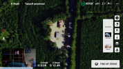
awesome, what version is your rc pro and what version is dji fly? Can you guide me how to fix it?I have a RC Pro, my map works properly. I also have Google Maps installed. This is a max zoom.
Have you installed google maps yet? you can try.Sorry no idea if that would work anyway, would depend on how the DJI Fly app chooses it's mapping source - would suspect it's connecting directly to an API. Would be interested to know if someone has managed to "fix" this though.
Hey guys,
Can you look at this post
 mavicpilots.com
Trying to get DJI to fix this issue...
Can you look at this post
DJI RC Pro & DJI RC satellite view survey.
Can all owners of RCPro & RC zoom right in as close as you can zoom in and see if it is satisfactory. Mine is pathetic and DJI aren't owning this so we need to show DJI that we have a problem that needs fixing. It is funny that if I use my Android phone with the same version of the fly app it...
DJI RC Pro & DJI RC satellite view survey.
and reply as per the second post.Trying to get DJI to fix this issue...
Last edited:
No hyperlink to any post included.Hey guys,
Can you look at this post
DJI RC Pro & DJI RC satellite view survey.
and reply as per the second post.
Trying to get DJI to fix this issue...
Link now provided...No hyperlink to any post included.
Thank you! Makes it a lot easier for everyone!Link now provided...
rexster1505
Well-Known Member
Please explain the procedure for installing Google maps.I have a RC Pro, my map works properly. I also have Google Maps installed. This is a max zoom.
If that is your max zoom, that's the same low res satellite map version that everyone else has on the RC Pro, which is much lower than the High Res version of the map in Fly app using the RC-N1 connected to either an iOS or Android device.I have a RC Pro, my map works properly. I also have Google Maps installed. This is a max zoom.
Similar threads
- Replies
- 7
- Views
- 2K
- Replies
- 9
- Views
- 1K
- Replies
- 0
- Views
- 549
- Replies
- 4
- Views
- 1K
- Replies
- 5
- Views
- 955
DJI Drone Deals
New Threads
-
-
3 A Cyclone is about to hit Darwin, do we stay or go?
- Started by Vernon
- Replies: 5
-
-
-


