

Got this from AOPA this morning.
GPS aerial navigation could become unreliable or unavailable again over the southeastern United States and adjacent coastal waters during a U.S. Navy exercise that will involve GPS interference testing this Friday, Aug. 30, and next Thursday, Sept. 5.
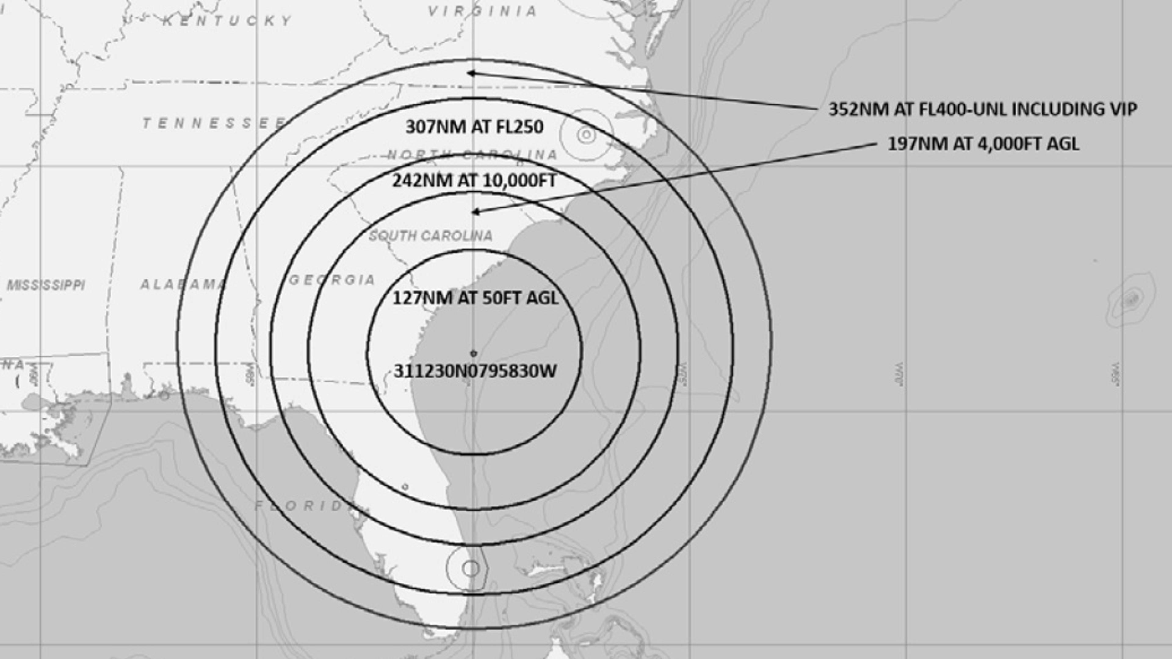
GPS aerial navigation could become unreliable or unavailable again over the southeastern United States and adjacent coastal waters during a U.S. Navy exercise that will involve GPS interference testing this Friday, Aug. 30, and next Thursday, Sept. 5.
GPS testing to degrade signal
GPS aerial navigation could become unreliable or unavailable again over the southeastern United States and adjacent coastal waters during a U.S. Navy exercise that will involve GPS interference testing Aug. 30 and Sept. 5.
www.aopa.org


