Hello.
Someone would know how to assemble the captured images with a photo map mission in GS PRO.
Let me explain . I created a mission that flew over a large lot and took pictures at different intervals. I would like to use and assemble it's photo to make a big picture. As it is many, I wondered if there was software that would facilitate assembly, or coordinate GPS or other.
Thank you
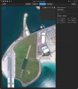