While travelling to Colombia, I thought it was a great idea to take photos of the city by night, with my Mavic Mini. It didn't turned out so well. The drone failed to return and landed in the middle of nowhere, in a complete dark jungle. Finding where and how wasn't a easy task.
I believe I got distracted with the task to take pictures, and I didn't paid attention to the battery levels. But my first mistake was to rise up too high, consuming a significant part of the energy.
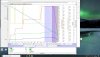
Link to the Airdata flight log if you're interested to take a look : https://app.airdata.com/share/okNImF
Oh yes, I'm french, sorry with my accent")
I believe I got distracted with the task to take pictures, and I didn't paid attention to the battery levels. But my first mistake was to rise up too high, consuming a significant part of the energy.
Link to the Airdata flight log if you're interested to take a look : https://app.airdata.com/share/okNImF
Oh yes, I'm french, sorry with my accent
Last edited: