DJI Mavic, Air and Mini Drones
Friendly, Helpful & Knowledgeable Community
Join Us Now

Lost my mavic need help with log

jcasado247

New Member
Joined
Sep 18, 2021
Messages
3
Reactions
0
Age
32
Location
island
Hello!

I know this is a general discussion but I tried to post it in mavic 2s forum and has been deleted so I would really appreciate you guys could help me with this.

I lost my air2s while flying over an active volcano! I know nobody will reach that place so I still have the chance to find it, I know it landed somewhere safe but the last info recorded is:
18m 48.4sAuto Landing23satellites381.2ftN/A0.9mph1,479.8ft13%10.896V3.63V3.64V3.63V0.010V

I’ve seen another similar threat and they finally found it so any kind of info would be helpful!
Here is the log!

 
This is the best place for the flight analysis.

That's a sad read of the logs alt / winds and stick movements.
You must have been panicking at various stages.

I hope someone here can give you an estimate of position it might have ended up, but when the log ends it seems to be still at 380' alt and a long way from home, with 13% battery still.

So you lost signal from the drone, probably due to that big ridge it crossed.
At that stage you were flying AWAY from home point in full speed ahead !

It looks like it would be a tough search.
But good luck, at least you can get some idea of what happened and where the drone may have ended up.
 
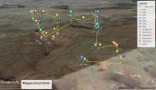
Did you try "find my drone". I like using the actual GPS picture to locate as it helps you navigate the landscape as well in your search.
 
I did it and according to my phone I was in that exact location. The thing is that the last location was 116 m above the ground so maybe it changed while descending.
 
Last edited:
I'm not an expert on logs and investigations, but I believe the drone may have landed somewhere in that valley.
I hope you find it ..


Inkedscreen_LI.jpg
the latest information says:

Event ID:170

Batería muy baja. Aeronave aterrizando automáticamente (Code: 30033). Señal de imagen débil. Ajusta las antenas (Code: 80004)

Flight time: 18m 48s
Altitude: 116.2 meters
Above Sea Level: 380 meters
Home Distance: 490 meters
 
I did it and according to my phone I was in that exact location. The thing is that the last location was 116 m above the ground so maybe it changed while descending.
It was 116 metres higher than the launch point, but 225 metres above the ground below it.
It should have taken almost a minute to reach the ground.
The autolanding descent after loss of signal should have continued vertically, with possibly a little drift, but only if there were strong winds.
 
Lycus Tech Mavic Air 3 Case

DJI Drone Deals

New Threads

Forum statistics

Threads
130,996
Messages
1,558,724
Members
159,983
Latest member
Glenn-S