DJI Mavic, Air and Mini Drones
Friendly, Helpful & Knowledgeable Community
Join Us Now

Mapping recommendations: Web ODM vs Maps made easy

Hello,
I too have played with a number of paid services for different outputs. I like many learning the process along the way with $0 budget.
MME, DD, pix4d along with a few others have been trialed. I was not a fan of having to pay for outputs. Flight planning is free with the above mentioned apps.
Fly Litchi (not free) and website ancient.land is a combo of app and website that can plan the collection photos without some of the restrictions of the limited paid license apps.
I am on PC and have used both the GUI of ODM (WeBODM) and the command line version (DOS like appearance) with great results. I am not a Linux user or knowledgeable when it come to virtual machines or GITHub so I paid the nominal fee for the PC installer.
The webodm / ODM software is Open Source so free once you have it installed and working.
There is a great community forum with access to developers and users alike. I strongly encourage you to follow up with your log in credentials.
WeODM has frequent engine updates that improve the out put at each step.
It can process your data to particular steps in the process sequence and stop if you tell it to. No need to wait hours or days to find out you have poor results.

I am processing on an i7 Dell G7 gaming laptop. I can process 330 images in about 2 hours with medium to high setting with acceptable quality results.
It will also allow the use of Ground Control Points if you wish to have higher absolute accuracy.

Cheers,
Miner_jeff
 
Insofar as MME/MPP my experience has been really good with certain areas (175 acres land being developed, construction sites, etc.) but I've seen the results fall apart on corrugated steel rooftops and other instances where there is no comparison to Drone Deploy (and the price increase last summer drove me out as well). Since client is only requesting progress photos and not GIS level data (yet) it was worth it to get on a monthly/yearly plan that gives me a whole lot more latitude for testing the software. Does it have limits? Certainly. Is the process relatively hassle free? For the most part. Of course you will need to supplement with points if you wish to include 3D (or 2.5D as MME refers to it) but so far the all in cost has been less than a month of DD. If you need a map within a few hours of uploading MME has been dependable in this regard.

This WebODM looks interesting BUT if it is a hassle to use (on Macs here) then the cost in time seems prohibitive. What type of VM solution are people using to run this on Mac successfully? Granted this thread is the first I'm hearing of this software and if I could avoid a few pitfalls I'd like to try it out, specifically orbits for 3D models.
 
My two penn'orth.... I have had good results with Webodm on an oldish Windows PC. I have flown missions manually but have also started using Maven with my Air 2S to fly grid missions. Getting Webodm installed and running takes a bit patience and watching Youtube tutorials, but I reckon it's worth the effort. I used to develop fluid dynamics models in Fortran back in the 70s so I enjoy the challenge!!
 
Insofar as MME/MPP my experience has been really good with certain areas (175 acres land being developed, construction sites, etc.) but I've seen the results fall apart on corrugated steel rooftops and other instances where there is no comparison to Drone Deploy (and the price increase last summer drove me out as well). Since client is only requesting progress photos and not GIS level data (yet) it was worth it to get on a monthly/yearly plan that gives me a whole lot more latitude for testing the software. Does it have limits? Certainly. Is the process relatively hassle free? For the most part. Of course you will need to supplement with points if you wish to include 3D (or 2.5D as MME refers to it) but so far the all in cost has been less than a month of DD. If you need a map within a few hours of uploading MME has been dependable in this regard.

This WebODM looks interesting BUT if it is a hassle to use (on Macs here) then the cost in time seems prohibitive. What type of VM solution are people using to run this on Mac successfully? Granted this thread is the first I'm hearing of this software and if I could avoid a few pitfalls I'd like to try it out, specifically orbits for 3D models.

WebODM on any system* runs inside of a VM through Docker. PC, Linux, Mac, whatever. The paid installer for Mac just makes the setup process easy.

*except for PC with a paid installer, then it runs native.
 
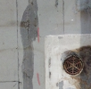
Also, yes- Agisoft is the best, hands down. There isn't anything out there at the moment that can do the job as well as they do. Here's a sample of a roof inspection I did a while back. About 5500 pictures taken from ~30 feet above the roof, and in the end I was left with a 32 GB geolocated ortho-tiff where each pixel was equal to .115" / 2.94mm. Very good for finding details of prior repairs gone wrong, etc.

1670723743600.png


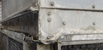
It's also good at doing 3D reconstructions of things. For example- demonstrating to people that have $$ authority but aren't on site that they really need to spend some on structural repairs to things. (Notice how the flat part at the bottom of that channel gets a lot less flat as it goes toward the left side?)

1670724066272.png
 
Took the dive into WebODM. Very useful tool and complimentary to MME. While it might not be DD it certainly adds a lot of flexibility to the toolkit. Well worth the price for the easy installer. If you're doing orthos in any capacity it is worth having.
 
UPDATE FWIW-
working with their excellent product support, i now have WebODM working On the MacStudio, They were having a problem working with the M1 chip but have figured it out!
In the end, WebODM it is perfect for my needs, even on a Mac! The following has been my personal experience with orthomapping only, i was not creating 3D models and except for Spexi, I did not/Could not produce contour map FYI:

MME- quality was good and cost wasnt bad but adds up quickly if you are not getting compensated. Took about 4 hrs to process my 374 photo orthomaps.
Spexi- a little more pricey than MME but excellent product. I found quality Equivalent to MME but much faster - 2hrs for processing 374 images.
WebODM- Excellent value! Perfect to learn on. Quality at High Resolution was almost the same as MME. Clise enough for my needs. Processing 374 images was only 2 hrs and no cost.
Ultra resolution - slightly better than the best MME image that i got- 10 hr processing (overnight).
Hope this helps
 
I did a dive into WebODM and got it working for my use (approx 400 photos of a field for agri) but concluded that MME is quicker, convenient and (in my case) charged to the end user. WebODM convinced me that it could be done but that I'd need to spend some £££ on PC hardware to avoid long waits..........I would move across to WebODM if I had other reasons to upgrade my PC hardware, or had lots of map processing to do.
 
  • Like
Reactions: Spartan Drones
WebODM is pretty good, *but* it's not particularly user friendly.

I don't mean that it's difficult to use, because it's not. You just set your options, pick your pictures, and let it run. The problem is that you don't get to see any of the intermediate steps. If your pictures didn't align, you're not going to see until everything is finished. If there's a couple thousand pictures, you might have to wait a couple days to find out that something didn't turn out right.

As far as running WebODM on a Mac (or even on a PC if you're doing the free-to-install method), it's not really ideal. You're running essentially inside of a VM and you have to assign a certain amount of resources to the VM. Now, that can be okay: if you're okay with having one arm tied behind your back, you can just put 1/2 of your computer resources toward WebODM and then have the other half left to use for whatever else you might want to do. That's fine- that's what I do when I want to run it on my MBP. I don't *think* you can change that resource allocation mid-run, though. IIRC, the Docker VM requires a restart if you want to change the amount of RAM or number of processors it can use.

Oh- also, last time I checked, I don't think that WebODM will make use of GPU processing on a Mac, though I might be wrong on that. I *think* it only uses CUDA, rather than OpenCL. Check the documentation, though.

If you have the paid installer for PC, though, you no longer run it through the virtual machine, and it will just run based on whatever system resources you have available, not whatever you decide to let it have. PC+nVidia GPU is really the ideal setup, in my opinion.

As far as the results that it gives... the point clouds aren't as dense as I'd like, but they are pretty good quality. Textured model outputs are okay. The really spectacular part, though, is the orthoTIFF output, and since you're doing mapping it sounds like that's what you need. The orthotiff output tends to be very, very good. Even without using GCPs, so long as you have enough pictures for the software to average out the GPS errors, you can get extremely accurate output here- overlaid in whatever GIS program is at hand, I'll frequently find that the map is out of line with reality by, say, half the width of the stripe on the road.

Ultimately, though, I wind up using Metashape more often: the ability to break it down into steps, and make adjustments after the alignment stage if the results aren't what I want, that makes a huge difference in my overall workflow, and I think the improved quality + time saved is worth the cost of the program.
Thanks muchly for this. I'm a DroneDeploy subscriber, love it, am wondering if I'll love ODM, this encourages me to try it...
 
  • Like
Reactions: Rusty_SWO
I’ve used WebODM just to get the hang of how to do 3D modeling and mapping. I find that once I get above 120 images it’s a crap shoot as to if it will complete or fail after 40 min processing. I’m too cheap to pay a per use charge if only doing for hobby. If I was doing for a job I’d invest in something more robust and easier to use. This was just a quick job I ran in Web ODM taking pics circling our house (maybe 100 images - give or take a few). Seeing as WebODM is free - it’s not bad to play around with and learn.View attachment 158026View attachment 158027View attachment 158028
Pretty nice result from just two orbits ,least to my eyes anyways. Which drone did you use for the execution?
 
Lycus Tech Mavic Air 3 Case

DJI Drone Deals

New Threads

Forum statistics

Threads
131,064
Messages
1,559,480
Members
160,049
Latest member
kramme