DJI Mavic, Air and Mini Drones
Friendly, Helpful & Knowledgeable Community
Join Us Now

Mavic Mini Flyaway! Help ?

  • Thread starter Deleted member 111775
  • Start date
There is no ATTI switch here.

That is just it when everything is working well I am able to hover in the house with GPS and when things have gone wrong , its a good sign for me that something has gone wrong.
Updates always come with a few surprises and I think this one has a few.

I just flew from inside the car which I posted and that came with quite a few surprises from the last update.

Phantomrain.org
Coal
 
That is just it when everything is working well I am able to hover in the house with GPS and when things have gone wrong , its a good sign for me that something has gone wrong.
Your drone will slip into atti mode any time it has insufficient satellites for position holding.
That's very common and expected when you are indoors with a roof blocking satellite signals.
Updates always come with a few surprises and I think this one has a few.
I just flew from inside the car which I posted and that came with quite a few surprises from the last update.
Updates rarely (if ever) come with "surprises".
Your "surprises" are most likely to misunderstanding things like your ideas about atti mode indoors.
 
Could anybody analyse my flight and see what they think caused this?
There are no joystick inputs in the flight data that would have caused the incident as described.
Although there are no error messages to explain things, your description sounds a lot like what happens with a yaw error.
It would be helpful to know about the surface you launched from.
 
Hey :)

That's interesting,

I have a heli launch pad.

So it launched from a completely flat surface

Thanks,
S
There are no joystick inputs in the flight data that would have caused the incident as described.
Although there are no error messages to explain things, your description sounds a lot like what happens with a yaw error.
It would be helpful to know about the surface you launched from.
 
Is it a foldable launch pad made of a photo reflector? Means a steel ring outside and just foil inside?
The steel ring could be magnetic...
 
Drone Landing Pad, WisFox Universal Waterproof D 75cm/30'' Portable Foldable Landing Pads for RC Drones Helicopter, PVB Drones, DJI Mavic Pro Phantom 2/3/4 Pro, Antel Robotic, 3DR Solo Drone Landing Pad, WisFox Universal Waterproof D 75cm/30'' Portable Foldable Landing Pads for RC Drones Helicopter, PVB Drones, DJI Mavic Pro Phantom 2/3/4 Pro, Antel Robotic, 3DR Solo: Amazon.co.uk: Toys & Games

It's this one here
I'll have to check when I'm home.
Have these been known to cause flyaways ?
Normally they are not a problem, but in single cases it could happen as there is this steel ring. You can check with your mobile phone and a compass app.
I know quite well why I am only doing takeoff from hand and catching the drone by hand instead of takeoff from ground and landing...
 
Wow that's shocking that it cpuld ahve that big of an impact.

For some reason I don't feel like this was the cause though?

I will check the magnetic field with compass app later today and report back
Normally they are not a problem, but in single cases it could happen as there is this steel ring. You can check with your mobile phone and a compass app.
I know quite well why I am only doing takeoff from hand and catching the drone by hand instead of takeoff from ground and landing...
 
There are a couple of reasons to conclude that the cause of this incident is a compromised Yaw value.

One way to see this is to look at the difference between 1) the velocities computed mostly from the accelerometers and gyros, and 2) velocities derived by differentiating GPS data. There shouldn't be any difference but here it can be seen theses velocities begin to diverge at about 8 secs. This type of behavior is almost always the result of a compromised Yaw.
1575641680662.png

At about 10 secs the MM is pitch down and moving moving in a NNE direction which means the MM would be facing NNE. But, the Yaw value is SSW - about 180° the wrong direction.
1575641401436.png

@Smgy94 , I saw the comments about the launch site being clean. Specifically, it's unlikely there is anything underneath the pad causing the launch site to be geomagnetically distorted. I'm supposing the extent of the distortion is much larger since the diverging velocities didn't start until about 5 meters altitude. Are there any large metallic objects close by? What are these?
1575642112186.png

In addition to compromised magnetometer data the compromised Yaw can also be caused by the FC making incorrect decisions about how to compute Yaw. A lot more could be learned if you could provide the .DAT from the Fly App controlling the flight. Look here to see how to retrieve it.
Retrieving a V3.DAT from the tablet
 
  • Like
Reactions: sar104
There are a couple of reasons to conclude that the cause of this incident is a compromised Yaw value.

One way to see this is to look at the difference between 1) the velocities computed mostly from the accelerometers and gyros, and 2) velocities derived by differentiating GPS data. There shouldn't be any difference but here it can be seen theses velocities begin to diverge at about 8 secs. This type of behavior is almost always the result of a compromised Yaw.
View attachment 87432

At about 10 secs the MM is pitch down and moving moving in a NNE direction which means the MM would be facing NNE. But, the Yaw value is SSW - about 180° the wrong direction.
View attachment 87430

@Smgy94 , I saw the comments about the launch site being clean. Specifically, it's unlikely there is anything underneath the pad causing the launch site to be geomagnetically distorted. I'm supposing the extent of the distortion is much larger since the diverging velocities didn't start until about 5 meters altitude. Are there any large metallic objects close by? What are these?
View attachment 87433

In addition to compromised magnetometer data the compromised Yaw can also be caused by the FC making incorrect decisions about how to compute Yaw. A lot more could be learned if you could provide the .DAT from the Fly App controlling the flight. Look here to see how to retrieve it.
Retrieving a V3.DAT from the tablet
Hey Bud,

Thanks do much for the taking the time to look at this.

Those two objects that you have circled and made out of plastic. They are oil tanks for heating the homes. There is nothing metallic in the vacinity,

I will post the .Day file later on today after work and hopefully that will help to shed more light on this

Thanks, Shane
Do you recall the MM's heading at launch. The Yaw data shows it being -119° (SSW). Wasn't it actually NNE?
 
  • Like
Reactions: sar104
There are a couple of reasons to conclude that the cause of this incident is a compromised Yaw value.

One way to see this is to look at the difference between 1) the velocities computed mostly from the accelerometers and gyros, and 2) velocities derived by differentiating GPS data. There shouldn't be any difference but here it can be seen theses velocities begin to diverge at about 8 secs. This type of behavior is almost always the result of a compromised Yaw.
View attachment 87432

At about 10 secs the MM is pitch down and moving moving in a NNE direction which means the MM would be facing NNE. But, the Yaw value is SSW - about 180° the wrong direction.
View attachment 87430

@Smgy94 , I saw the comments about the launch site being clean. Specifically, it's unlikely there is anything underneath the pad causing the launch site to be geomagnetically distorted. I'm supposing the extent of the distortion is much larger since the diverging velocities didn't start until about 5 meters altitude. Are there any large metallic objects close by? What are these?
View attachment 87433

In addition to compromised magnetometer data the compromised Yaw can also be caused by the FC making incorrect decisions about how to compute Yaw. A lot more could be learned if you could provide the .DAT from the Fly App controlling the flight. Look here to see how to retrieve it.
Retrieving a V3.DAT from the tablet

In this case I'm not yet convinced that it was a yaw error - it has some, but not all the right characteristics. Looking at the discrepancy between IMU velocities and first time derivative of position does suggest yaw, at least superficially, although note the π phase difference in the north and east values:

Delta_V.png

But looking at integrated IMU velocities against position paints those data in a slightly different light:

Position.png

There is no real directional disagreement - it's all in the magnitudes. Generally when there is a significant yaw error the velocities are inconsistent with the direction of travel.

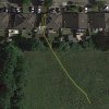
On the other hand the OP stated that it took off and flew forwards into the house, bounced off, and flew backwards into the field. The yaw data indicate that the drone was facing SW however, and the recorded position doesn't match that description when plotted on Google Earth:

1575645014729.jpeg

@Smgy94 - which direction was the aircraft facing at takeoff?

And yes - we need the DAT file.
 
In this case I'm not yet convinced that it was a yaw error - it has some, but not all the right characteristics. Looking at the discrepancy between IMU velocities and first time derivative of position does suggest yaw, at least superficially, although note the π phase difference in the north and east values:

View attachment 87435

But looking at integrated IMU velocities against position paints those data in a slightly different light:

View attachment 87436

There is no real directional disagreement - it's all in the magnitudes. Generally when there is a significant yaw error the velocities are inconsistent with the direction of travel.

On the other hand the OP stated that it took off and flew forwards into the house, bounced off, and flew backwards into the field. The yaw data indicate that the drone was facing SW however, and the recorded position doesn't match that description when plotted on Google Earth:

View attachment 87438

@Smgy94 - which direction was the aircraft facing at takeoff?

And yes - we need the DAT file.
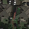
And, also the impact point doesn't seem to be the side of the house.
1575646467302.png
The colors match yours - green is the GPS data and red is the IMUCalcs position. I suppose that may be due to the Google Earth data being slightly off.
 
And, also the impact point doesn't seem to be the side of the house.
View attachment 87439

The colors match yours - green is the GPS data and red is the IMUCalcs position. I suppose that may be due to the Google Earth data being slightly off.

Maybe, but I'd be very surprised if GE were off by that much. The OP can no doubt shed some light on the accuracy of the tracks.
 
In this case I'm not yet convinced that it was a yaw error - it has some, but not all the right characteristics. Looking at the discrepancy between IMU velocities and first time derivative of position does suggest yaw, at least superficially, although note the π phase difference in the north and east values:

View attachment 87435

But looking at integrated IMU velocities against position paints those data in a slightly different light:

View attachment 87436

There is no real directional disagreement - it's all in the magnitudes. Generally when there is a significant yaw error the velocities are inconsistent with the direction of travel.

On the other hand the OP stated that it took off and flew forwards into the house, bounced off, and flew backwards into the field. The yaw data indicate that the drone was facing SW however, and the recorded position doesn't match that description when plotted on Google Earth:

View attachment 87438

@Smgy94 - which direction was the aircraft facing at takeoff?

And yes - we need the DAT file.
Hey Sar104,

I'm attaching the .DAT file now

My Mavic Mini was facing NW when I pressed the auto-takeoff button.

After I increased altitude it flew almost side-ways towards the house

I do believe it reached the roof of the house the was slanting toward the field!
In this case I'm not yet convinced that it was a yaw error - it has some, but not all the right characteristics. Looking at the discrepancy between IMU velocities and first time derivative of position does suggest yaw, at least superficially, although note the π phase difference in the north and east values:

View attachment 87435

But looking at integrated IMU velocities against position paints those data in a slightly different light:

View attachment 87436

There is no real directional disagreement - it's all in the magnitudes. Generally when there is a significant yaw error the velocities are inconsistent with the direction of travel.

On the other hand the OP stated that it took off and flew forwards into the house, bounced off, and flew backwards into the field. The yaw data indicate that the drone was facing SW however, and the recorded position doesn't match that description when plotted on Google Earth:

View attachment 87438

@Smgy94 - which direction was the aircraft facing at takeoff?

And yes - we need the DAT file.

I'm attaching the .DAT file now

My Mavic Mini was facing NW when I pressed the auto-takeoff button.

After I increased altitude it flew almost side-ways towards the house

I do believe it reached the roof of the house the was slanting toward the field!

View media item 3146
Here CCTV of the Mavic Mini FlyAway:

<iframe width="560" height="315" src="
" frameborder="0" allow="accelerometer; autoplay; encrypted-media; gyroscope; picture-in-picture" allowfullscreen></iframe>
 

Attachments

  • 19-12-04-06-22-08_FLY012.DAT
    1.2 MB · Views: 10
That is just it when everything is working well I am able to hover in the house with GPS and when things have gone wrong , its a good sign for me that something has gone wrong.
Updates always come with a few surprises and I think this one has a few.

I just flew from inside the car which I posted and that came with quite a few surprises from the last update.

Phantomrain.org
Coal
I suspect the atti message will come up based on not having GPS, but not accounting for VPS with the downward position sensors. When I got the atti message indoors, I hadn't taken off yet. It was stable at takeoff despite not yet having GPS.
 
Hey Sar104,

I'm attaching the .DAT file now

My Mavic Mini was facing NW when I pressed the auto-takeoff button.

After I increased altitude it flew almost side-ways towards the house

I do believe it reached the roof of the house the was slanting toward the field!


I'm attaching the .DAT file now

My Mavic Mini was facing NW when I pressed the auto-takeoff button.

After I increased altitude it flew almost side-ways towards the house

I do believe it reached the roof of the house the was slanting toward the field!

View media item 3146
Here CCTV of the Mavic Mini FlyAway:

<iframe width="560" height="315" src="
" frameborder="0" allow="accelerometer; autoplay; encrypted-media; gyroscope; picture-in-picture" allowfullscreen></iframe>
The immediate cause of the incident was probably the 30° difference between the compass and the FC's Yaw value at launch. The geoDeclination at the launch site is -3° so the Yaw/magYaw difference should have been 3°.

The .DAT begins 100 secs before the flight starts. At -100 secs the Yaw/magYaw difference was about 72°. At -93 secs it appears that the MM was picked up, turned and then placed about .7 meters lower. This allowed the Yaw/magYaw separation to be partially reconciled to the 30° seen at launch.
1575727477012.png
Why was the Yaw/magYaw separation 72° at the start of the .DAT? It can be seen from the clock value (tick#) that the MM had been powered up for roughly 24 secs prior to the start of the .DAT. I suspect that the MM was powered up in a geomagnetically distorted location resulting in both Yaw and magYaw being set to the same incorrect value. The MM was then moved to a less distorted location which resulted in the Yaw/magYaw separation seen when the .DAT started recording.
 
Lycus Tech Mavic Air 3 Case

DJI Drone Deals

New Threads

Forum statistics

Threads
130,983
Messages
1,558,545
Members
159,972
Latest member
valter123