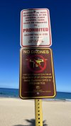
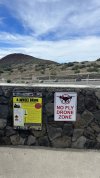
Was excited to get some nice drone footage this morning but got to the beach and there was a specific sign for no drones! Bummer….I did get some awesome shots yesterday though
You are using an out of date browser. It may not display this or other websites correctly.
You should upgrade or use an alternative browser.
You should upgrade or use an alternative browser.
No Drone Zone Sign Hawaii ughh
- Thread starter jay2020
- Start date
- Joined
- Jul 3, 2019
- Messages
- 388
- Reactions
- 610
- Location
- Fort Saskatchewan Alberta
- Site
- www.youtube.com
Just pull out the sign and throw it over the cliff. 
- Joined
- May 25, 2017
- Messages
- 8,476
- Reactions
- 7,966
- Age
- 63
..
Looks like the location might have been inside one of the > State Parks < on one of the islands ??
I guess state parks are restricted in some states, not so much in others.
The other spot was nice too.
Looks like the location might have been inside one of the > State Parks < on one of the islands ??
I guess state parks are restricted in some states, not so much in others.
The other spot was nice too.
macfawlty
Well-Known Member
Hawaii state parks are no drone zones. However, I found the law widely ignored by locals. Exceeding the speed limit is widely ignored across the country so use your best judgement and avoid annoyance and detection.
tlswift58
Well-Known Member
Many parks do restrict TAKE OFF / LANDING there. Simply go outside that zone and do it. Airspace is typically open above the parks. Yet, be courteous and a good pilot to avoid people and such.Was excited to get some nice drone footage this morning but got to the beach and there was a specific sign for no drones! Bummer….I did get some awesome shots yesterday though
It’s so funny you say that because yes it’s a state park and when I went to pay for parking a local guy was like nah you don’t need to pay it’s good. He literally talked to us for a minute and was saying how it’s the States way of ripping everyone off and these beaches and lands are for everyone you don’t have to pay. Interesting concept and mentality I kinda respect because in my State you have to pay 3x as much to go to a crappy beach then you can only go off road for a couple hundred yards if that with all these special requirements but here we went off roading for miles and miles of beautiful sites. We didn’t trail blaze but still off roading and free.Hawaii state parks are no drone zones. However, I found the law widely ignored by locals. Exceeding the speed limit is widely ignored across the country so use your best judgement and avoid annoyance and detection.
As for the drone sign, I respected the rules/law but it’s too bad they take that from us because there is some real beauty here!
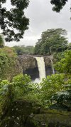
I learned something yesterday while flying. I was so far down in the valley that I had to increase my altitude limit to over 800’ and that still wasn’t as high as the waterfalls and cliffs. I never would have thought about raising my altitude for being below/inside an area like that. Then when I was up top I dropped down and it was a negative reading for altitude so you loose your altitude to ground proximity when it reads negative.
Here’s an unedited photo from yesterday:
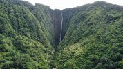
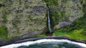
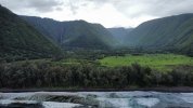
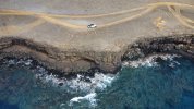
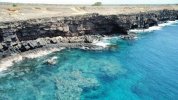
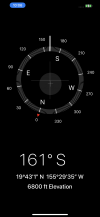
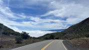
I’m on the big island. That sign was at Hapuna State Beach. The other pics are from South Point. The southern most point in the USA actually (I thought it was Key West but it’s not). I couldn’t get a ton of pics/video because it was really gusty. One of the most challenging flights I’ve done thus far...
Looks like the location might have been inside one of the > State Parks < on one of the islands ??
I guess state parks are restricted in some states, not so much in others.
The other spot was nice too.
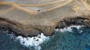
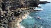
cgmaxed
Well-Known Member
What affect do drones have when flying over a state or federal park. What harm do they really do. Drop beer cans, litter, drop too many plastic bottles or glass? What? Make too much noise? That's malarkey. How do they really cause significant environmental issues. I think it's a load of crap. Drones, are less harmful, than actual people walking through the park...
Looks like the location might have been inside one of the > State Parks < on one of the islands ??
I guess state parks are restricted in some states, not so much in others.
The other spot was nice too.
Edit; I have a feeling that the federal and state governments made up these restricted areas to better regulate and coral human beings into smaller areas, in order to police them easier.
- Joined
- May 25, 2017
- Messages
- 8,476
- Reactions
- 7,966
- Age
- 63
What affect do drones have when flying over a state or federal park. What harm do they really do. Drop beer cans, litter, drop too many plastic bottles or glass? What? Make too much noise? That's malarkey. How do they really cause significant environmental issues. I think it's a load of crap. Drones, are less harmful, than actual people walking through the park.
Edit; I have a feeling that the federal and state governments made up these restricted areas to better regulate and coral human beings into smaller areas, in order to police them easier.
Hey I’m with you there.
Here our National Parks are restricted from flying FROM NP land in most of our states / territories, except for 2 of the 8 states.
2 have no restrictions, one is easy to get a permit, the rest just about forget it.
You can fly from outside the park perimeter in all restricted states, but vlos rules almost make that non viable.
As a bushwalker, I can understand the restrictions placed on these parks.
People go to them to escape the modern world and enjoy nature in peace and quiet.
I gave flown often in NPs in one of the unrestricted states, and am relatively sure I’ve never infringed on anyone’s personal enjoyment, remote, during working weeks when almost no one there, etc, and never fly at popular features in parks when there are others around.
Some do / would of course, with no regards, so GOVCO has blanket rules.
I do feel authorities can be overly proactive in this regard though, ‘in case there’s a problem with drones’, when there is no precedent of problems.
After all, we are talking about 15-20 min flights, often very sparse / remote terrain, very rarely happen to be others around etc, little chance of a real issue.
- Joined
- May 25, 2017
- Messages
- 8,476
- Reactions
- 7,966
- Age
- 63
I’m on the big island. That sign was at Hapuna State Beach. The other pics are from South Point. The southern most point in the USA actually (I thought it was Key West but it’s not). I couldn’t get a ton of pics/video because it was really gusty. One of the most challenging flights I’ve done thus far.
That’s awesome coastline there, glad you where able to get some flight time.
- Joined
- May 25, 2017
- Messages
- 8,476
- Reactions
- 7,966
- Age
- 63
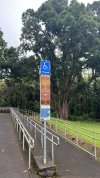
I have another disappointing no drone sign on a Mountain side…here it is but you can go 4 wheeling all over the mountain side?? Go figure.
Now that sort of policy does seem extreme, considering a 4wd up there and down would be about same (or more) than a drone would spend in the air on a battery.
Let alone the any actual impact on the environment, be it visual / noise, erosion, oil / coolant type leaks etc.
- Joined
- May 25, 2017
- Messages
- 8,476
- Reactions
- 7,966
- Age
- 63
Wouldn't surprise me if one state has that sort of policy in all that particular states parks.
Just remember, you can fly from outside a park, and fly over park territory, if say a feature you want to fly is within safe distance, and (technically) if you follow other drone regulations like VLOS and altitude 400' etc.
Hawaii is a pretty big destination for worldwide visitors, and I imagine their state parks get a lot of foot traffic.
Looking at that sort of infrastructure for visitors in your first photo, that looks like the sort of place that drone flight (on a regular basis by many pilots) could start to cause conflict between numerous pilot flights and other park users.
cgmaxed
Well-Known Member
I carry my Air2S in a little bag , made to carry a six pack of drinks. It has small pouches on the sides where I can put my batteries and a larger pouch on top for the remote. You all can yell at me, but I have to say it's a little too easy, just to wonder off the path, find a small clearing, take off for 5 minutes, take a few shots, land and pack it up. My little drink container doesn't look like it's carrying a drone, but if asked, I would certainly say, it wasn't me that was flying the drone. Of course, I'd put my mini sd card in my wallet to hide any evidence. In my opinion, a short 5 minute flight causes no harm. And my 5 minute limit allows me to remain undetected. Or if the drone is seen, it's not up long enough to bother anyone. I certainly wouldn't do it , if their were lots of people walking the paths that day.
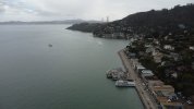
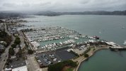
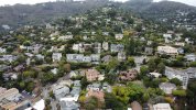
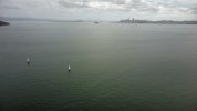
Moving on to California on my adventure and once again the west coast strikes! There are signs all over and based on my screenshot you can see there’s practically no place to fly near me. Found one cool spot to fly at though just across the Golden Gate Bridge. It’s a bit overcast but I could see Alcatraz in a couple shots I took the last photo you can see a small island and that is Alcatraz 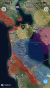
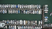


cgmaxed
Well-Known Member
I would just go to the highest spot on the edge, just outside of the restricted zone and fly over the area, unless the actual airspace is restricted. Even then, I might take a quick 5 minute peak, and then get the hell out of dodge as quickly as possible, that is, if there was something I just really had to see, but I doubt there is anything that interesting to risk the trouble. Are those red areas, no fly zones? Meaning totally restricted airspace? If so why? What's so important. Do movie stars live there or something?
Yeah the red are no fly zones. When I turn on the DJI app and the B4UFLY app the red areas show as restricted due to national parks: Golden Gate Bridge, Alcatraz, etc. the state parks come up as yellow zones and an advisory warning not to fly in State/City parks due to ordnances. I met a couple that were flying the Air 2 and Air 2 Pro in an area called Twin Peaks and they said they had a lot of interference from the radio towers that were right next to us. I got a couple pics nearby overlooking San Francisco Bay Area:I would just go to the highest spot on the edge, just outside of the restricted zone and fly over the area, unless the actual airspace is restricted. Even then, I might take a quick 5 minute peak, and then get the hell out of dodge as quickly as possible, that is, if there was something I just really had to see, but I doubt there is anything that interesting to risk the trouble. Are those red areas, no fly zones? Meaning totally restricted airspace? If so why? What's so important. Do movie stars live there or something?
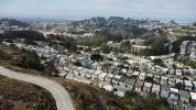
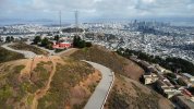
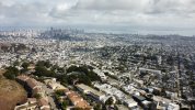
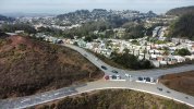
Corsair415
Well-Known Member
Most of the red is the GGNRA(National Park land), and then there’s Angel Island state park. The big yellow circle on the NE part of the city is a helipad for UCSF’s children hospital/ Oracle Park/Hall of Justice. Funny that the Hall of Justice’s heliport is listed since there’ll once at the hospital is the only active one in the city.I would just go to the highest spot on the edge, just outside of the restricted zone and fly over the area, unless the actual airspace is restricted. Even then, I might take a quick 5 minute peak, and then get the hell out of dodge as quickly as possible, that is, if there was something I just really had to see, but I doubt there is anything that interesting to risk the trouble. Are those red areas, no fly zones? Meaning totally restricted airspace? If so why? What's so important. Do movie stars live there or something?
Last edited:
cgmaxed
Well-Known Member
Wow, those pics make it look like people are packed in there like sardines.
Similar threads
- Replies
- 13
- Views
- 764
- Replies
- 22
- Views
- 3K
- Replies
- 13
- Views
- 2K
DJI Drone Deals
New Threads
-
-
-
3 We hit another Log, also destroyed our Jib. Awesome Week
- Started by Vernon
- Replies: 0
-
-
Members online
Total: 3,096 (members: 10, guests: 3,086)


