

So while messing around with B4UFLY/Kittyhawk, I noticed that on the Kittyhawk map (but not B4UFLY), all the homes have 10ft markers over them which I'm guessing means a ceiling height of 10 feet. Am I reading this right and if so, is that something we really have to abide by? I can't imagine that I can fly up to 400ft over my neighborhood but no more than 10 feet over the homes. I've tried to research this on Google and here but don't see anything. Lastly, when I launch B4UFLY, the map just shows my neighborhood as "Clear for Takeoff". Slap me if it's something very obvious.
You are using an out of date browser. It may not display this or other websites correctly.
You should upgrade or use an alternative browser.
You should upgrade or use an alternative browser.
Question about minimum flight altitudes over homes
- Thread starter TnDronePilot
- Start date
THE CYBORG
Well-Known Member
i believe that the air space up to 10ft above your properties highest point is considered to belong to you its like a invisible boundary, it does not mean you control it ,its more to do with being considered trespass if someone flies their drone into that airspace without the home owners permission
but as always i could be wrong
but as always i could be wrong

So while messing around with B4UFLY/Kittyhawk, I noticed that on the Kittyhawk map (but not B4UFLY), all the homes have 10ft markers over them which I'm guessing means a ceiling height of 10 feet. Am I reading this right and if so, is that something we really have to abide by? I can't imagine that I can fly up to 400ft over my neighborhood but no more than 10 feet over the homes. I've tried to research this on Google and here but don't see anything. Lastly, when I launch B4UFLY, the map just shows my neighborhood as "Clear for Takeoff". Slap me if it's something very obvious.
Interesting. I've never seen or heard of anything like that before. I'd love to see a screen shot of the app with those markings.i believe that the air space up to 10ft above your properties highest point is considered to belong to you its like a invisible boundary, it does not mean you control it ,its more to do with being considered trespass if someone flies their drone into that airspace without the home owners permission
but as always i could be wrong
I doubt anyone has ever seen or heard anything about this.Interesting. I've never seen or heard of anything like that before. I'd love to see a screen shot of the app with those markings.
It sounds like people are just guessing.
I would assume it is no lower than 10 feet not a minimum height ?
Interesting. I've never seen or heard of anything like that before. I'd love to see a screen shot of the app with those markings.
Attachments

So hypothetically, 10ft ARL (Above Roof Level) is the homeowner's property and anything higher is FAA?i believe that the air space up to 10ft above your properties highest point is considered to belong to you its like a invisible boundary, it does not mean you control it ,its more to do with being considered trespass if someone flies their drone into that airspace without the home owners permission
but as always i could be wrong
This was just someone's (incorrect) assumption.So hypothetically, 10ft ARL (Above Roof Level) is the homeowner's property and anything higher is FAA?
There is no 10 ft limit to anything, and I'd be more than interested to see if anyone can provide a source for this.
The FAA believe their territory goes right down to the grass.
So AboveGrassLevelThis was just someone's (incorrect) assumption.
There is no 10 ft limit to anything, and I'd be more than interested to see if anyone can provide a source for this.
The FAA believe their territory goes right down to the grass.
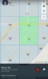
") I grabbed the attached image from a national security no go zone near me and even its buildings all show 10ft so it must just be a default label that means nothing.
I grabbed the attached image from a national security no go zone near me and even its buildings all show 10ft so it must just be a default label that means nothing.Attachments
Last edited:
Papabri
Well-Known Member
The 10’ is likely a MINIMUM height you must fly over another structure, regardless of what the MAXIMUM may be. No one “owns“ the airspace above their property, but that doesn’t mean you can come closer than 10’ to your neighbor’s roof.So while messing around with B4UFLY/Kittyhawk, I noticed that on the Kittyhawk map (but not B4UFLY), all the homes have 10ft markers over them which I'm guessing means a ceiling height of 10 feet. Am I reading this right and if so, is that something we really have to abide by? I can't imagine that I can fly up to 400ft over my neighborhood but no more than 10 feet over the homes. I've tried to research this on Google and here but don't see anything. Lastly, when I launch B4UFLY, the map just shows my neighborhood as "Clear for Takeoff". Slap me if it's something very obvious.
A key item we must bear in mind, is that while the US government has declared the FAA as the sole source for directives and enforcements of the navigable airspace, there remains an undefined (to my knowledge) area, from ground level to at least the top of a habitable structure including attachments, i.e., antennas, tall trees, etc., above a home (read building), on private property, that is not navigable. A person is free to extend structure, for defined purpose, upward (meeting applicable established codes). This space, with my understanding, has been challenged as to legalities of airspace definition and falls in the non-navigable airspace. In a sense, while the FAA is the sole entity for the control of navigable US airspace (key word is ‘navigable’, the FAA not extended enforcement to the areas of private property below the navigable airspace.
In a sense, to purposely transit the non-navigable airspace of a private property, could, potentially, be considered as trespassing. Thus, possibly subjecting one to penalties.
Now, if all this holds true, then to pilot one’s UAS across another’s private property below the defined navigable airspace, one could potentially be in violation.
Further reading:
 www.faa.gov
In a sense, to purposely transit the non-navigable airspace of a private property, could, potentially, be considered as trespassing. Thus, possibly subjecting one to penalties.
Now, if all this holds true, then to pilot one’s UAS across another’s private property below the defined navigable airspace, one could potentially be in violation.
Further reading:
Airport Airspace Analysis (AAA) – Airports
Resources for notifying the FAA about proposed construction on or near airports that might affect airspace.
www.faa.gov
Romulus Archibald
Well-Known Member
Hold on guys....I remember while studying for my Part107 it was mentioned several times that airmaps drop the last 0 when listing air ceilings. So 400 feet shows as the number 40 inside of a box, where you add the last zero.
Could that be it?
Could that be it?
Corsair415
Well-Known Member
If you are able to fly through the airspace doesn’t that by definition make it navigable?A key item we must bear in mind, is that while the US government has declared the FAA as the sole source for directives and enforcements of the navigable airspace, there remains an undefined (to my knowledge) area, from ground level to at least the top of a habitable structure including attachments, i.e., antennas, tall trees, etc., above a home (read building), on private property, that is not navigable. A person is free to extend structure, for defined purpose, upward (meeting applicable established codes). This space, with my understanding, has been challenged as to legalities of airspace definition and falls in the non-navigable airspace. In a sense, while the FAA is the sole entity for the control of navigable US airspace (key word is ‘navigable’, the FAA not extended enforcement to the areas of private property below the navigable airspace.
In a sense, to purposely transit the non-navigable airspace of a private property, could, potentially, be considered as trespassing. Thus, possibly subjecting one to penalties.
Now, if all this holds true, then to pilot one’s UAS across another’s private property below the defined navigable airspace, one could potentially be in violation.
Further reading:
Airport Airspace Analysis (AAA) – Airports
Resources for notifying the FAA about proposed construction on or near airports that might affect airspace.
If you are able to fly through the airspace doesn’t that by definition make it navigable?
Airport Airspace Analysis (AAA) – Airports
Resources for notifying the FAA about proposed construction on or near airports that might affect airspace.
www.faa.gov
Corsair415
Well-Known Member
I’ll take that as a yes.Airport Airspace Analysis (AAA) – Airports
Resources for notifying the FAA about proposed construction on or near airports that might affect airspace.
I am NOT the definitive! But, I’ll bet an inquiry to the FAA could help solve your quest!I’ll take that as a yes.
- Joined
- Jan 5, 2018
- Messages
- 3,148
- Reactions
- 6,830
- Age
- 79

Similar threads
- Replies
- 9
- Views
- 2K
- Replies
- 5
- Views
- 1K
- Replies
- 34
- Views
- 13K
- Replies
- 0
- Views
- 518
- Replies
- 22
- Views
- 4K


DJI Drone Deals
New Threads
-
 3 Lanzhin Skok waterfalls - one of my best flights so far
- Started by alex_markov
- Replies: 1
-
 Motion Sensor Beeping when Taking Photograph
- Started by HoozierDroneDaddy
- Replies: 0
-
-
-
Members online
Total: 1,482 (members: 6, guests: 1,476)
Forum statistics
