DJI Mavic, Air and Mini Drones
Friendly, Helpful & Knowledgeable Community
Join Us Now

Question concerning Kittyhawk - can I fly here?

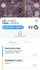
From the Kittyhawk app on my phone.
if you are in controlled airspace and it says permissible altitude for authorization and lists the height restriction, in my case 100 ft. You can fly in that area. If I go a half mile to the west I enter another zone where I can only go 50 feet. The. A little further west it becomes an NFZ. Zero feet
in your picture it says zero feet. So I’d want some cross streets of the location to double check to see what Kittyhawk phone app says. Before I comment further

Like the guy above, I’d like a LAANCE authorization for all flights just for the documents to show law enforcement
Most of my flights are in controlled airspace and I prefer Kittyhawk to airmap.
Good luck
 

Attachments

  • 21278A18-0258-45BE-8869-E5522AF9F55C.png
    21278A18-0258-45BE-8869-E5522AF9F55C.png
    3.2 MB · Views: 16
Right. The sectionals don't show the restrictions for a UAS, only what the airspace class is. Think of the facilities map grid as a sub-class for MAS within a class.
The sectionals do apply if you're looking to avoid any airspace class and only stay in G.
 
Maybe I'm mistaken, but it appears that the airspace shown is a LAANC controlled airspace. I believe that Kittyhawk color codes its LAANC areas and you get altitudes actually permitted later in the authorization process. When you try to obtain authorization in a red colored box or one that is primarily red, it means you cannot fly there, thus the authorization in the warning is "0" meaning that LAANC will not approve a flight at any height. The warning says "Permissible altitude for authorization: 0 ft". I think the meaning is you can't get LAANC approval to fly at that location, not that you haven't gotten the approval yet. The difference in Airmap and Kittyhawk is that the rectangles in Airmap show the maximum permitted flight altitude numerically on the map right up front, thus "0" would mean no flight authorization even through LAANC. I believe Kittyhawk gives you this information by written warning as shown here. I believe in this case the LAANC grid and the colors or max altitudes given may supersede the areas shown by the sectionals. Though confusing, I think I would go with at least initial approval through the FAA website and even contact an FAA office to see where the priorty lies. Remember, LAANC is a newer science than the sectionals, requiring input from both the FAA and the airports controlled by it and therefore may be more up to date with area airport operations that the sectional itself.
You bring up a good point.

@BigAl07 he can’t get LAANC approval for that location because the square he is in touches that restricted area at the top so the whole square is at 0 when in fact part of the square is Class G, part of it is class D, and only a small section is restricted.

I think in this case I would move my location in kittyhawk to be inside the square next to this one so I could get LAANC approval for the class D and make sure I don’t wander into the restricted airspace in red and stay before the 250 ft AGL. It’s this or don’t fly there at all really. This is kinda playing the system but this is where those squares on the facilities map really do come into play.

They clearly CAN make areas other than squares since they did it with this red restricted area which is annoying. Seems lazy. I wonder what their rational for doing that is.
D444F92A-35A5-4E92-84C7-ADB3CB0F1B43.jpeg
 
From that picture, this is the best I can do.

Don’t know if you really need to cheat.

But the Kittyhawk app says you can fly at 259 feet. Here’s the picture from the app. 7F0A299F-98FB-4639-9A77-28695A22B6CC.pngAF8E9FBA-3836-47F1-9F53-819116943CCC.png
 
From that picture, this is the best I can do.

Don’t know if you really need to cheat.

But the Kittyhawk app says you can fly at 259 feet. Here’s the picture from the app. View attachment 88002View attachment 88003
He’s actually in the box above that. My arrow is suppose to be from actual location to declared location but I didn’t illustrate that very well. You are in the correct box I was saying to get authorization for but that’s not actually where he is. That’s why it’s cheating
 
I was in Kill Devil Hills in early August and I was flying over portions of the Wright Bros National Memorial. To my surprise, once I viewed the video, I saw a small plane doing touch and go's at the Kitty Hawk airport that I didn't know was there. I was very surprised my geo-fencing didn't prevent me from flying in that area. Up and down the Outer Banks I encountered no restrictions. One night just before a storm hit from the north, I was flying in the evening over the beach and got some unbelievable lightning flashes. Got some high wind warnings and set it down and just moments before being hit with horizontal rain. What an experience!
 
Without getting into the FAA controls the airspace thing, drones are prohibited in the Wright Bros Park, regardless of where you took off from. Several of the Towns in the OB have laws prohibiting operation from Town property, including parking lots, as well as requiring permission from property owners prior to take-off. A city cop in Nags Head is likely to tell you that you can't fly a drone ANYWHERE in Nags Head. (He's wrong on that.). Note: Town laws regarding drones don't appear in Airmap, Kittyhawk, etc. and at times the local PDs get very anti-drone.

Just an FYI
 
Lycus Tech Mavic Air 3 Case

DJI Drone Deals

New Threads

Forum statistics

Threads
131,269
Messages
1,561,451
Members
160,217
Latest member
lucent6408d