

I'm a professional videographer and just passed the Part 107 exam three weeks ago. I have a Mavic 2 Pro and want to start my drone business. I'm aware there are about a dozen industries that utilize drones. Humbly asking for legit leads, advice, wisdom on correct steps to start with. Thank you in advance.

You are using an out of date browser. It may not display this or other websites correctly.
You should upgrade or use an alternative browser.
You should upgrade or use an alternative browser.
SEEKING WISDOM / ADVICE FROM EXPERIENCED PILOTS
- Thread starter Joe Herrera
- Start date


AnzacJack
Australian Defence Veteran
I guess the first thing to do is research the demand in your area.
Do you have other skills or knowledge that could be used in conjunction with a drone.
Drones can be used in so many areas, its just a matter of finding something unique and combining your skills and knowledge with the capabilities of a drone.
The standard real-estate a marketing gigs are flooded and hard to break into with an expectation of making any reasonable profit.
Are you computer savy? using drones to gather data of various types seems to be an up and coming area for development.
Alejandro Villegas
Well-Known Member
I'm a professional videographer and just passed the Part 107 exam three weeks ago. I have a Mavic 2 Pro and want to start my drone business. I'm aware there are about a dozen industries that utilize drones. Humbly asking for legit leads, advice, wisdom on correct steps to start with. Thank you in
The Mavic 2 Pro is a nice backup drone to have. It has been used on the roof and solar inspection space. Some video, and as mentioned you can still get into real-state shots. Just network with your realtor buddies of the old days or some that have realtor friends. If you are a photographer then you know computers and editing software. You can easily learn others like photogrammetry software Pix4D Drone deploy and DJI Terra. But you going to need another drone. To go into high-end video n photo you need a Mavic 3Pro, as for mapping & Surveys, a Mavic 3 Enterprise. They used the same batteries so you can get a fly more pro combo on the 3pro and a basic Mavic 3E w/ one battery. Get Care Refresh basic for 2 years just in case of a crash or fly away.
There are other more expensive options with Skydio & Autel as well as a thermal drone for these two and DJI.
You need to survey your area and c where the need for this tool is.You need to solve a problem and do it better than others.
If you are in a city that is growing and has lots of construction sites, there is your niche, site progress & mapping.
If you live in an agriculture area, then fumigation, and plant health and are done with MAPIR MULTISPECTRAL mounting cameras or a DJI multispectral drone. Mapir will b better and less expensive since you can mount them on your 2pro &/or M3E
If you are in an area that has solar farms and Electrical then you will need a thermal drone.
If you are in a beachfront, or green/snow mountain range then a M3Pro for aerial plus your cameras and lenses will do.
I wish I was in your shoes, knowing all the info in photography and editing. I'm learning all that from scratch, but since I was a computer tech for 30 years in IT. Sales, customer service, and software and hardware are my thing.
Good luck my Droner friend
Take courses at your community college that have drone programs, the FAA107 is just the start.
I recommend buying bundles of courses with The Pilot Institute
Getting a subscription at the Drone U
Buying Aerial Photography A-Z by Alex Harriss and the drone launch academy.
Also listen to Drone podcast! On your iPhone or Hart radio app.
You wanted advice! So there it is!
Alejandro
San Diego CA
760-580-4039
AnzacJack
Australian Defence Veteran
think outside the box
 viso.ai

 neuratum.com

 geekflare.com

 www.microfocus.com

 kjr.com.au
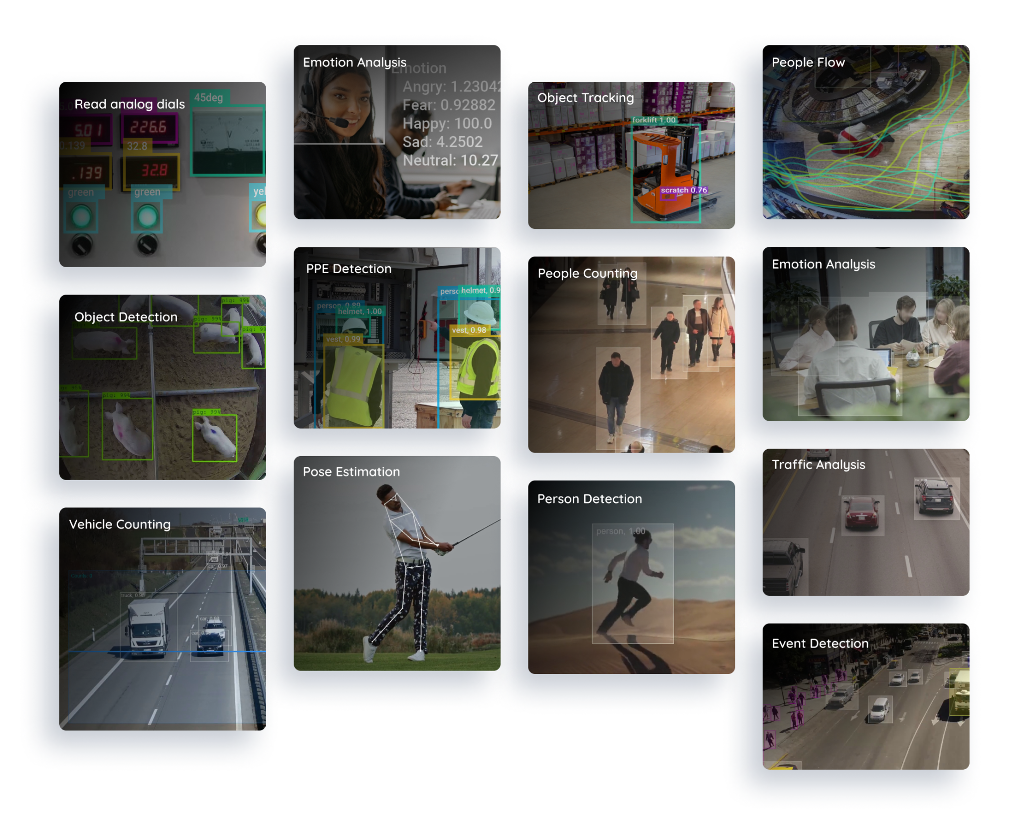
Computer Vision as a Service
Computer Vision as a Service™ Get Full Solution Services When you invest in Viso Suite, you get access to our team of engineers. Get expert services and software as a complete package – everything from one provider. Request more info Delivering long-term success for leading companies worldwide...
viso.ai
AI Traffic counting system | X-PASS - Neuratum
AI traffic counting system for people and vehicles passing by an outdoor area.
5 AI-Based Video Analytics Tools for Better Media Analysis
We have discussed about AI-based video analytics, its use cases, the best AI-based video analytics tools in the market and how you can use them to improve your media analysis.
geekflare.com
Video Analytics with Artificial Intelligence & Machine Learning | OpenText
Video Analytics software to automatically detect, analyze, and interpret activity in video files using Artificial Intelligence and Machine Learning.
www.microfocus.com
Drone and AI to rediscover thousands of world-heritage Aboriginal rock art sites in far north Queensland - KJR
World-heritage Aboriginal rock art dating back thousands of years is one step closer to being rediscovered thanks to drone, artificial intelligence (AI) and mapping technology. A group of leading Queensland tech companies, directed by KJR Australia and supported by Trusted Autonomous … Continued
kjr.com.au
AnzacJack
Australian Defence Veteran
Flying for Archaeology with Anna Kreij
We think of drones as tools for the future, but did you know that they can also be used to study the past? Archaeologist Anna Kreij shared with us some of the many ways that drones can be used in Archaeology and Cultural Heritage Management.Archeologists are interested in understanding how people lived in the past. They do this by looking at the materials and evidence left behind. Traditionally, archeologists survey landscapes by foot, but drones allow archeologists to look at large areas of land much more efficiently. The unique birds eye view provides the opportunity to look at the landscape as a whole, and gives an idea of how archaeological sites are connected within the landscape.
Anna worked with the Kaiadilt peoples on their traditional land in northern Australia to document and understand their fish traps – large stone structures along the coastlines built to capture fish with the ingoing and outgoing tide. To better understand how the fish traps work, they used drones and photogrammetry to model sea levels.
Together, Anna and the Kaiadilt community found 13 fish traps in the area. Individual traps were up to 1m tall and 300m in length, and by modelling sea levels in GIS, they worked out that these traps were most likely 2000-3500 years old! Working with drones allows Archaeologists to partner with local communities for the efficient documentation of archaeological sites. This provides us with insights to the past, as well as the conservation of archaeological and heritage sites into the future.
AnzacJack
Australian Defence Veteran
Drone Photography Meets Fashion with Yumi Morrissey
Next we meet Yumi Morrissey, a fashion designer in Australia who uses beautiful aerial photography that she captures with her drone to create her own custom fabrics for her fashion label, Zilpah Tart.Yumi brought her first drone in 2018 just to fly recreationally. She loves photography and wanted to explore the different perspectives that drones could provide. She particularly loved photographing the ocean, as it was a continuously moving landscape, and so her pictures captured a singular moment in time. She used this as the inspiration for her 2018 Shoreline Collection, which was created using custom fabric printed with her drone photography.
The fabric was created using giant digital printers which captured the amazing detail of the photographs in print. There was a great reaction to the drones prints, as people loved the story of the fabric and the process involved in creating it. Many customers were excited to wear designs that featured photos of their favourite local spots. With her designs, Yumi is creating meaningful fashion that people hang on to and cherish rather than just sending to landfill at the end of the season, and hopes to change attitudes towards our connection with our clothes.
AnzacJack
Australian Defence Veteran
Geography and Drones for Surveying with Narelle Underwood
Many of us see surveyors working with their tripods by the roadside but have a limited understanding of what it is they do or just how different and exciting their jobs can be. Narelle Underwood, the Surveyor General of New South Wales, shared with us the many exciting opportunities that come with working as a surveyor, including opportunities to fly drones. Surveying is the measurement of the world around us – mapping and capturing the built and natural environment. Here are just some of the different fields that you can work in as a surveyor:- Marking out property boundaries for private and commercial estate
- Hydrographic surveying – mapping the ocean floor
- Engineering and construction – mapping infrastructure
- Tracking tectonic plate movements with geodetic surveying
- Mining surveying – mapping tunnels underground
- Tracking the way that ice shifts in Antarctica
- Digital Twins – can use digital twins to see how a potential building project might influence the surrounding environment e.g. how a tall building might produce shade.
- 3D Models – through 3D scanning buildings you can generate 3D virtual models to be able to conduct ‘walk throughs’.
- Point Clouds – surveyors use drones to generate point clouds, which are many millions of points stitch together to create a 3D model.
- Augmented and Virtual Reality – so that on site you can pull out your phone to help locate an underground site.
That sounds very intriguing! I can see using a drone as a less disruptive device to float over a site, scanning the area and documenting images and giving the project participants a more accurate picture of the landscape ahead of them. Would love to go to Australia one day soon!Flying for Archaeology with Anna Kreij
We think of drones as tools for the future, but did you know that they can also be used to study the past? Archaeologist Anna Kreij shared with us some of the many ways that drones can be used in Archaeology and Cultural Heritage Management.
Archeologists are interested in understanding how people lived in the past. They do this by looking at the materials and evidence left behind. Traditionally, archeologists survey landscapes by foot, but drones allow archeologists to look at large areas of land much more efficiently. The unique birds eye view provides the opportunity to look at the landscape as a whole, and gives an idea of how archaeological sites are connected within the landscape.
Anna worked with the Kaiadilt peoples on their traditional land in northern Australia to document and understand their fish traps – large stone structures along the coastlines built to capture fish with the ingoing and outgoing tide. To better understand how the fish traps work, they used drones and photogrammetry to model sea levels.
Together, Anna and the Kaiadilt community found 13 fish traps in the area. Individual traps were up to 1m tall and 300m in length, and by modelling sea levels in GIS, they worked out that these traps were most likely 2000-3500 years old! Working with drones allows Archaeologists to partner with local communities for the efficient documentation of archaeological sites. This provides us with insights to the past, as well as the conservation of archaeological and heritage sites into the future.
AMann
Well-Known Member
I’ve been using mine to look for rock art in hard to reach places - along cliffs and other inaccessible sites. We also were going to do survey mapping along an ancient shoreline to look for fish traps. It’s not full-time work though so one needs to have other skills as well…. Start out by volunteering with projects, get some references, and then use those to open bigger doors.
AnzacJack
Australian Defence Veteran
we are using AI to assist. Loading up all known sites and then loading up high res imagery of a large area. The AI selected 6 likely spots for undiscovered rock art. 4 of these were spot on. Technology is amazingI’ve been using mine to look for rock art in hard to reach places - along cliffs and other inaccessible sites. We also were going to do survey mapping along an ancient shoreline to look for fish traps. It’s not full-time work though so one needs to have other skills as well…. Start out by volunteering with projects, get some references, and then use those to open bigger doors.
Similar threads
- Replies
- 18
- Views
- 1K
- Replies
- 9
- Views
- 1K
- Replies
- 0
- Views
- 598


DJI Drone Deals
1. Mini 2
2. Mini 3 Pro
3. Mini 4 Pro
4. Air 2s
5. Air 3
6. Avata 2
7. Mavic 3 Pro
8. Mavic 3 Classic
2. Mini 3 Pro
3. Mini 4 Pro
4. Air 2s
5. Air 3
6. Avata 2
7. Mavic 3 Pro
8. Mavic 3 Classic
New Threads
-

-

-
 Air 3 Loch Kinardochy - Spring Highland Sunshine
- Started by AlbionDrones
- Replies: 0
-

-

Forum statistics
