

You are using an out of date browser. It may not display this or other websites correctly.
You should upgrade or use an alternative browser.
You should upgrade or use an alternative browser.
Spiral Maker for Litchi Waypoint Missions
- Thread starter DJ Wes
- Start date
-
- Tags
- google earth litchi spiral waypoint
D
Deleted member 94047
Guest
@DJ Wes, greatly appreciate what you did here and you sharing it. Someone in this forum mentioned doing something similar a while ago and I was among many who were asking how they did it. Sadly, that someone decided not to enlighten us with their knowledge. And here you come along and give us the full buffet! You are awesome mate! I have a few places in mind that are begging for this type of mission and I am really looking forward to trying this (it won't be soon though unfortunately). But I have your page bookmarked and will be following this thread with keen eyes.
That can easily be done in post without any ill effect on the quality of the footage, especially if you just want to speed things up. Shoot at any speed, any frame rate, and just speed it up where you want in post; no need to enter complexities in to the mission! If you want to slow down the footage, then you will have to put a little forethought in to your video recording before the mission. The mission footage has to be filmed with the max frame rate that your drone is capable of - for Mavics, I think that would be 120fps but you will have to compromise on the video resolution. In either case, I think introducing a speed factor in to the mission is hardly worth the extra complication and wouldn't really produce the effect you desire unless you go from extremely fast to extremely slow or vice versa; which i don't think is good for this kind of mission. Slow and steady gives you good, stable, footage. Get your exposure and framing right and you can play with it however you like in post.maybe it's possible to add a speed bar. To make the drone getting faster at every waypoint
Yes, but i looks nice if every waypoint the speed is going up, you can also adjust speed in each waypoint manually but that's taken a lot of work, also afterwards in post production. Just like the height bar min-max, a bar min max speed is for me beautifull.
joeruby
Well-Known Member
Works just like described. Great piece of software design. Thank you so much for sharing with us.
KC7GHT
KC7GHT
laryy555
New Member
DJ Wes, syour generator works perfectly
and also google earth pro, Litchi everyone's favorite,everything worksin Cyrillic language!
I love using Litchi and after learning more., thanks! great tool.
happy New Year!
laryy555
New Member

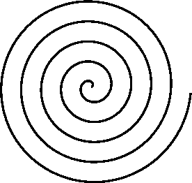
Your program generates a cylindrical spring-coil path, which is terrific! Tried it, love it! ? Now (you knew this was coming!) here's your first enhancement request! An extremely useful variant would generate a true spiral path, like a coiled snake:
You'd add a field that steps the radius incrementally with each WP, either positively or negatively, so that the drone--as it circles the POI--recedes from (or approaches) the POI at a constant rate. That's doubtless easier said than done; I've done a bit of coding myself. Still, if you find a way, it'd be an excellent addition!
Again, thanks for the cool tool as-is!
I have added this new feature request to Spiral Mission Maker for Litchi. There is an added control that allows one to specify the ending radius scale factor. The first waypoint is always at a distance (radius) from the POI determined by the circle in the kml file from Google Earth Pro. The last waypoint can be repositioned either closer to or further from the POI by specifying a scale factor. If the scale factor is 0.5, the last waypoint will be half the normal distance away from the POI. If the scale factor is 2.0, the last waypoint will be twice the normal distance from the POI.
I hope this makes sense. If not, just give it a try.


webvan
Well-Known Member
- Joined
- Nov 4, 2017
- Messages
- 382
- Reactions
- 105
- Age
- 49
Prismatic
Well-Known Member
Just tried it out, and I am mightily impressed! An elegant solution to a thorny problem.I have added this new feature request to Spiral Mission Maker for Litchi. There is an added control that allows one to specify the ending radius scale factor ...
One note, and I’m not sure what options you have, but in the spiral missions I made, I had to manually manage the curve sizes at each WP. Otherwise the mission consisted of long straight segments with a minimal curve (<5m) at each WP. (The POI in this case is a relatively modest volcanic cone in AZ, but still a final radius of 1000m for the spiral mission.)
Because of the changing radius, the best solution for this was to max-out the curvature at each WP, beginning at the innermost one and working the WPs in order from there. yields a smooth curve for the entire flight.
A small thing in a wonderful tool! Thanks again!
Yes. Before I added the variable radius, I could compute (and store) one global curve size for the entire mission. However, now that the radius can change throughout the mission, the curve size will also change. This is apparent when the ending radius is larger than the beginning radius. To fix this I need to compute the curve size at every waypoint. That computation is expensive (lat/long -> feet/meters) but can be done. I'll work on that. It's amazing how quickly the complexity of this application is increasing.Just tried it out, and I am mightily impressed! An elegant solution to a thorny problem.
One note, and I’m not sure what options you have, but in the spiral missions I made, I had to manually manage the curve sizes at each WP. Otherwise the mission consisted of long straight segments with a minimal curve (<5m) at each WP. (The POI in this case is a relatively modest volcanic cone in AZ, but still a final radius of 1000m for the spiral mission.)
Because of the changing radius, the best solution for this was to max-out the curvature at each WP, beginning at the innermost one and working the WPs in order from there. yields a smooth curve for the entire flight.
A small thing in a wonderful tool! Thanks again!
Prismatic
Well-Known Member
The solution I described above, using Mission Hub, works very well. Starting with the innermost WP, you just max-out the "Curve Size" slider for each WP in order of increasing radius. It's not much of a burden for the user, and you've already given us a solution for the heart of the matter: getting that perfect--and cinematic!--spiral.
PS: As for the fast increase in code complexity, you should have a chat with @namirda , who developed the Virtual Litchi Mission app (which works perfectly with a spiral mission, of course!). In software engineering, as you probably know, the core functionality is often the easy part; the vast bulk of the code just handles corner-cases and errors!
PS: As for the fast increase in code complexity, you should have a chat with @namirda , who developed the Virtual Litchi Mission app (which works perfectly with a spiral mission, of course!). In software engineering, as you probably know, the core functionality is often the easy part; the vast bulk of the code just handles corner-cases and errors!
CareyL
Well-Known Member
I am pretty sure that if you go into Litchi ->Settings and change it to 100% or the largest you can that all your curves will be maximized.
...
One note, and I’m not sure what options you have, but in the spiral missions I made, I had to manually manage the curve sizes at each WP. Otherwise the mission consisted of long straight segments with a minimal curve (<5m) at each WP. (The POI in this case is a relatively modest volcanic cone in AZ, but still a final radius of 1000m for the spiral mission.)
Because of the changing radius, the best solution for this was to max-out the curvature at each WP, beginning at the innermost one and working the WPs in order from there. yields a smooth curve for the entire flight.
A small thing in a wonderful tool! Thanks again!
Prismatic
Well-Known Member
I tried that, but it didn't do anything.I am pretty sure that if you go into Litchi ->Settings and change it to 100% or the largest you can that all your curves will be maximized.
I have made a change so that it now calculates the curve size independently at each waypoint to provide the maximum curve size at each waypoint.Just tried it out, and I am mightily impressed! An elegant solution to a thorny problem.
One note, and I’m not sure what options you have, but in the spiral missions I made, I had to manually manage the curve sizes at each WP. Otherwise the mission consisted of long straight segments with a minimal curve (<5m) at each WP. (The POI in this case is a relatively modest volcanic cone in AZ, but still a final radius of 1000m for the spiral mission.)
Because of the changing radius, the best solution for this was to max-out the curvature at each WP, beginning at the innermost one and working the WPs in order from there. yields a smooth curve for the entire flight.
A small thing in a wonderful tool! Thanks again!
Prismatic
Well-Known Member
Wow! That's amazing. Works exactly as you'd hope. Thanks 10^6, sir!I have made a change so that it now calculates the curve size independently at each waypoint to provide the maximum curve size at each waypoint.
")
Recent Enhancements to Spiral Mission Maker for Litchi:
- New "Add Approach" option: The first waypoint of a waypoint mission is sometimes problematic. Despite defining a heading and gimbal pitch angle at the first waypoint, when executed, the drone heading and camera angle are not applied until after the drone passes the first waypoint.
To remedy this, an option has been added to add a waypoint prior the first spiral waypoint of the mission. This provides several advantages:- It enables the drone to achieve the correct heading and gimbal pitch angle prior to the first spiral waypoint of the mission.
- It enables the drone operator to begin recording prior to the first spiral waypoint of the mission while on a smooth path.
- It enables the addition of more waypoints prior to the first waypoint on the spiral so that more complex spiral entries are possible.
- Increased metric resolution: When used with metric units, the height sliders will move in one-meter increments instead of five-unit increments which are used when "feet" is selected.
- Cosmetic user interface improvements
Prismatic
Well-Known Member
The approach waypoint is very helpful. I've been doing it manually, and laboriously:Recent Enhancements to Spiral Mission Maker for Litchi:
- New "Add Approach" option: The first waypoint of a waypoint mission is sometimes problematic. Despite defining a heading and gimbal pitch angle at the first waypoint, when executed, the drone heading and camera angle are not applied until after the drone passes the first waypoint.
To remedy this, an option has been added to add a waypoint prior the first spiral waypoint of the mission. This provides several advantages:
- It enables the drone to achieve the correct heading and gimbal pitch angle prior to the first spiral waypoint of the mission.
- It enables the drone operator to begin recording prior to the first spiral waypoint of the mission while on a smooth path.
- It enables the addition of more waypoints prior to the first waypoint on the spiral so that more complex spiral entries are possible.
- Increased metric resolution: When used with metric units, the height sliders will move in one-meter increments instead of five-unit increments which are used when "feet" is selected.
- Cosmetic user interface improvements
- Save off the attributes of WP1 (coordinates, speed, all of it; a screen capture is helpful)
- Insert a new WP2 after WP1
- Move WP1 out of the way
- Use the saved attributes of WP1 to make the new WP2 a "clone" of the original WP1
Prismatic
Well-Known Member
And now that you have a WP before the spiral, you can just keep inserting WPs ahead of the spiral (not to mention after it), and thus design an arbitrary mission with an embedded spiral.... The "Add Approach" option is a huge improvement in the usability of SMMfL! Thanks!
Sweet!
Similar threads
- Replies
- 7
- Views
- 3K
- Replies
- 5
- Views
- 3K
- Replies
- 9
- Views
- 839
- Replies
- 1
- Views
- 842


DJI Drone Deals
Members online
Total: 4,088 (members: 10, guests: 4,078)
Forum statistics
