DJI Mavic, Air and Mini Drones
Friendly, Helpful & Knowledgeable Community
Join Us Now

***UPDATE*** Failed RTH- distraught 15 year old - HAS BEEN FOUND!

debholmes15

Member
Joined
Jul 29, 2021
Messages
9
Reactions
22
Age
51
Location
northampton, uk
Hi all. Desperate mumma here. Son spent all his birthday morning on a Mavic Mini. He and his dad were flying it for the first time yesterday.

Husband took it to 72m and low battery alarm started bleeping so pressed RTH. Drone just kept rising in altitude and lost signal. Not at RTH site. Not at location last recorded on flight log.

We’ve searched for hours for it. Poor lad is distraught. Any advice?
 
Get your device (phone, ipad etc) and obtain your txt file for the flight.

Upload that here . . .

DJI Flight Log Viewer | Phantom Help

Copy the URL for the report, and Paste / post that back here on this thread.

If you need any further help on getting the txt file, go here and read section 3.

Mavic Flight Log Retrieval and Analysis Guide

The numerous flight analysts on the forum have a very good track record of helping people with a search area, and the success stories have been many.

Hopefully yours will be a successful result too.
 
At 72m+ the Mini is not likely to be in one piece when you find it unless it managed to land on its own or is stuck nicely in a tree. So be prepared for that possibility

If you do get your Mini back or another one to replace it...... make sure that Dad reads the manual thoroughly with your son and the two of them set everything properly. Minis are a little more prone to flyaways due to lower wind resistance, but the majority of lost drones are still due to improper settings or operator error. If you upload your logs here.... the pros will help to find the drone and will have a better guess as to what happened.

RTH should be set to a height above the tallest structure in your flight path but not so high that it puts the Mini in peril from high winds. The Mini should be flown into the wind if possible so that when RTH is engaged due to low battery, it doesn't need to fight its way home.
 
Amazing news!!!! Spent 2 hrs last night looking for it. Been out since 5am this morning looking for it. Son up at 7am looking for it.

Spoken to several people who were walking their dogs. One of them walked back to his house and saw it outside the front of one of the houses in his street!!! My son had said the RTH had kept flitting from one place to another. Clearly, it has gone to the most current RTH location...?? Any reason why that might be happening....bet you can read that in the bloody manual!

I cannot believe how lucky we have been!!!! One thing for sure...neither my son or his dad are flying it until it has a GPS tracker on it and they have read the manual thoroughly.

I am so grateful for you help folks. My lad is beside himself and I am in floods of tears for him.
 
At 72m+ the Mini is not likely to be in one piece when you find it unless it managed to land on its own or is stuck nicely in a tree. So be prepared for that possibility

If you do get your Mini back or another one to replace it...... make sure that Dad reads the manual thoroughly with your son and the two of them set everything properly. Minis are a little more prone to flyaways due to lower wind resistance, but the majority of lost drones are still due to improper settings or operator error. If you upload your logs here.... the pros will help to find the drone and will have a better guess as to what happened.

RTH should be set to a height above the tallest structure in your flight path but not so high that it puts the Mini in peril from high winds. The Mini should be flown into the wind if possible so that when RTH is engaged due to low battery, it doesn't need to fight its way home.
ITS BEEN FOUND! SEE MESSAGE AT BOTTOM OF THREAD. WE ARE SOOOOO LUCKY. THANK YOU FOR YOUR ADVICE.
 
Get your device (phone, ipad etc) and obtain your txt file for the flight.

Upload that here . . .

DJI Flight Log Viewer | Phantom Help

Copy the URL for the report, and Paste / post that back here on this thread.

If you need any further help on getting the txt file, go here and read section 3.

Mavic Flight Log Retrieval and Analysis Guide

The numerous flight analysts on the forum have a very good track record of helping people with a search area, and the success stories have been many.

Hopefully yours will be a successful result too.
ITS BEEN FOUND! SEE MESSAGE AT BOTTOM OF THREAD. WE ARE SOOOOO LUCKY. THANK YOU FOR YOUR ADVICE.
 
Fantastic news. I was feeling for you.... my kids aren't quite old enough for a drone yet but I was putting myself in your shoes. Heartbreaking.

There is a button in the settings under Safety for updating the RTH point to where you are standing. Also, the Mini updates the RTH every time you land and takeoff. Not sure of any other reasons it would fail to come all the way home.
 
Last edited:
  • Love
Reactions: debholmes15
Wow, great Deb.

I haven't opened your flight log to view fully (plus I'm not all that up with log analysis like 4 or so pilots here), but can see the RTH was reset to 500m.
This was probably the main reason for the flights undoing.
It never went that high form what I can see, but probably trying.

The Mini is good in winds to a reasonable level, but struggles if it's too high, yes the max m/s in in the manual, can be converted back to MPH or knots etc for whatever forecast app you might use.

Goggle > DJI Mavic Mini pdf manual < online, it can be printed or saved for later reference.

The wind up at that altitude can be SO much stronger than down lower.
(Bear in mind too the legal max altitude for flight is only 400' or 120m.)
ALWAYS set RTH for each flight to the minimum required, plus a little safety margin, maybe another 10m.

Maybe another member up with flight analysis will take a look and see if there is anything they can advise about the RTH possibly moving about, or other info they find that contributed.
 
  • Like
Reactions: debholmes15
My son had said the RTH had kept flitting from one place to another. Clearly, it has gone to the most current RTH location...??
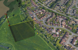
That doesn't seem to be the case. The home point was set to the yellow pin here:

1627548806040.png

The log shows high wind warning messages. And at that altitude, the wind was likely a lot stronger. The aircraft was probably blown off course as it was attempting to auto land at the pin.
 
That doesn't seem to be the case. The home point was set to the yellow pin here:

View attachment 132527

The log shows high wind warning messages. And at that altitude, the wind was likely a lot stronger. The aircraft was probably blown off course as it was attempting to auto land at the pin.
Thank you for this. It was found in the estate just to the east of the yellow point by the house. What info does the pic above show us? Does it mean it was blown off course in the direction of the red dots and then tried to RTH but auto landed due to the battery running out short of the RTH pin and it having to work against the stronger wind at the higher altitude?
 
  • Like
Reactions: Bradders71
That doesn't seem to be the case. The home point was set to the yellow pin here:

View attachment 132527

The log shows high wind warning messages. And at that altitude, the wind was likely a lot stronger. The aircraft was probably blown off course as it was attempting to auto land at the pin.
Finding this really interesting. I assume the red dots are from the flight log where we lost contact with it and therefore where it was headed. Would love to know how to do this myself.
 
  • Like
Reactions: Bradders71
Wow, great Deb.

I haven't opened your flight log to view fully (plus I'm not all that up with log analysis like 4 or so pilots here), but can see the RTH was reset to 500m.
This was probably the main reason for the flights undoing.
It never went that high form what I can see, but probably trying.

The Mini is good in winds to a reasonable level, but struggles if it's too high, yes the max m/s in in the manual, can be converted back to MPH or knots etc for whatever forecast app you might use.

Goggle > DJI Mavic Mini pdf manual < online, it can be printed or saved for later reference.

The wind up at that altitude can be SO much stronger than down lower.
(Bear in mind too the legal max altitude for flight is only 400' or 120m.)
ALWAYS set RTH for each flight to the minimum required, plus a little safety margin, maybe another 10m.

Maybe another member up with flight analysis will take a look and see if there is anything they can advise about the RTH possibly moving about, or other info they find that contributed.
Thank you for your advice! They only took it to about 70+m and then my husband reported it lost contact. It took itself upwards to 120m+ not us. Really do appreciate all the advice.
 
  • Like
Reactions: Bradders71
What info does the pic above show us?
It's showing the recorded flight path. The end of the flight is missing since the remote controller disconnected from the aircraft while it was attempting to return to the home point (at the yellow pin).

Does it mean it was blown off course in the direction of the red dots and then tried to RTH but auto landed due to the battery running out short of the RTH pin and it having to work against the stronger wind at the higher altitude?
While not shown in your flight log, it appears it was blown off course while attempting to land at the yellow pin.

I assume the red dots are from the flight log where we lost contact
The red dots are showing points where warning messages were recorded in your flight log. You can see those messages on the page where you uploaded your TXT flight log above.

Would love to know how to do this myself
Install Google Earth and click the "Download KML" link here.

They only took it to about 70+m and then my husband reported it lost contact. It took itself upwards to 120m+ not us.
They had the return to home (RTH) altitude set to 500 meters before taking off. When the aircraft returns home, it ascends to that set altitude and then starts flying back home.
 
Use AirData and have your logs auto downloaded. I would guess return to home altitude set too high so it first must reach that altitude before it even starts home.
 
Use AirData and have your logs auto downloaded. I would guess return to home altitude set too high so it first must reach that altitude before it even starts home.
The flight data was supplied in post #5 and it confirms that RTH height had been changed to 500 metres.
 
The image on the flight analysis report created by @msinger in post 15 shows a high-voltage power line between the controller and the location where the drone experienced signal interruption. Might that have contributed to the signal loss?

(DJI Flight Log Viewer - PhantomHelp.com)

I've seen comments from several people saying that power lines aren't a problem. On the other hand, one of the DJI text "hints" that appeared when I was updating the firmware in the Air 2S today said warned that they could cause signal interference.
 
The image on the flight analysis report created by @msinger in post 15 shows a high-voltage power line between the controller and the location where the drone experienced signal interruption. Might that have contributed to the signal loss?
There are no high voltage lines visible on the google earth display of the flight path.
There are a few poles that might carry a low voltage line.
But low/high voltage cables weren't the problem.
Poor antenna orientation was the most likely cause of loss of signal.
 
Lycus Tech Mavic Air 3 Case

DJI Drone Deals

New Threads

Forum statistics

Threads
130,599
Messages
1,554,240
Members
159,603
Latest member
refrigasketscanada