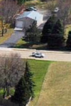
With a continuing effort in the 360° panoramic photo world my effort has finally produced a better photo. Its color definition is better, sharpness and clarity has improved without distortion and now comes with a full sky view. Kuula shows the difference's between the photo.
*New* 360° shows the shingle's of the homes are clearer/cleaner, the grass, tree's and evergreen's clarity and color is enhanced and improved along with the full sky view while looking up.....Much better then the Mavic 2 Pros drone produced 360° photo in my words....")
https://kuula.co/post/NDNh5 .... Drone produced 360° photo
https://kuula.co/post/NDN5z .... *New* 360° photo
*New* 360° shows the shingle's of the homes are clearer/cleaner, the grass, tree's and evergreen's clarity and color is enhanced and improved along with the full sky view while looking up.....Much better then the Mavic 2 Pros drone produced 360° photo in my words....
https://kuula.co/post/NDNh5 .... Drone produced 360° photo
https://kuula.co/post/NDN5z .... *New* 360° photo