DJI Mavic, Air and Mini Drones
Friendly, Helpful & Knowledgeable Community
Join Us Now

DJI Mini 2 Flyaway/Crash Assistance

CMGogo

New Member
Joined
Apr 26, 2023
Messages
2
Reactions
0
Age
42
Location
Madison, WI
Hi All! Trying to understand what happened to my Mini 2. I am a new-ish drone operator and it flew away on me last weekend.

I think something went wrong with the altitude sensor and it somehow thought it was at negative altitude and attempted to correct itself.

If you you looked at these logs, what would you say?

Also, I was asked to include the following here to notify folks: @slup @sar104

Thank you!
 
Last edited:
Hi All! Trying to understand what happened to my Mini 2. I am a new-ish drone operator and it flew away on me last weekend.

I think something went wrong with the altitude sensor and it somehow thought it was at negative altitude and attempted to correct itself.
Your flight data shows multiple problems.
The height sensor is just one of them.
Right from the start, your height sensor is displaying garbage data.
But there are also serious issues with GPS that started 31.6 seconds into the flight.
Although teh data still shows plenty of satellites, it shows the flight controller lost confidence in the gps data, but there's no obvious reason why.
As a consequence, the flight controller ignored teh gps data and left the drone to drift on the breeze in Aiit Mode.
At 51.1 sec GPS was back, but only for 16 seconds.

There are also problems with the data showing the pitch (tilt angle) of teh drone and that is showing unbelievable numbers for much of the flight and an unexplained message indicating the drone was using a dynamic home point - a feature that the drone does not have.

Despite the obvious malfunctions, it appears that the drone was receiving GPS location data, but just not using it.
If the data was correct, the map in the Phantomhelp report shows where you brought the drone down in trees or on the roof of a house in the end of Seaton Court.

The malfunctions in the data show a genuine hardware error and this incident should be covered by DJI if the drone is less than one year old.
 
  • Like
Reactions: Zonian and RodPad
Your flight data shows multiple problems.
The height sensor is just one of them.
Right from the start, your height sensor is displaying garbage data.
But there are also serious issues with GPS that started 31.6 seconds into the flight.
Although teh data still shows plenty of satellites, it shows the flight controller lost confidence in the gps data, but there's no obvious reason why.
As a consequence, the flight controller ignored teh gps data and left the drone to drift on the breeze in Aiit Mode.
At 51.1 sec GPS was back, but only for 16 seconds.

There are also problems with the data showing the pitch (tilt angle) of teh drone and that is showing unbelievable numbers for much of the flight and an unexplained message indicating the drone was using a dynamic home point - a feature that the drone does not have.

Despite the obvious malfunctions, it appears that the drone was receiving GPS location data, but just not using it.
If the data was correct, the map in the Phantomhelp report shows where you brought the drone down in trees or on the roof of a house in the end of Seaton Court.

The malfunctions in the data show a genuine hardware error and this incident should be covered by DJI if the drone is less than one year old.
Thank you so much for the @Meta4 for the detailed analysis. The drone is unfortunately 26 days out of warranty :( I still haven't found it but I assumed it was somewhere on that house on a nearby tree on Seaton Court.
 
Hello All,
After two years and just one month after my DJI Care Refresh for 2 years expired my DJI Mini 2 fly away without any reasonable explanation.

It was the 4ths flight of the day in good weather conditions. In less than one minute after takeoff I was warned that the number of satellites dropped at 6 and after that I heard another warning that the drone could not hoover. Seconds after that in accordance with the video still received the drone fly away with max speed and very quick finished in some bushes. The video transmission disappeared and also I lost any connection with the drone (maybe the battery felt out).

It is true that at the moment I was using Litchi for Android but it was not the 1st time and even that day was the second flight with Litchi. From previous experiences with Litchi I had better connection with the drone than when I used DJI Fly.

What is interesting is that in accordance with the flight log (.csv file) the drone position was always right above the home point and there is no recording of the fly away track.

I wonder if someone can analyze the attached log file and suggest my in which direction I have to look for the crash position. The log file is 2023-05-02_11-18-44_v2.csv but in order to atach it I added an .txt extension. To view the file delete the .txt extension for obtain the original file.

Thank you for your help.
 

Attachments

  • 2023-05-02_11-18-44_v2.csv.txt
    280.5 KB · Views: 9
What is interesting is that in accordance with the flight log (.csv file) the drone position was always right above the home point and there is no recording of the fly away track.
Your drone lost GPS and had no location data from about 22 seconds into the flight, the reason for that is not clear.
With no location data, there is no record of where the drone went.
I wonder if someone can analyze the attached log file and suggest my in which direction I have to look for the crash position. The log file is 2023-05-02_11-18-44_v2.csv but in order to atach it I added an .txt extension. To view the file delete the .txt extension for obtain the original file.
Unfortunately that csv file is just a scrappy collection of some of the data and it's very hard to make much sense of it.
It would have been better if you had just posted the .txt file rather than a converted csv.
Better still if you had used DJI Fly which records much more data (and should have had the same strength of connection anyway).
 
Thank you so much for the @Meta4 for the detailed analysis. The drone is unfortunately 26 days out of warranty :( I still haven't found it but I assumed it was somewhere on that house on a nearby tree on Seaton Court.

I'd still definitely submit the crash situation / data to DJI, they might offer you a replacement, or a very generous discount on an aircraft & battery only.
I would also copy some of @Meta4 analysis, so they see you know there were numerous issues.
Worth a shot, DJI have been generous from time to time, depends on how approached, calm not aggressive, seek in an asking manner, what happened ?

(Any other pilots with crash requests should start a new thread.)
 
Your drone lost GPS and had no location data from about 22 seconds into the flight, the reason for that is not clear.
With no location data, there is no record of where the drone went.

Unfortunately that csv file is just a scrappy collection of some of the data and it's very hard to make much sense of it.
It would have been better if you had just posted the .txt file rather than a converted csv.
Better still if you had used DJI Fly which records much more data (and should have had the same strength of connection anyway).
Thank you very much for your answer.
I found out that Litchi is saving flight log file also in .txt format but in a folder of the DJI.app.
I am attaching the original log file in .txt format. Hope to give you more clues about a possible direction of the ATTI fly away direction.
The ideea is that the drone dont went into the sea but if the altitude of 27m is real, she must hit the buildings that are on the hill on the western part of the parking lot. I read that in ATTI mode the drone is keeping altitude but is heretic in direction
 

Attachments

  • DJIFlightRecord_2023-05-02_[11-18-41].zip
    157.8 KB · Views: 8
Last edited:
Thank you very much for your answer.

I found out that Litchi is saving flight log file also in .txt format but in a folder in » com.aryuthere.visionplus » FlightRecord.
I am attaching the original log file in .txt format but I had to zip it in order to be accepted for upload. Hope to give you more clues about a possible direction of the ATTI fly away direction.
The ideea is that the drone dont went into the sea (in accordance with latest video images) but if the altitude of 27m is real, she must hit the buildings or trees that are on the top of the hill on the western part of the parking lot.

I read that in ATTI mode the drone is keeping altitude but is heretic in direction
 

Attachments

  • DJIFlightRecord_2023-05-02_[11-18-41].zip
    157.8 KB · Views: 2
Last edited:
I found out that Litchi is saving flight log file also in .txt format but in a folder of the DJI.app.
Litchi saves a .txt file, but it's not in the DJI app.
Look in the phone or tablet you used and you should find it here:
LitchiApp/flightlogs
 
Litchi saves a .txt file, but it's not in the DJI app.
Look in the phone or tablet you used and you should find it here:
LitchiApp/flightlogs
Hello,
I found the txt flight log file with Litchi in folder com.aryuthere.visionplus> files >DJI >com.aryuthere.visionplus > FlightRecord > .txt files of Litchi flights
You are right. Is not the DJI app. Only the folder is titled DJI.
 
Hello,
I found the txt flight log file with Litchi in folder com.aryuthere.visionplus> files >DJI >com.aryuthere.visionplus > FlightRecord > .txt files of Litchi flights
You are right. Is not the DJI app. Only the folder is titled DJI.
If you post that.txt file, I'll see what it might tell us
 
Here it is. I had to .zip it because in format .txt I can not upload it.
Thanks .. this data shows much more than the previous set.

There is still the problem of no reliable location data after satellite reception was lost.
Here is a short summary of the flight data:

The loss of GPS is unusual, with the sat numbers decreasing as you climbed higher than 14 metres.
This is similar to a few sets of flight data that I've seen from areas affected by Russian GPS jamming.
Given your location, this might have been what caused the GPS problem.
It could have been that if you had descended below 14 metres, that GPS would have returned?

The reliable GPS data ended at 10:57.5 when the drone was 15 metres above the launch point.
The green curved track is based on location data that could be either approximate or very wrong.

It looks like the data recorded a collision just one minute after the start of the data.
The drone ran into something 24 metres higher than the launch point and came down about one metre before the data stopped.
It might be that the drone came to rest there and signal was blocked by an obstacle, or that the battery was knocked out and the drone could have fallen further?
If you can see an obstacle 24 metres or more high, in the direction the drone flew away, that might be a good place to search.

I'm still puzzled at what caused the drone to zoom away like that.
Losing GPS should not cause that and it must be something else.

I have a few questions that might help me to work out a bit more about the incident.

What direction did you see the drone fly away?
Do you remember which direction the drone was pointing when it was on the home point?
Was it pointing towards the nearest building (southwest) or somewhere else?
What was the surface you launched from?
Dear Meta4 thank again for your time spent to help me.
I was afraid to think that the loss of satellites is connected with the Ukrainian war, but could be true.

In the spring of 1999 during the NATO bombardments is Serbia for ending the Yugoslavian war I was sailing on merchant ships the Mediterranean, Aegean, Black sea. Especially at night when the NATO bombers had missions we were losing the GPS satellites used for determining the ship position.


Regarding your questions. I remember that:

- I wanted to lift the drone to no more than15-17m. I was surprised to see in the log that the max. alt. was 27m

- I started to turn the drone to the right towards the sea and it was towards the sea (East) when I received the warning of 6 satellites and after that that the warning that drone cannot HOOVER

- I had the impressions that the drone started to move very very fast to the left, but with a swing movement and in a few seconds I saw the image in bushes. During the swing

- In accordance with the track from the log file which shows the drone still in the middle of the parking area, you can think that was a collision with a seagull but was not the case because she did not fall in the parking lot.

- I launched the drone from the asphalt of the parking lot

Any how the real altitude of the drone at crashing time is the main factors for trying to logical locate the crash site. Altitude of 27 m seams too high to have a hit with something in just 2-5 sec away from the launching point.

I will try to animate the rotation to the right of the spiral track that I see on the AIRDATA map to see where is intersecting the hill area west of the parking lot. But this test will be valid only if the real altitude was no more than 15-17 m.

What is the Sonar alt. that remained at a maximum of 11.9 meters ?

On Tuesday (May 9) I will have my new Mini 2 drone, but I am afraid to go again over there in order to make some field tests regarding were the drone is pointing at different altitudes towards the hill.
 
What direction was the drone pointing when it was on the ground for launch?
What direction did it fly off?
Did the drone fly in that C shaped path that you see on Airdata ... or somewhere else?
- I had the impressions that the drone started to move very very fast to the left, but with a swing movement and in a few seconds I saw the image in bushes. During the swing
Swing movement??
Do you mean a curved flight path?
How tall are those bushes to the west of the homepoint?
What is the Sonar alt. that remained at a maximum of 11.9 meters ?
The sonar data indicates that the drone was flying 24 metres higher than the launch point and teh sonar height indicates that for the last 4 seconds, there was something (a building, treetop etc) 3.5 metres below the drone.
Then the sonar height goes to zero at the time the data indicates a crash.
 
What direction was the drone pointing when it was on the ground for launch?
What direction did it fly off?
Did the drone fly in that C shaped path that you see on Airdata ... or somewhere else?

Swing movement??
Do you mean a curved flight path?
How tall are those bushes to the west of the homepoint?

The sonar data indicates that the drone was flying 24 metres higher than the launch point and teh sonar height indicates that for the last 4 seconds, there was something (a building, treetop etc) 3.5 metres below the drone.
Then the sonar height goes to zero at the time the data indicates a crash.
In the previous 3 flights of the day I focused on the Historical building from hill top to make some video. I used DJI Fly, Litchi Focus POI and Maven Lite cablecam on this building. This is why I know that at that level the altitude of the drone was 15 m (Site 1.jpg). 24 m altitude is over the first raw of buildings from top of the hill.

For the 4th fly of the day I loaded again Litchi and wanted to film the marina, so I start to rotate the camera towards the sea (East). As you can see from Site 2.jpg there are hundreds of meters of free space on the North-South direction.

Because the crash was only seconds away I assume that once entered in ATTI mode the motion of the drone was in the C shape track. The obstacles were only on the western part (initially on the back of the drone).

The drone had hit something higher and dropped in the bushes (or can be some high grass).

I am not trying to recover my drone because I assume that until now some same homeless people leaving in the area already found it and I had not a sticker with my phone number (only the sticker with the drone registration number).

I am trying to understand what happened in order to prevent a similar incident. Is the Litchi fault? Is the war fault? Is the Mini 2 fault?

Also I would like same advices regarding what should be done in such a situation. Because the drone was 15-20 m right above me, in a bright sunny day, I had no visual contact with the drone. I disregard the warning of 6 satellites and I almost freeze at the CANNOT HOOVER warning.

Now I am thinking that maybe if I had started a descent at full speed I could save the drone. Or to shut down the motors using the both joysticks command for obtaining a direct 20 m fall on the asphalt. Anyhow if you do not have visual contact with the drone I do not think that you are able to control the drone in ATTI mode.
 

Attachments

  • Site 1.jpg
    Site 1.jpg
    282.7 KB · Views: 11
  • Site 2.jpg
    Site 2.jpg
    371.7 KB · Views: 11

Because the crash was only seconds away I assume that once entered in ATTI mode the motion of the drone was in the C shape track.
Because there was no GPS location data after 10:57.5 when the drone was still 15 metres directly above the launch point, I'm not at all certain that the curved track is showing the actual path that the drone flew.
If it went in that direction, there wouldn't have been many obstacles 24 metres up to hit?

Can you tell me which direction you saw the drone fly away?
Was it towards the buildings, the sea, north, south etc?

I am trying to understand what happened in order to prevent a similar incident. Is the Litchi fault? Is the war fault? Is the Mini 2 fault?

Also I would like same advices regarding what should be done in such a situation. Because the drone was 15-20 m right above me, in a bright sunny day, I had no visual contact with the drone. I disregard the warning of 6 satellites and I almost freeze at the CANNOT HOVER warning.
I am trying to identify the cause of the flyaway, and that will help with advice to prevent a repeat.
But I need to know what direction was the drone pointing when it was on the ground ready for launching?

It's not normal for the drone to fly off when GPS is lost.
There must have been something else to cause that.
Normally without GPS, the drone is still fully controllable and will hover (despite DJI's badly worded message) but it cannot hold position and will drift on any wind and will continue to slide through the air when you centre the joysticks (it has no brakes).

DJI's warning should say that the drone can hover but will have no horizontal position holding ability.


Now I am thinking that maybe if I had started a descent at full speed I could save the drone.
If the incident was what I'm thinking it was, it would have been too fast to do anything and the drone wouldn't have responded properly anyway.
The best way to deal with this sort of issue is to prevent it happening.
 
Hello again,
I always try to be behind the drone for the take off. So the drone was heading towards NW at take off.
I rised the drone at 15-17 m and started to rotate it towards the sea (NE).
At 24 m high only towards west are the obstacles. There are also buildings on the S-SE but over 400 m away.
From the video image I had the impression that the drone is moving to the leftbut for only a few seconds before the crash.
 
Hello again,
I always try to be behind the drone for the take off. So the drone was heading towards NW at take off.
Thanks .. the data (which might not be correct) indicates that the drone was pointing southwest.
Would you say that is incorrect?

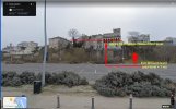
i-7FCv8h8-M.jpg


I rised the drone at 15-17 m and started to rotate it towards the sea (NE).
At 24 m high only towards west are the obstacles. There are also buildings on the S-SE but over 400 m away.
From the video image I had the impression that the drone is moving to the leftbut for only a few seconds before the crash.
Would that make the flyaway path be toward the northwest?
 
Lycus Tech Mavic Air 3 Case

DJI Drone Deals

Forum statistics

Threads
134,437
Messages
1,594,776
Members
162,975
Latest member
JNard1