DJI Mavic, Air and Mini Drones
Friendly, Helpful & Knowledgeable Community
Join Us Now

Drones "Spying" on New Jersey.

I haven't been able to get either of the drone scanner apps to work on my phone.
Even with my drone right in front of them.

If your phone is an iPhone, that is because Apple does not allow 3rd party apps to interact with WiFi in the way that is necessary for a Drone Scanner app to detect WiFi based Remote ID. Drone Scanner for iOS can only detect Bluetooth Remote ID.

DJI (and others) are equipped with WiFi Remote ID.

Mark
 
The FAA has confirmed drones have been flying in the areas in question.

Mark
Most of those confirmations have been identified as drones belonging to US LEO and Military, with a few (as in low counts like three or four) private drones flying in places they shouldn't, like airport flightpaths and military no-fly zones. But don't make the mistake of thinking that a few identified drones in the air proves all the reports are true. The vast majority of reported sightings are of commercial and civilian aircraft.

And keep in mind people are claiming drones are being seen in Ohio, now "multiple sighting" in the media; and if you read the actual reports it becomes clear they all seem to reference the Wright-Patterson closure on a runway while a drone was cleared. So one event is being amplified by calling the WP event "airports in Ohio shut down" ... it makes more clicks that way. btw, WP is in Ohio.
 
  • Like
Reactions: Torque
If your phone is an iPhone, that is because Apple does not allow 3rd party apps to interact with WiFi in the way that is necessary for a Drone Scanner app to detect WiFi based Remote ID. Drone Scanner for iOS can only detect Bluetooth Remote ID.

DJI (and others) are equipped with WiFi Remote ID.

Mark
FAA RFID for drones is never bluetooth. Why? Bluetooth has a max range of 100 meters. RFID is intended to reach out miles allowing LEO to identify owners and locate drones from distance.

[correction]: appears I am 100% in error here. so strike the no bluetooth comment.
 
Last edited:
If NOTAMS don't stop imaginary drones, nothing will.

Sarcasm aside, there's a legitimate question of why the FAA is issuing NOTAMs if there is absolutely nothing going on other than hysteria over manned flights that were always there to begin with.

The FAA is one of those "credible" authorities that cause me to take notice over something like this.
 
The looney tunes folks at Fox News think they have it all worked out and are spreading paranoia without any supporting facts.
To view this content we will need your consent to set third party cookies.
For more detailed information, see our cookies page.
As demonstrated in recent years, they have the ability to convince large numbers of gullible people of anything.
The looney tunes folks are eating our lunch atm. And they have convinced enough gullible people they are now in charge and it's going to be interesting to see how quickly the network changes their tune when the government changes over. Statements like "the government is not telling us...." overnight you won't hear that from them any longer.
 
And keep in mind people are claiming drones are being seen in Ohio, now "multiple sighting" in the media; and if you read the actual reports it becomes clear they all seem to reference the Wright-Patterson closure on a runway while a drone was cleared. So one event is being amplified by calling the WP event "airports in Ohio shut down" ... it makes more clicks that way. btw, WP is in Ohio.
I guess they got tired of all the pet consumption and found a new hobby.
 
FAA RFID for drones is never bluetooth. Why? Bluetooth has a max range of 100 meters. RFID is intended to reach out miles allowing LEO to identify owners and locate drones from distance.

You need to call the FAA to let them know that Bluetooth can't be used for Remote ID because they approved both Bluetooth Remote ID and WiFi Remote ID. You also need to contact Remote ID module manufacturers to tell them to stop making modules with Bluetooth Remote ID.


Mark
 
If your phone is an iPhone, that is because Apple does not allow 3rd party apps to interact with WiFi in the way that is necessary for a Drone Scanner app to detect WiFi based Remote ID. Drone Scanner for iOS can only detect Bluetooth Remote ID.

DJI (and others) are equipped with WiFi Remote ID.

Mark
Thanks but I use Android.
 
Make sure you don't deny the necessary permissions to configure wifi – the standard wifi config doesn’t work well recieving the wifi beacon that's used by RID. The app needs to set this up.
 
You need to call the FAA to let them know that Bluetooth can't be used for Remote ID because they approved both Bluetooth Remote ID and WiFi Remote ID. You also need to contact Remote ID module manufacturers to tell them to stop making modules with Bluetooth Remote ID.


Mark
Well, I stand corrected, I think. I was recently reading some online FAA.gov paper work looking up my drones particulars (that now I can't find) and came away with the normal 2.4/5.8 wifi bands specified; and my mind locked it to traditional WiFi. As I recall the doc mentioned WiFi but didn't mention Bluetooth.

But yeah, seems some of the Bluetooth only RFID modules mentioned and sold above are registered on Dronezone.
Not sure why you keep using "RFID" for Remote ID. RFID is the acronym for a different technology.

Mark
 
Drones over Lockheed Martin F35 factory and Carswell Naval Air Station.

To view this content we will need your consent to set third party cookies.
For more detailed information, see our cookies page.
 
Last edited:
Drones around Hill AFB

To view this content we will need your consent to set third party cookies.
For more detailed information, see our cookies page.
 
I can't believe I have to say this but sadly it's probably time for the current crop of government official to go and to step aside for those who are fresh and have an open mind and may be able/willing to do the job. This is getting ridiculous. Hopefully the same sad excuses (like you need to look up in the sky more often or it's the moon) won't be applied to the military when they report their observations; hopefully they will be taken seriously.
 
Vandenberg Space Base incident
Obviously a master espionage agent.
Flying a Mini a mile high, he would have captured even less detail than Google Earth.
The top secret details of roofing and car park layout might have been revealed!
i-DMrV29x-XL.jpg
 
  • Like
Reactions: Torque and jaja6009
Obviously a master espionage agent.
Flying a Mini a mile high, he would have captured even less detail than Google Earth.
The top secret details of roofing and car park layout might have been revealed!
i-DMrV29x-XL.jpg

If only these master spies did some research, they could save themselves a lot of trouble.

Every year or so our county purchases a hi-res ortho from Eagle View. Higher quality than Google and free.
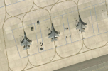
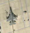
This version is the tiled one. I am sure the true ortho holds even more detail. They use it to look for property upgrades no reported for tax purposes. On another note, F-16's are pretty birds.

1734762905836.png

1734763137517.png
 
If only these master spies did some research, they could save themselves a lot of trouble.

Every year or so our county purchases a hi-res ortho from Eagle View. Higher quality than Google and free.
This version is the tiled one. I am sure the true ortho holds even more detail. They use it to look for property upgrades no reported for tax purposes. On another note, F-16's are pretty birds.

View attachment 179915

View attachment 179916
Can you post Google Earth photos showing the Vandenberg Space X launch site the exact day that Zhou flew his Mavic 2? If you can, would getting such a photo off the internet help you test the security of the AFB and its response time to drone incursions?
 
Can you post Google Earth photos showing the Vandenberg Space X launch site the exact day that Zhou flew his Mavic 2? If you can, would getting such a photo off the internet help you test the security of the AFB and its response time to drone incursions?
To do everything your claiming he did, I hope it was at least the Mavic 2 Zoom.
 

DJI Drone Deals

New Threads

Members online

Forum statistics

Threads
135,132
Messages
1,602,810
Members
163,615
Latest member
RichK69
Want to Remove this Ad? Simply login or create a free account