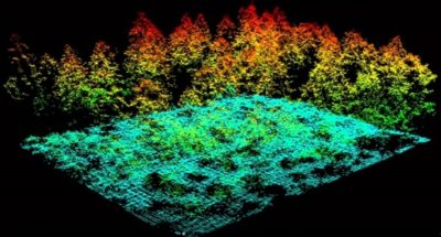
I am the Local History Librarian with a public library in N.C. We have been conducting a cemetery survey of the African American cemeteries including slave cemeteries in our county. I was watching a documentary on TV that showed a drone being used with a LIDAR. Is there an entry level drone with LIDAR on the market? Has anyone tried to purchase a LIDAR scanner and a drone and put them together to create their own?
Thanks,
Joel
Thanks,
Joel