

new guy from NC starting out with some hard lessons learned already $$$$ hopefully can gain some much needed guidance here smh
You are using an out of date browser. It may not display this or other websites correctly.
You should upgrade or use an alternative browser.
You should upgrade or use an alternative browser.
lost in carolina
- Thread starter fatback68
- Start date


Mrktn
Well-Known Member
A big welcome to the forum from the UK!new guy from NC starting out with some hard lessons learned already $$$$ hopefully can gain some much needed guidance here smh
What’s happened?
the drone just started bugging out i think mabe the controller failed or maybe was jammed lots of gov drones in my area its unreal have been seeing them for 3 years now its crazy

This could easily be why you are seeing military air traffic. The yellow line just south of Rowland is a military training route.

Kendallfordguy
Well-Known Member
careless
Well-Known Member
Hi! Welcome to the forum, from Hauptmann in Hurst, Texas!
Normally, I can read the recorded data from a drone flight and understand what happened in an flight incident.the drone just started bugging out i think mabe the controller failed or maybe was jammed lots of gov drones in my area its unreal have been seeing them for 3 years now its crazy
There are numerous problems with your recorded flight data and I'm having a lot of trouble making sense of it to work out what happened in your flight.
Some of the issues I see:
You had GPS reception for only a small part of the flight.
The flight data starts with your drone showing that it's already 1243 feet up and 2.5 miles away ???
Basically we have no idea where your drone actually was or how high it was.
Your post suggests that you might have recently bought the drone?
But it's an old model that came out 9 years ago.
It shouldn't have cost much.
Going by the mess the data is in, I'm guessing that it was a wreck and faulty when you bought it.
It doesn't look like controller failure was an issue and I doubt that jamming or government drones had anything to do with the incident.
When it lost control signal and had no GPS reception, the drone is programmed to land where it is, but we can't tell where that would be from the data.
Last edited:
PakNheat380
Well-Known Member
Welcome to the forum from the beautiful woods of Maine!
Welcome to the forum. We look forward to your participation and your view of the world.
LoudThunder
Part 107 Licensed
new guy from NC starting out with some hard lessons
Welcome from the Hampton Roads area of Virginia, USA. We have a Member's Map in the Upper Right of the Title Bar. Click on "Members" and then Click on "Member's Map…" Check it out and you might find some new flying friends.
Member Map
 mavicpilots.com
Here is a list of things you might do when you buy a new drone…
As a New Drone Pilot, there are a couple of Legal Things you may need to do…
If you have not already done so, you will need to get your TRUST Certificate. You can get that at the Pilot Institute Web Site (FREE…). If your Drone weighs less than 250-grams (0.55 pounds), and while you are flying under The Exception for Recreational Flyers, you are not required to register your Drone.
If your Drone weighs more than 250-grams (0.55 pounds), and even while you are flying under The Exception for Recreational Flyers, you are required to register your Drone.
Link to the TRUST Certificate at the Pilot Institute Web Site (FREE…)

FAA TRUST Online Portal for Recreational Drone Operators - Pilot Institute
Get your FAA TRUST Certificate of Completion to legally fly drones for recreational reasons in the United States.
Link to the FAADroneZone (Optional Registration for Drones under 250-Grams…)
FAADroneZone
Since you live in North Carolona, there are specific laws and rules for you to follow, please check the link below for all the Rules and Laws that are in effect in your neck of the woods and it also links you to some of the Best Places to Fly in your area… Also, if you travel on vacation, visit friends, and relatives in other parts of the country, check back here so you do not run afoul of the law.
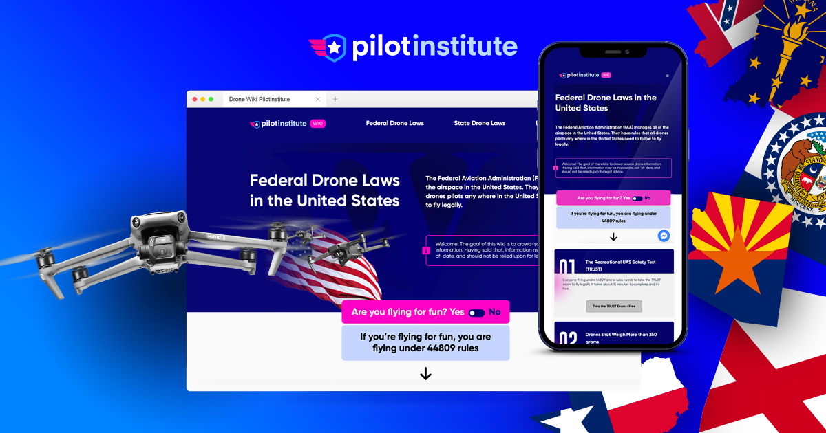
Federal Drone Laws in the United States (FAA) - Pilot Institute
44809 is an exemption from Part 107 drone laws. This means that drone pilots fly under Part 107 drone rules by default unless they meet all 9 of the requirements to fly under 44809, the exception for limited recreational operations of unmanned aircraft. You can read more about these requirements...
Even if you have flown Drones before, here is some Good Old Fashion Advice…
You paid a lot of money for that Drone, put your phone number on it. If your drone gets lost or stuck in a tree and it finally comes down when you are not around, give the finders an opportunity to contact you so it can be returned.
Now, for the Fun Part, But do not let the excitement of the moment get the best of you. When you are going out to fly, do it slowly and deliberately. Get used to a set procedure and even practice it.
There are so many things I could write but these are the highlights that I feel need mentioning.
Plug in your phone/tablet into your controller; turn on the Controller and DJI Fly App (if it does not start on its own…). On the Drone, open the front legs, then open the back legs, then remove the Gimbal Cover.
The Gimbal is the most delicate item on the Drone and banging or bumping can damage it. I also fastened a short "Remove Before Flight" ribbon to the cover so it's more noticeable and I do not forget to remove it…
Turn on the drone and watch it come to "life." Watching the Gimbal go through its self-check is almost like watching a puppy or kitten opening its eyes for the first time…
Place the drone down (preferably on a Landing Pad) while it finishes its self-test (collecting satellites, etc…).
Check your battery status (Phone, Drone, and Controller), check the Signal Strength, by now the Controller should have reported it updated the Home Point.
Lift off, 6- feet (2-meters) or so, hover a bit, check the controls (move the drone a bit forward, back, left, right, yaw left and right). By now, your Controller will probably report again, Home point Updated.
If you go out in a rush and race thru your start up and take off before the drone has finished it prep, it may update its Home Point over that pond or that old tree you are flying over and in your excitement, you'll fly the drone long past it Low Battery point and when it engages Return to Home and lands in the pond or in a tree; it will be all on you…
Now go have fun, learn to fly the drone by sight before you try to fly it out a distance depending on the video feed, FPV.
I would also advise you to use YouTube and watch a lot of the Videos on flying and setting up the Drone. When it is too dark, too cold, or too wet, you can "fly it vicariously" through YouTube. Also watch some of the Blooper Drone Videos and learn how not to fly your "New Baby."
Fly On and Fly Safe…
... this is first leg of flight i had rebooted app trying to gain control so its in 2 peacesNormally, I can read the recorded data from a drone flight and understand what happened in an flight incident.
There are numerous problems with your recorded flight data and I'm having a lot of trouble making sense of it to work out what happened in your flight.
Some of the issues I see:
You had GPS reception for only a small part of the flight.
The flight data starts with your drone showing that it's already 1243 feet up and 2.5 miles away ???
Basically we have no idea where your drone actually was or how high it was.
Your post suggests that you might have recently bought the drone?
But it's an old model that came out 9 years ago.
It shouldn't have cost much.
Going by the mess the data is in, I'm guessing that it was a wreck and faulty when you bought it.
It doesn't look like controller failure was an issue and I doubt that jamming or government drones had anything to do with the incident.
When it lost control signal and had no GPS reception, the drone is programmed to land where it is, but we can't tell where that would be from the data.
Greetings from Birmingham Alabama USA, welcome to the forum! We look forward to hearing from you!
OK ... having that information helps to put the previous information into context.this is first leg of flight i had rebooted app trying to gain control so its in 2 peaces
I have to ask .. have you flown DJI drones before or was this your first time?
Are you aware of the rules pertaining to drone flying?
And were you flying at 4am?
It looks like you didn't have much drone survival instinct.
You launched and flew south-southeast, further and further, higher and higher, far away from where you launched.
You had repeated issues with losing signal, kept increasing altitude and going further.
Your drone fully lost signal a couple of times and when signal returned, the drone was in RTH and heading back towards home.
But you cancelled the RTH and persisted flying further to the SSE.
Towards the end of the first part of the flight data, at 18:28.8 the the drone began to have problems with GPS reception.
The number of sats acquired dropped abruptly from 14 to zero -that's not normal.
Normal GPS reception resumed after about 15 seconds.
At 18:52.2 the drone entered RTH again and continued until 19:33.6 when you "rebooted the app trying to gain control", although the app doesn't show anything that suggests why you thought this was necessary.
You suggested that the drone "just started bugging out".
I'm not sure what that means and can't spot anything in the data that explains it.
Can you give more details?
At the end of data, the drone was 2.5 miles away and 1245 feet higher than where you launched.
End of Part 1
Last edited:
Part 2this is first leg of flight i had rebooted app trying to gain control so its in 2 peaces
The data resumes 30 seconds later with the drone reporting no GPS reception - not normal since the drone had not been switched off.
You started flying towards home and GPS was dropping out and back throughout the flight.
There are a number of yaw errors reported but these make no sense.
At 2:17.5 the reported speed is false, due to unreliable GPS data.
After 2:25.4, although you kept flying forwards, there is no updated location data and we have noidea where the drone was from then on.
You kept flying for nearly 3 minutes when the data stops.
At the time the drone was reporting that it was 1278 feet higher than the launch spot.
Because of the erratic control inputs and the time without location data, there is no way to estimate where the drone ended up.
Without GPS, the drone couldn't have returned to home as it is programmed to.
If/when signal was lost the drone would have landed where it was at some unknown location, possibly a mile or so from where you started.
Battery data shows 3.7 volts per cell, so the drone should have been able to land safely.
The reason for the erratic GPS reception is a mystery.
Last edited:
warning after warning back to back flags were popping up on app i paniced an yea just getting my feet wet bwine f7 was first now this mavic pro i fell in loveOK ... having that information helps to put the previous information into context.
I have to ask .. have you flown DJI drones before or was this your first time?
Are you aware of the rules pertaining to drone flying?
And were you flying at 4am?
It looks like you didn't have much drone survival instinct.
You launched and flew south-southeast, further and further, higher and higher, far away from where you launched.
You had repeated issues with losing signal, kept increasing altitude and going further.
Your drone fully lost signal a couple of times and when signal returned, the drone was in RTH and heading back towards home.
But you cancelled the RTH and persisted flying further to the SSE.
Towards the end of the first part of the flight data, at 18:28.8 the the drone began to have problems with GPS reception.
The number of sats acquired dropped abruptly from 14 to zero -that's not normal.
Normal GPS reception resumed after about 15 seconds.
At 18:52.2 the drone entered RTH again and continued until 19:33.6 when you "rebooted the app trying to gain control", although the app doesn't show anything that suggests why you thought this was necessary.
You suggested that the drone "just started bugging out".
I'm not sure what that means and can't spot anything in the data that explains it.
Can you give more details?
At the end of data, the drone was 2.5 miles away and 1245 feet higher than where you launched.
End of Part 1
the warning flags were back to back like i had lost control i paniced i did was going to my girlfriends trailer tree line was blocking signal so i kept going up that 12800 mah battery gave me a false security i had flown 50,000 plus feet the day before an still had 20 percent when i landed so yea i was seeing what she would do didnt think i would loose the thing smhOK ... having that information helps to put the previous information into context.
I have to ask .. have you flown DJI drones before or was this your first time?
Are you aware of the rules pertaining to drone flying?
And were you flying at 4am?
It looks like you didn't have much drone survival instinct.
You launched and flew south-southeast, further and further, higher and higher, far away from where you launched.
You had repeated issues with losing signal, kept increasing altitude and going further.
Your drone fully lost signal a couple of times and when signal returned, the drone was in RTH and heading back towards home.
But you cancelled the RTH and persisted flying further to the SSE.
Towards the end of the first part of the flight data, at 18:28.8 the the drone began to have problems with GPS reception.
The number of sats acquired dropped abruptly from 14 to zero -that's not normal.
Normal GPS reception resumed after about 15 seconds.
At 18:52.2 the drone entered RTH again and continued until 19:33.6 when you "rebooted the app trying to gain control", although the app doesn't show anything that suggests why you thought this was necessary.
You suggested that the drone "just started bugging out".
I'm not sure what that means and can't spot anything in the data that explains it.
Can you give more details?
At the end of data, the drone was 2.5 miles away and 1245 feet higher than where you launched.
End of Part 1
Trees will block the controller signal if there are enough of them.warning after warning back to back flags were popping up on app i paniced an yea just getting my feet wet bwine f7 was first now this mavic pro i fell in love
the warning flags were back to back like i had lost control i paniced i did was going to my girlfriends trailer tree line was blocking signal so i kept going up that 12800 mah battery gave me a false security i had flown 50,000 plus feet the day before an still had 20 percent when i landed so yea i was seeing what she would do didnt think i would loose the thing smh
You need to fly where there is a clear, unobstructed line of sight between the controller and drone.
None of the warning messages indicated any loss of control and the data up to that point suggests that you had full control.
But many of the messages should have been a clue that you were flying much too far.
The loss of GPS is puzzling and definitely not normal.
Possibly due to a hardware issue?
So have you flown DJI drones before?
Are you aware of the rules for drone flying?
Similar threads
- Replies
- 26
- Views
- 3K
- Replies
- 19
- Views
- 1K


DJI Drone Deals
Members online
Total: 1,135 (members: 10, guests: 1,125)
Forum statistics
