DJI Mavic, Air and Mini Drones
Friendly, Helpful & Knowledgeable Community
Join Us Now

Making your own ground control points

Andrex

Well-Known Member
Joined
Oct 29, 2019
Messages
119
Reactions
61
Age
35
Location
52.671512,-2.677724
Who has made their own Ground Control Points (GCPs)?

I'm going to set up a number of GCPs at a site where I will be carrying out regular drone surveys (it's a developing quarry site, for info).

The GCPs will be picked up by the quarry surveyor using accurate equipment.

I'm thinking of popping along to the local B&Q hardware store and purchasing some thing sheets of plywood, white and black paint, and making GCPs approximately 40-50 cm wide with a large white/black painted cross on which will be pegged to the ground at various secure locations around site.

Just wondered if anyone else has experience in making their own GCPs?
 
What are they, and what are they for??? Sorry, new flier here..
 
What are they, and what are they for??? Sorry, new flier here..

For creating an orthophoto or DEM. The built in Mavic 2 GPs is not accurate enough. Manually surveying the GCPs to exact ordnance datum (so, x,y,z) means the generated orthophoto from the software can be accurately corrected to national grid, to a much higher, centimeter, degree of accuracy.
 
  • Like
Reactions: Movr
I've spoken with guys that have used kitchen tiles on boards similar to what you're talking about putting together, provided that you can ensure they won't move and the point you're tagging in your photos is representative of the location/elevation you've tagged you should be fine. It doesn't need to be a specific tile or target.

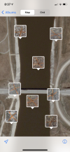
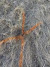
I've had a good deal of success even just using spray paint and 12" nails. I just make sure to take a ground shot so that A) my phone makes a geotag I can refer back to if I need and B) I have something visual to refer back to if my aerial photos aren't as clear as I would've liked.
 

Attachments

  • Photo_Oct_20_20 08-17-26 AM-1.png
    Photo_Oct_20_20 08-17-26 AM-1.png
    8.7 MB · Views: 18
  • Photo_Oct_20_20 08-17-26 AM-10.jpg
    Photo_Oct_20_20 08-17-26 AM-10.jpg
    6 MB · Views: 18
  • Photo_Oct_20_20 08-17-26 AM-15.jpg
    Photo_Oct_20_20 08-17-26 AM-15.jpg
    6.5 MB · Views: 17
If you are repeating the mission to show progress or removal of material over time I would install permanent control points which can be tagged in every flight over time. Processed and on the correct datum they require. Of course you will need to place CGP's in areas which change over time but you will have a correct base station and permanent control points to come from.
 
Just a question, how do you know where to place your GCP's ? Do you have to find your location with lat/long numbers and place them or do you just place them? If you just place them, how do you calibrate them?
 

DJI Drone Deals

New Threads

Forum statistics

Threads
130,593
Messages
1,554,204
Members
159,598
Latest member
fast54