Who has made their own Ground Control Points (GCPs)?
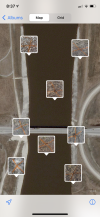
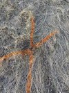
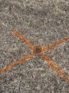
I'm going to set up a number of GCPs at a site where I will be carrying out regular drone surveys (it's a developing quarry site, for info).
The GCPs will be picked up by the quarry surveyor using accurate equipment.
I'm thinking of popping along to the local B&Q hardware store and purchasing some thing sheets of plywood, white and black paint, and making GCPs approximately 40-50 cm wide with a large white/black painted cross on which will be pegged to the ground at various secure locations around site.
Just wondered if anyone else has experience in making their own GCPs?