DJI Mavic, Air and Mini Drones
Friendly, Helpful & Knowledgeable Community
Join Us Now

More erroneous NFZ's....

Donnie Frank

Well-Known Member
Joined
Sep 21, 2017
Messages
529
Reactions
374
Age
61
Location
Albuquerque, N.M.
Hey doods!

Out on a photography job last night I received more erroneous NFZ notifications from DJI.
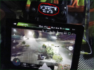
1655395460692.png


Fortunately, my Mavic Pro is hacked and I was able to complete the mission unimpeded. But I can only imagine what guys are going through with their unhacked drones. I have had the same issues on a construction shoot with my Inspire 1, which is NOT hacked (posted about it last week). I have figured out a workaround, but it's still a bit inconvenient.

I double and triple checked all NOTAM's for the area and there are no published restrictions for this area, temporary or otherwise.

I don't know what DJI is up to, but I have a feeling that they're erroneously grounding drones on purpose. Who knows why???

Anybody else experiencing this??

D
 
  • Like
Reactions: Faster
Did you check the DJI Flysafe geo map for their own restrictions on top of airspace authority NFZs ?

It’s not often a problem here, but I’ve had a recent experience with it, and a couple of other examples on the forum here from Aussie pilots over the years.

Links here in this post.

 
Did you check the DJI Flysafe geo map for their own restrictions on top of airspace authority NFZs ?

It’s not often a problem here, but I’ve had a recent experience with it, and a couple of other examples on the forum here from Aussie pilots over the years.

Links here in this post.

I have distanced myself from DJI. Other than Go and Go4, I don't use any of their apps. Even then, I use Go and Go4 in limited capacity. I mostly use them to clear MicroSD cards and inspect WiFi interference. I rarely use them for actual flying. The screenshot in the OP is one of those rare occasions.

D
 
I have distanced myself from DJI. Other than Go and Go4, I don't use any of their apps.

D

I only use go4 myself.
The flysafe Geo map is a web based tool, and the database one downloaded to your drone (user can ignore) when you start up the app / drone connection.
If you don’t check it before important fights near some locations, you might get caught out.
It could be what you experienced, you won’t know if you don’t check that location on the page in linked post.
 
I have distanced myself from DJI. Other than Go and Go4, I don't use any of their apps. Even then, I use Go and Go4 in limited capacity. I mostly use them to clear MicroSD cards and inspect WiFi interference. I rarely use them for actual flying. The screenshot in the OP is one of those rare occasions.

D
Not far enough evidently. 👍
 
  • Like
Reactions: Donnie Frank
DJI's definition of a NFZ is sometimes inconsistent with the FAA or your the agency where you live. Yesterday I did a job in a LAANC "Zero" area (with an FAA waiver to fly 125 AGL). The DJI app advised I was close to an airport but did not restrict in any way. The DJI Flysafe did restrict and require an unlock for the runway zones but I was not operating in those. BTW I have not had any trouble getting DJI unlocks; you sometimes have to have an uploadable image of your LAANC approval but that's the worst of it.
 
  • Like
Reactions: skysheen
DJI's definition of a NFZ is sometimes inconsistent with the FAA or your the agency where you live.
Yessir. That would be an understatement.


Yesterday I did a job in a LAANC "Zero" area (with an FAA waiver to fly 125 AGL). The DJI app advised I was close to an airport but did not restrict in any way. The DJI Flysafe did restrict and require an unlock for the runway zones but I was not operating in those. BTW I have not had any trouble getting DJI unlocks; you sometimes have to have an uploadable image of your LAANC approval but that's the worst of it.
It's funny, but the chain of events that have to go right for me to deliver an end product is insane. One broken link in the chain can cause a free do-over or cost my clients thousands. Yesterday's logistical nightmare was "trees." For the first time in 6 years of mapping, trees were causing so much interference that I ALMOST couldn't complete a normally-routine mapping job. It never ceases to amaze me how many curve balls this industry tosses me. Everything from battery management to data management to drone management to camera management to launch locations, software management and on and on and on creates a very logistically-heavy career. So the LAST thing I have time for is erroneous NFZ's. And I learned WAAAAAY early on to NEVER count on DJI for ANYTHING. I love their drones, so I use them. But the buck stops there. "Support" is non-existent. I absolutely, positively can NOT rely on connections to DJI infrastructure or DJI "permissions" to launch and fly my missions.

Tuesday I flew 3 missions for 3 clients using 3 different drones; My Inspire 1, my Mavic Pro and my P4P. Both the construction progress mission (Inspire 1) and parking lot light photography mission (Mavic Pro) encountered completely erroneous NFZ's that I just bite my thumb at and fly unimpeded. The P4P encountered interference from trees. I lost connection 1 time a mere 2200ft out. Fortunately, my missions are set up to take these into account, but I digress. My point is that I have enough to deal with logistically without making sure I have a LAANC screenshot stored on my iPad (don't have a smart phone and don't want one).

All of my jobs are away from WiFi. And some of them are out of cell range. So all my missions - every last one - are completely self-contained. All maps are cached as well as terrain data. I never, ever count on any outside sources, connections or servers for ANY mission. Ever. This has served me well over the past 7 or 8 years. I highly recommend professional UAS pilots do the same.

D
 
  • Like
Reactions: skysheen
Lycus Tech Mavic Air 3 Case

DJI Drone Deals

New Threads

Forum statistics

Threads
132,304
Messages
1,571,811
Members
161,023
Latest member
kkanoz86