

You are using an out of date browser. It may not display this or other websites correctly.
You should upgrade or use an alternative browser.
You should upgrade or use an alternative browser.
Official Mavic Pro Range Leaderboard!
- Thread starter Long Ranger
- Start date

Both the distance traveled and the distance to the home point can be seen using CsvView. Go here to obtain a copy of CsvView. Go here to see the CsvView user manual. and here to see info about retrieving the .DAT.@JakeMaxxUAV 45,884ft
Just completed my first dual 3000mah lihv setup. Roughly 35min flight time. 4.5mph average wind with a few 12mph gusts. The Mavic performed without a hitch. GO crashed as did my AZ screen recording software and I did get to 46,587ftbut Airdata only recorded 45,884ft so that will have to do! Gutted, I wanted 3rd place! Any one know any decent .mp4 recovery software / a way to extract max distance from .dat?
Airdata UAV - Flight Data Analysis for Drones
Airdata UAV - Flight Data Analysis for Drones
View attachment 20626

Cheers for the info. What a great tool! My home point is still 100m or so less as it didn't update until I had flown that far as I forgot to update manually. Proof enough for 3rd?  The flight is split into 2 separate .dat files but this is the one that matters, I believe. You can see the point I was turning around from this too.
14086m = 46213ft

The flight is split into 2 separate .dat files but this is the one that matters, I believe. You can see the point I was turning around from this too.14086m = 46213ft
dirtybum
Well-Known Member
- Joined
- May 4, 2017
- Messages
- 538
- Reactions
- 460
- Age
- 49
Cheers for the info. What a great tool! My home point is still 100m or so less as it didn't update until I had flown that far as I forgot to update manually. Proof enough for 3rd?
14086m = 46213ft
View attachment 20644
300 feet from home point!! my 50,000 foot flight should be third place then if if landing 300 foot away is good enough[emoji41]
I landed where I took off from, well within 5ft or so, so the longer distance is correct. The first part is missing on Airdata, hence the .dat proof.
Hey I'm happy with what ever Jake decides. No point being too serious about it. I cocked up by relying on AZ recorder.
Gives me another excuse to try again if not
Hey I'm happy with what ever Jake decides. No point being too serious about it. I cocked up by relying on AZ recorder.
Gives me another excuse to try again if not
TheLightSpeed!
Well-Known Member
Those are the batteries I have too, also a clip. I need to do the mod to the clip like you did.
What controller mods?
@Japtastic what was the final product of your clip mod? Did you just electrical tape it? Or did you do something else like shrink tube?
TheLightSpeed!
Well-Known Member
Just electrical tape for now. Turned out just fine.
You're my inspiration @Japtastic just so you know! I finally went "F IT" I'm tired of cramming the wires all over! Much more room!
I hate damaging my $50 part that costs $2 to make.

TheLightSpeed!
Well-Known Member
I single wrapped and heat shrinked the two copper flats, and then one big piece over it and re shrunk another piece over the XT's
I may as well hot glue it on there, I don't plan on taking it off unless I go direct. But I think you're pushing the limits of the list and may have been the only "clip" in the top ten.
I may as well hot glue it on there, I don't plan on taking it off unless I go direct. But I think you're pushing the limits of the list and may have been the only "clip" in the top ten.
**mick**
Well-Known Member
I'm 5th on the LB, with the vertical modded clip ... japtastic got the idea from me lol,I single wrapped and heat shrinked the two copper flats, and then one big piece over it and re shrunk another piece over the XT's
I may as well hot glue it on there, I don't plan on taking it off unless I go direct. But I think you're pushing the limits of the list and may have been the only "clip" in the top ten.
I would defiantly glue it down, mine is glued to the vinyl skin so easy remove when needed
TheLightSpeed!
Well-Known Member
I'm 5th on the LB, with the vertical modded clip ... japtastic got the idea from me lol,
I would defiantly glue it down, mine is glued to the vinyl skin so easy remove when needed
Standing corrected! Yeah it just makes so much better sense to me.
Sorry to let you down @TheLightSpeed! I saw a few people had done it but Mick supplied the info.
I saw a few people had done it but Mick supplied the info.**mick**
Well-Known Member
Ah man shame about the app crash, it's a nice day today, I'll think I'll have another go, I'm just looking for a new spot on google maps to take off from@JakeMaxxUAV 45,884ft
Just completed my first dual 3000mah lihv setup. Roughly 35min flight time. 4.5mph average wind with a few 12mph gusts. The Mavic performed without a hitch. GO crashed as did my AZ screen recording software and I did get to 46,587ft
Airdata UAV - Flight Data Analysis for Drones
Airdata UAV - Flight Data Analysis for Drones
View attachment 20626
Last edited:

brandon0611
Member
Any verdict on the titan antenna? I have a lot of trees and signal sucks. Max out at around 12,000 feet for distance.
TheLightSpeed!
Well-Known Member
Any verdict on the titan antenna? I have a lot of trees and signal sucks. Max out at around 12,000 feet for distance.
It's really great. I haven't tested it against anything, but I've owned many DBS panel antennas boosted and not... this is an all in one clean unit. Anything else and you'll be carrying a rats nest of crap and charging battery banks etc. just to keep it working.
This unit seems to be pretty Legit. For the price you cannot beat it.
I know foot in mouth. I'm eating crow. So save it.
MacIak
Well-Known Member
I never intended to join the board, just love long range flights.
Still id like to post this one to honor Creep. (@JakeMaxxUAV ).
It's been out n back further and not the most efficient flight but this particular one is over the very waters it s resting in.
Dual 3000 LiHv, Nanosync BOOST-ed.
Airdata UAV - Flight Data Analysis for Drones
Edit: and no, it's NOT the last one!
JakeMaxxUAV
Well-Known Member
- Joined
- Oct 13, 2016
- Messages
- 84
- Reactions
- 135
- Age
- 39
Welcome to the board bud!I never intended to join the board, just love long range flights.
Still id like to post this one to honor Creep. (@JakeMaxxUAV ).
It's been out n back further and not the most efficient flight but this particular one is over the very waters it s resting in.
Dual 3000 LiHv, Nanosync BOOST-ed.
Airdata UAV - Flight Data Analysis for Drones
Edit: and no, it's NOT the last one!
I also plan on joining very soon. Hopefully this weekend!
ColoradoBob
Member
- Joined
- Dec 1, 2016
- Messages
- 21
- Reactions
- 16
- Age
- 71
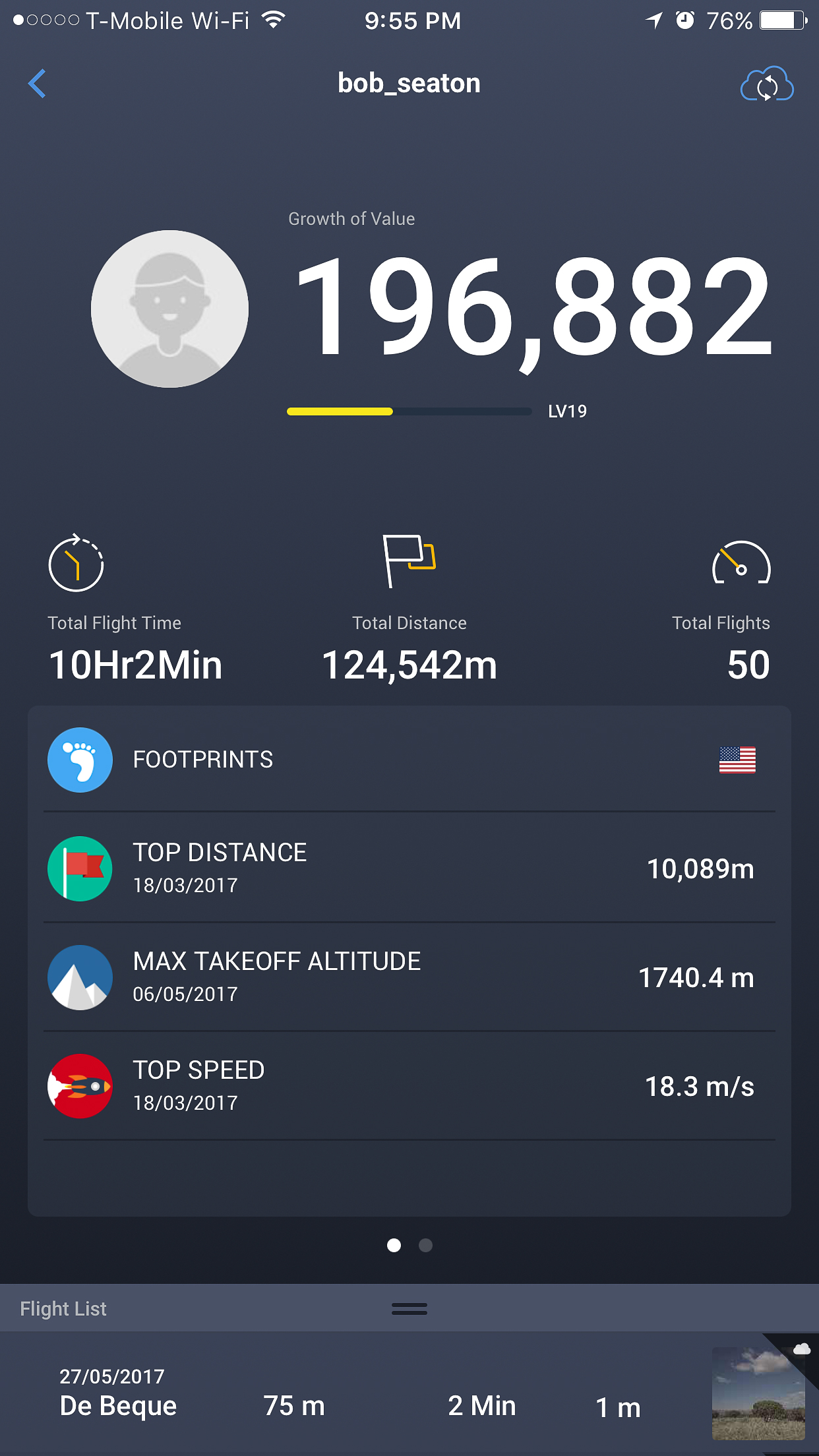
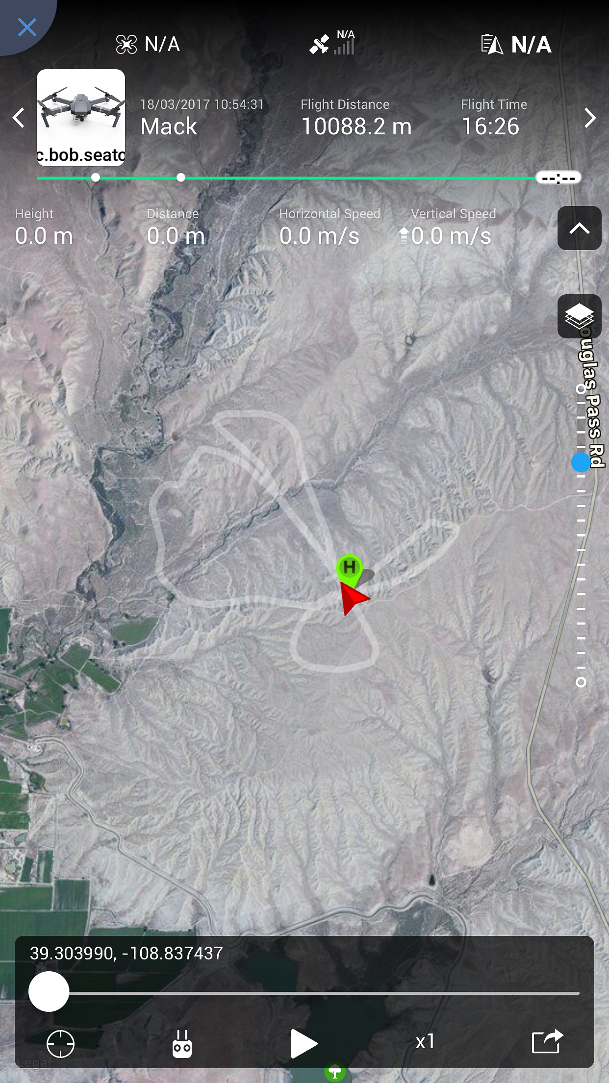
Here is my longest single battery flight 10,088.2 meters that equals out to 33,097.769 feet on one battery, stock setup... Didn't see this thread until today, duh...
Cold day in March with no wind...Only used the Sport setting for the last 1000 meters
Cold day in March with no wind...Only used the Sport setting for the last 1000 meters
Similar threads
- Replies
- 11
- Views
- 1K
- Replies
- 0
- Views
- 1K
- Replies
- 10
- Views
- 2K
- Replies
- 6
- Views
- 1K


DJI Drone Deals
New Threads
-
-

-
 Simulators with the DJI RC N1 controller.....
- Started by Dan'sUavTech
- Replies: 0
-

-
 UAS Nexus (By Chris 'The Drone Geek' Fravel)
- Started by The Droning Company
- Replies: 0
Members online
Total: 4,485 (members: 7, guests: 4,478)
Forum statistics
