Very neat piece of work. There is another enhancement that would be interesting.
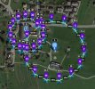
Right now the POI height can be set but it is static. Being able to control the pitch angle as the altitude increases would provide some benefits when flying around taller structures.
One could start looking at the base (ground level) with a large degree of pitch and then decrease pitch as altitude increases to get a horizontal view higher on the structure. This would then bring the horizon into view and offer a sweeping vista at altitude.


")