

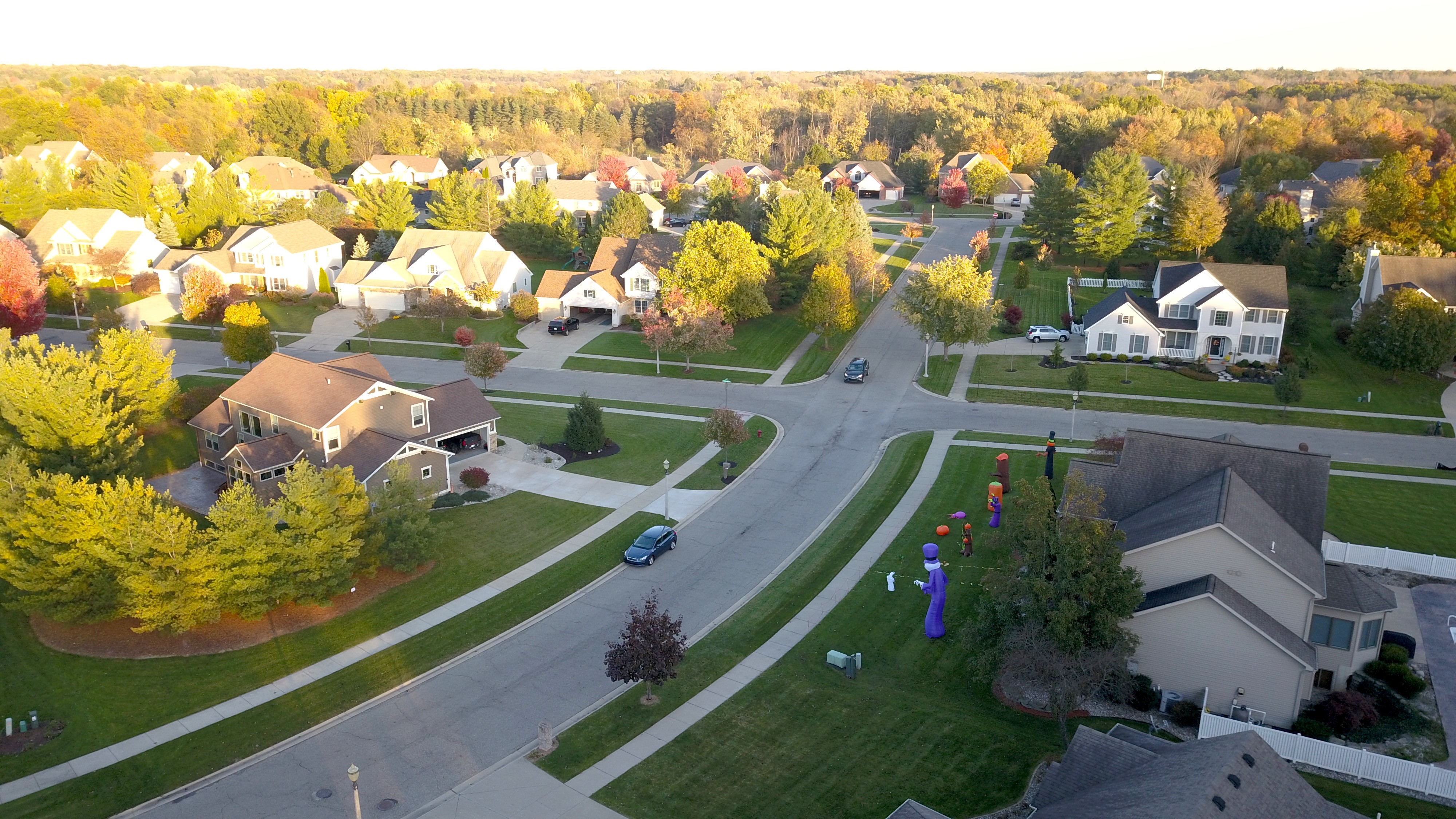
Various pics from around Perthshire Scotland

You are using an out of date browser. It may not display this or other websites correctly.
You should upgrade or use an alternative browser.
You should upgrade or use an alternative browser.
Fall Foliage Photo Contest. Prizes for top 6 entries.
- Thread starter Former Member
- Start date
- Status
- Not open for further replies.
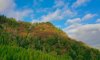

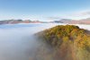
The weather isn't looking too good for the next week, so here's my entry from this weekend at River Gaur.

- Time: 11am
- No physical filter
- 1/800 shutter speed, ISO 100
- Tweaked curve in photoshop and applied ND filter over the sky.
- River Gaur, Perthshire, Scotland
- elevation: ~15ft
- Mavic 2 Zoom

ndroll
Member
- Joined
- Aug 14, 2017
- Messages
- 12
- Reactions
- 9
- Age
- 56

Taconic State Parkway
10/21/18
Mavic 2 Pro
ND32
3:40pm
1/200. ISO 100
Edit-photo post error. Can’t seem to embed.
View attachment 51109
10/21/18
Mavic 2 Pro
ND32
3:40pm
1/200. ISO 100
Edit-photo post error. Can’t seem to embed.
View attachment 51109
Last edited:
Gold leaves in a historic gold mining area
10-7-18
Mavic pro
Edited in LR
Near Cripple Creek Colorado

10-7-18
Mavic pro
Edited in LR
Near Cripple Creek Colorado
Here is the @NAUIDIVER photo from post #75
Taconic State Parkway
10/21/18
Mavic 2 Pro
ND32
3:40pm
1/200. ISO 100

Taconic State Parkway
10/21/18
Mavic 2 Pro
ND32
3:40pm
1/200. ISO 100
Taken Oct 9, 2018 in Moultonborough NH. 2:37PM. Mavic Pro. 125 meters. Auto exposure, some minor  Photoshopping.
Photoshopping.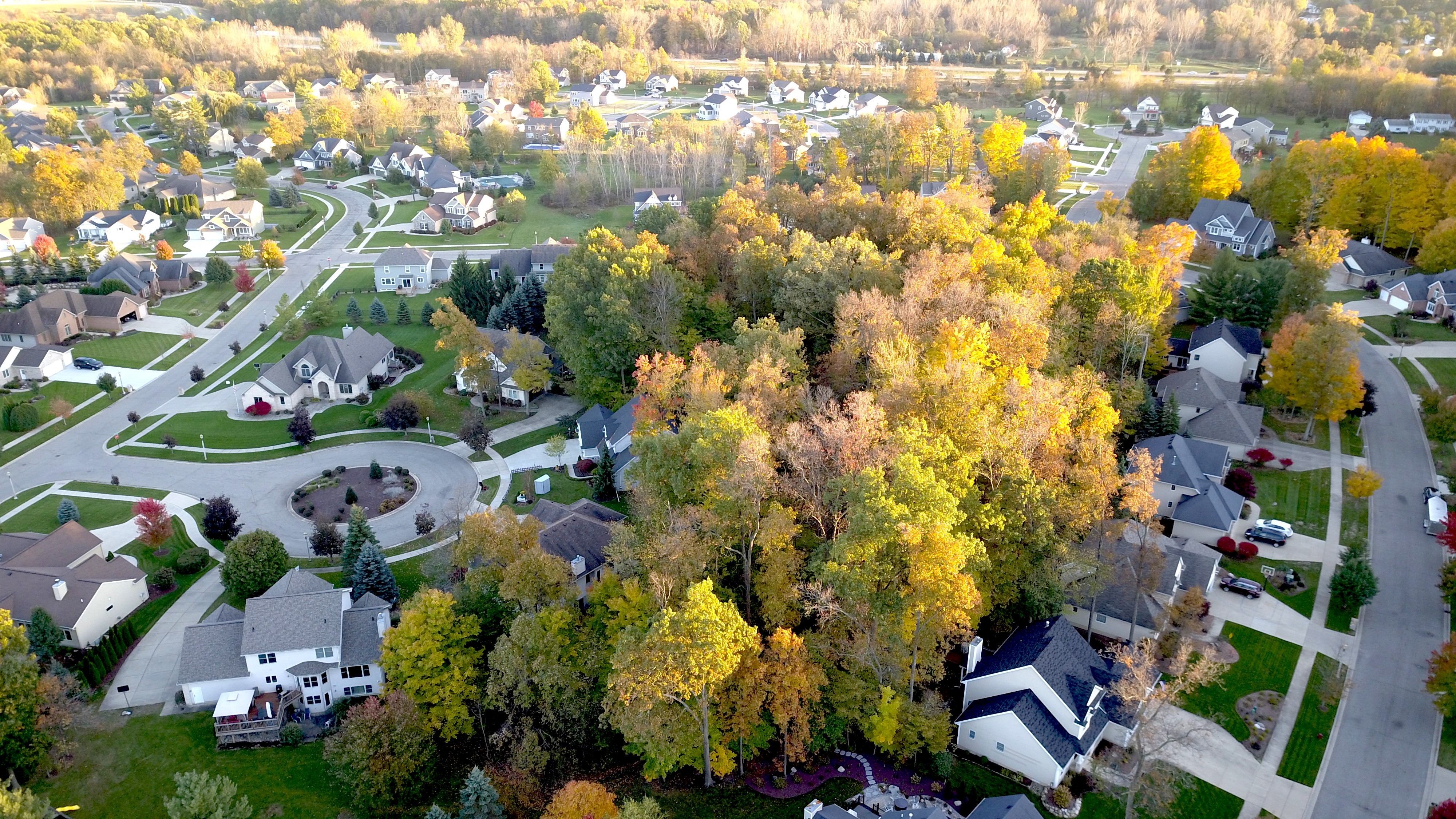
The colors keep getting better this year. The forum software refuses to do a thumbnail of this one:
View attachment 2018_pano_high.jpg
.jpg")
ISO 100, f 5.6, 1/400 s. RAW, 3-image pano using Affinity.
View attachment 2018_pano_high.jpg
ISO 100, f 5.6, 1/400 s. RAW, 3-image pano using Affinity.
calmar81
Well-Known Member
- October 6th – 7:10 AM / Sunrise
- No Hardware Filter, Mavic Air
- Exposure Series (5 pictures) – ISO 100, 1/50 sec
- Lightroom Classic HDR post processing
- Berg, Bavaria, Germany (49°20'29.97" N 11°25'48.328" E)
- 18 meters above ground

(edited for having a thumbnail image instead)
Last edited:
Djr01974
Well-Known Member
Mavic Pro no filters. A little post processing but not much. Taken in Invermere BC. 
lertsek
Well-Known Member
- Joined
- Oct 15, 2018
- Messages
- 93
- Reactions
- 83
- Age
- 66

mrwagdog
Well-Known Member
I love the Fall and I had a hard time picking just one pic from this year. But, here it is: shot in Derby, VT looking north into Quebec with Lake Memphremagog to the left. The upper 1/5 of the image is Canada.
Taken with a Mavic Pro, cropped and photoshopped....

And since I had a hard time picking, here is a link to an imgur photo album of several fall shots from this year. The attached pic is the one I'm entering though...
Taken with a Mavic Pro, cropped and photoshopped....
And since I had a hard time picking, here is a link to an imgur photo album of several fall shots from this year. The attached pic is the one I'm entering though...
Attachments
Last edited:
Benton, New Hampshire, USA (Lost River Rd)
October 9th 2018 7:31:34AM
1/60s, F/2.8, ISO400, Single
Freewell ND8/PL Filter + Lightroom CC

October 9th 2018 7:31:34AM
1/60s, F/2.8, ISO400, Single
Freewell ND8/PL Filter + Lightroom CC
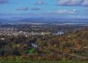
Derwentwater in the Lake District (UK)
Mavic 2 Pro
Early morning just after sunrise 18th October
1/200s, f4.0, ISO100
Post processing in Lightroom
Mavic 2 Pro
Early morning just after sunrise 18th October
1/200s, f4.0, ISO100
Post processing in Lightroom
Attachments
JeffS
Member
Fall colors in the northeast have been rather lackluster due to the unusually wet summer and above average temperatures into the 2nd week of October. The trees don't know what to do. They are just turning sorta yellow and falling off. So this is the best I could do, color wise.
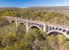
Location: Paulinskill RR viaduct, Hainesburg NJ (40.9480°N 75.0613°W ). The Delaware Water Gap is 3.5 miles away in the distance.
Mavic Air at 180 feet. Circular Polarizer (CPL) filter used. Time around 1pm. shutter 1/230 on auto / 0-EV.
Post processing on RAW DNG in Lightroom to crop, fine tune exposure, highlights/shadows, and vibrancy.
The Paulinskill Viaduct, is a reinforced concrete railroad bridge built by the Delaware Lackawanna & Western RR that crosses the PaulinsKill [river]. It is 1100 feet long (you're seeing about half of it), and 115 feet above the river. Built between 1909-11, when completed it was the largest reinforced concrete structure in the world. It has been abandoned since 1982. There have been talks about restoring commuter service on this line from NY to Scranton PA. Personally, I don't think it will ever happen as the talks have been going on for 20 years (they should have thought about that before pulling the rails up).
Attachments
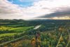
Location: Cherohala Skyway, NC (near the Mud Gap trailhead)
UAS: Mavic 2 Pro
Filters: None
Exposure information: ISO 100, 1/240, f4
Processing: 21-shot panorama (180 degree mode), stitched in Lightroom. Local adjustments applied.
Time: 6:35PM, 24 October, 2018 (approximately 15 minutes before sunset).
Elevation: 400ft AGL

UAS: Mavic 2 Pro
Filters: None
Exposure information: ISO 100, 1/240, f4
Processing: 21-shot panorama (180 degree mode), stitched in Lightroom. Local adjustments applied.
Time: 6:35PM, 24 October, 2018 (approximately 15 minutes before sunset).
Elevation: 400ft AGL


- Status
- Not open for further replies.
Similar threads
- Replies
- 0
- Views
- 528
- Replies
- 0
- Views
- 1K
- Replies
- 19
- Views
- 1K


DJI Drone Deals
New Threads
-
Overheated drone/batteriers and lost connection with the drone
- Started by Noexcuse
- Replies: 0
-

-
-

-
Forum statistics
