You are using an out of date browser. It may not display this or other websites correctly.
You should upgrade or use an alternative browser.
You should upgrade or use an alternative browser.
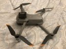
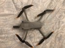
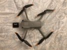
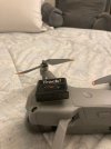
Lost drone please help asap I’m on vacation at lake house and 5 hours from home
- Thread starter flyingz06
- Start date
- Joined
- Jan 16, 2019
- Messages
- 329
- Reactions
- 226
If your battery is depleted you may have GPS coordinates in log however, still easier to have a tracking device it buys you days instead of minutes to find. Drone could be under something or in my case on chimminy top. It is a small price to pay.
In my case tracker ran for two days.
In my case tracker ran for two days.
JMC3
Well-Known Member
I'm just spitballing here but you might consider becoming an active member. There is a great deal of information on this forum to learn from. we often get panicked folks who only join when it to late.
macfawlty
Well-Known Member
I have one on my car key 'bunch', works great for that if I leave them somewhere.
Here from Apple (about the only place we can get them, not sure about the US) they are AUD$45 single, or pack of 4 AUD$149, so buying 4 you get a decent deal, one ' and a bit' free.
Your $ is a lot lower of course, and the US might get better relative pricing too, best check with your local Apple store.
You can get all sorts of mounts, the rubbery ones seem to hold the tags well, urethane onto the drone, or each battery then swap the tag out for changes of batteries.
I guess if you know roughly where the drone went down (find my drone) and you get closer then use the 'find my' app on the i device, you've got a much better chance of locating it.
Even more so if you put a bright white led strobe on it, such as a Firehouse Technology ARCII or similar . . .
FHT ARCII STROBE
These stand out really well in vegetation etc, and at dusk or early darkness they would be really easy to spot through scrub / trees etc.Two
Two things I’ve learned is; 1) crashes are always a possibility, and; 2) recovery is key.
AirData is an essential/critical app for locating your drone in the event of a crash or flyaway. Learn how to use it for rescue and how to access the data for more extensive analysis.
The AirTags are probably the most convenient and cost effective option for GPS. You can’t rely on the Find my Drone function for a number of reasons. Marco Polo may be more accurate, but it’s bulky to carry with you all the time.
The Firehouse ArcXL is another good product with the automated flashing and audible. PhantomRain wetsuits are always a good idea.
State Farm insures all my drones for $60/year. DJI’s Refresh plan may be worth it for some folks, but it always seemed a bit expensive to me and requires recovery.
Most importantly, you need to consider several risk/recovery factors related to your locale:
Terrain you’re flying over, recovery accessibility - Wooded, water, topography, trails, Leaf cover/season, private property, etc. Are you dressed appropriately for bushwhacking?
Time of day, duration of trip/visit - Do you have time to recover before darkness? Can you return the next day?
GPS/Satellite/Cellular - Are you in an area with good cellular service for a satellite view from your Fly app flight path? Can you upload and access data from AirData and upload to forum for real time assistance?
Take your risk factors into consideration before and during your flights. Fly more cautiously when the risk factors are higher and recovery more challenging. Always have video recording so you can view proxy video for visual keys to location. It also helps to be able to identify trees by leaves as the drone drops through the canopy. Be especially careful of altitude and obstacles during sideways travel/POI’s. Check your RTH and home point settings. Don’t fly over water if you don’t have the PR Rescue Jacket, especially if you’re in a moving watercraft.
I’ve had at least a few challenging recoveries. Most recently, flying over a large river (Potomac), I crashed on an island on the opposite side of the river doing a descending POI. That recovery necessitated driving to a location 3/4 mile upstream, taking my kayak down some class 2 rapids, ferrying across the river to the island, searching for an hour using my paddle as machete, finding it, ferrying 200 yds back to my side of the river, paddling down the C&O Canal to portage point, getting on the bike I dropped off on the way to the put in, biking back upriver to the car, drive back downriver to pick up the kayak.
Last edited:
- Joined
- May 25, 2017
- Messages
- 8,476
- Reactions
- 7,966
- Age
- 63
The Firehouse ArcXL is another good product with the automated flashing and audible. PhantomRain wetsuits are always a good idea.
State Farm insures all my drones for $60/year. DJI’s Refresh plan may be worth it for some folks, but it always seemed a bit expensive to me and requires recovery.
Most importantly, you need to consider several risk/recovery factors related to your locale:
Terrain you’re flying over, recovery accessibility - Wooded, water, topography, trails, Leaf cover/season, private property, etc. Are you dressed appropriately for bushwhacking?
More good points.
If you can get coverage like State Farm, it’s really a great last resort in the risk factor of drone ownership.
Most US states seem to have this available.
The ARC XL, yeah the audible alarm would be very handy for many situations, along with the strobe action.
And another great point re wetsuits.
In some scenarios, if it’s possibly GOT to be left out in bad weather, why not use one just in case (bright colour and protection).
And most importantly, look at possible loss of aircraft as part of pre flight checks, and option up to suit.
Take your risk factors into consideration before and during your flights.
A really good addition to the pre flight list.
I do this but not often consciously.
skycam1
New Member
dronescape.com also makes a great device called FIND THE DRONE. I have one on back order because they are waiting on parts. Several people recommended that particular one to me. I use Apple Tags in my equipment cases and I also have one on my drone while waiting for the one from Dronescape.

 dronescape.com

FindtheDrone | DroneScape
macfawlty
Well-Known Member
Forgot to mention high visibility skins. Gray does not stand out in any environment.
Pilots like me, often practicing/filming cinematic video are flying a greater risk. Closer to trees and landforms, over water, tracking, gimbal tilts that often limit your FOV. Flying high may be the safe way to go, but doesn’t produce the variety of clips needed for a good edit.
If you’re primarily a photographer, you’re much less likely to crash. I love photos too, but for me, the beauty is in the move and capturing a variety of clips for a good edit.
One of the many reasons I’d like to have the M3 are the side sensors. There’s a lot of debate about whether folks should upgrade from a M2P or MA2S. Given that I’ve had 3-4 crashes resulting from the lack of side sensors (notwithstanding pilot error), I’d appreciate not having to deal with a recovery situation.
Longer battery life is another big upgrade with the M3. With a pre-flight/filming plan, I can get a fair amount accomplished with a M2P and extra batteries, but the extra comfort of a RTH with 30% battery is less stressful.
Last edited:
macfawlty
Well-Known Member
Seems sketchy given the 404 errors and dearth of info.dronescape.com also makes a great device called FIND THE DRONE. I have one on back order because they are waiting on parts. Several people recommended that particular one to me. I use Apple Tags in my equipment cases and I also have one on my drone while waiting for the one from Dronescape.

FindtheDrone | DroneScape
dronescape.com
Merrill277
Well-Known Member
Yes. I have invested in a Tracki GPS unit. Not only small and lightweight but it can be used anywhere. It is also extremely accurate. You will need to purchase a subscription service (month to month or more), but it's well worth not losing a drone. I affixed mine w/ 3M Dual Lock Strip Tape; similar to Velcro, but much better/stronger.Whoa I found it !! Realized that after the gps stopped the speed and altitude was still changing. Based on the speed we calculated it to be out about 500 ft. So we walk out from the last gps ping and found it about 400’ out! Thanks for your help everyone.
Is there a gps tracker I can put on it in the event the battery dies ??


Last edited:
Similar threads
- Replies
- 8
- Views
- 974
- Replies
- 19
- Views
- 3K
- Replies
- 24
- Views
- 3K
- Replies
- 3
- Views
- 935
DJI Drone Deals
New Threads
-
-
Mini 5 Pro Drone generated pano (21 images) vs Photoshop Pano (21 images)
- Started by Dale D
- Replies: 1
-
-
Panorama question - how do I process 11 and 21 and greater images?
- Started by Dale D
- Replies: 7
-
Members online
Total: 2,348 (members: 7, guests: 2,341)


