


You are using an out of date browser. It may not display this or other websites correctly.
You should upgrade or use an alternative browser.
You should upgrade or use an alternative browser.
Mavic 3 for mapping
- Thread starter lebaneso
- Start date
There's no SDK and the Mavic 3 won't be a mapping drone until that's released and the mapping app developers can modify their apps to use the Mavic 3.Hi guys any news on when the mavic 3 k will be available and what abt the drone efficiency for 3 d mapping is it better than the p2p or is the late still the best for mapping ?

I'm hearing from my sources that DJI will not release SDK for the Mavic 3, only the upcoming Mavic 3 Enterprise.Hi guys any news on when the mavic 3 k will be available and what abt the drone efficiency for 3 d mapping is it better than the p2p or is the late still the best for mapping ?
If this is true, DJI is making a HUGE mistake.
The Enterprise machine will probably use a more fully-featured app and have the ability to fly waypoint missions ?
But how many regular M3s could you buy for the price of the Enterprise model?
Eagle Eye 62
Well-Known Member
PHZ
Well-Known Member
I hope they do create an SDK for the Mavic three but I fear it is unlikely. I’m sure there plans had the Mavic three enterprise of the drawing board long before the Mavic three came out so it may very well be their plan to hold back the SDK to encourage people that want that to buy the Enterprise version. Time will tell.
There are a lot of pilots on the sidelines waiting to see if the SKD is released for mapping. May have to look further afield for a new mapping drone.
Regards
Regards
SkyWay Weezel
Member
Heard confirmations that an SDK will be out sometime in December around Christmas time.
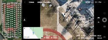
Until an SDK comes out, here is a site I just found when I was searching how to manually map with a Mavic 3. Looks like it could work well! I'm definitely going to try it.
 www.pix-pro.com
Until an SDK comes out, here is a site I just found when I was searching how to manually map with a Mavic 3. Looks like it could work well! I'm definitely going to try it.
The Mavic 3 for photogrammetry - Manual Nadir Scanning
The Mavic 3 - latest and greatest DJI drone without support for flight planners yet. Learn how to fly manually for photogrammetry purposes.
That involves you doing the flying and somehow managing the side overlap with the drone capturing at 2 second intervals while flying slowly.Heard confirmations that an SDK will be out sometime in December around Christmas time.
Until an SDK comes out, here is a site I just found when I was searching how to manually map with a Mavic 3. Looks like it could work well! I'm definitely going to try it.
The Mavic 3 for photogrammetry - Manual Nadir Scanning
The Mavic 3 for photogrammetry - Manual Nadir Scanning
The Mavic 3 - latest and greatest DJI drone without support for flight planners yet. Learn how to fly manually for photogrammetry purposes.
 www.pix-pro.com
And the slow flying speed would limit the area you could do on one battery.
SkyWay Weezel
Member
It's not for everybody but it's an option until an SDK comes out. Doesn't look that hard or inconvenient, to be honest. Fly in Cine mode, which the drone flies slow enough, and the drone automatically taking photos every 2 seconds seems like a good alternative if you really need to get by for now.
Debaser_AZ
Well-Known Member
I can’t think of any reason to do this in a professional setting. I know it’s doable but only for small areas or subjects—and when accuracy is not as critical. 40 acres at 1 cm per pixel? I’m not waiting for an SDK or painstakingly trying to fly that manually. What about camera calibration? That’s not really covered in the article.It's not for everybody but it's an option until an SDK comes out. Doesn't look that hard or inconvenient, to be honest. Fly in Cine mode, which the drone flies slow enough, and the drone automatically taking photos every 2 seconds seems like a good alternative if you really need to get by for now.
The P4P and M2P are working just fine. That said I’m still hopeful the SDK will support automated flights early next year—that battery life and sensor size is killer for the size/form factor.
ETQuall
New Member
For those that bought Mavic 3 in good faith that DJI would release the SDK for it, think again. This received just a few days ago when I flat out asked if they had any intention at all to release the SDK for Mavic 3:
William Wong (DJI)
2022/9/9 GMT+8 10:52
Dear Client
Thank you for contacting DJI.
There is no plan to support Mavic 3 in this year and we havn't [sic] made the next year plan. So I cannot tell you if we have intention or not. In conclusion, the priority of Mavic 3 is low.
Kindly Regards,
DJI Developer Support
Looks like they don't care much about their flagship product when they can upsell to the enterprise models for basic features like waypoints.
Debaser_AZ
Well-Known Member
Agreed, If so, this is a mistake on DJI's part IMHO. The value in using something like a M2P/P4P without RTK to map was it's low cost ratio-to-quality for those who have access to survey equipment. Pushing those customers to "Enterprise" prices with what most likely will be proprietary automated flight software definitely cuts me out as continued customer. As if the whole 'US made only' wasn't a warning sign. No, I don't want a "1-inch" sensor either for photogrammetry just to have waypoint missions and extended battery times. I'm guessing the M3 Enterprise won't have a mechanical shutter either, yet will flaunt a built-in RTK. I have no need for thermal, but I wish there was a Lidar option for close/detailed flights. Without that, I'll just use my iPad for detailed scanning at close range lol.I saw the same answers from DJI in various venues. This is a problem for me. I expected the M3 to have SDK support and their utter lack of it leaves me cold for future DJI purchases.
I might sell my M3, but I like what it does for the time being--at the top of it's class for compact aerial photography and videography. I will not part with the M2P or P4P as long as I can obtain batteries and parts, as both models are covered by all four of the automated flight software programs I use.
and @Debaser_AZ looks like the new M3 Enterprise has a good old fashioned real shutter and an SDK....so I think we have our answer. No SDK for M3. : ). The M3E is their mapper....
Yes! Finally a new mavic with a mechanical shutter, and even better, not just a RTK option, but looks like optional module and ground station (so can be purchased separate later)!!and @Debaser_AZ looks like the new M3 Enterprise has a good old fashioned real shutter and an SDK....so I think we have our answer. No SDK for M3. : ). The M3E is their mapper....
It seems a bit unclear whether the RC PRO Enterprise controller is the one and only way the control the drone thou, or if this is an optional extra - does this mean we can’t use an ipad/tablet connected controller and therefore can’t use apps like Dronedeploy? Are DJI forcing us into only using their mapping software (DJI Terra I believe it is called?), surely not….
Debaser_AZ
Well-Known Member
Ah, this is great news, except all that bitter M3 taste in my mouth. Will be surprised if it's ready out the box. Also an annoyance or even deal breaker if it can't run DroneHarmony/DroneDeploy/MapPilotPro within a couple months after release.and @Debaser_AZ looks like the new M3 Enterprise has a good old fashioned real shutter and an SDK....so I think we have our answer. No SDK for M3. : ). The M3E is their mapper....
Similar threads
- Replies
- 6
- Views
- 3K
- Replies
- 3
- Views
- 858
- Replies
- 7
- Views
- 859
- Replies
- 10
- Views
- 3K


DJI Drone Deals
New Threads
-

-

-
-
DJI Fly 1.5 keeps crashing on new OS Android 13, if I update will I lose CJD and DH?
- Started by phad
- Replies: 1
-
 4 Pro STILL doubting if the Mavic 4 Pro combo upgrade is worth it?
- Started by christangey
- Replies: 4
Members online
Total: 3,485 (members: 13, guests: 3,472)
Forum statistics
