DJI Mavic, Air and Mini Drones
Friendly, Helpful & Knowledgeable Community
Join Us Now

Mavic completely lost connection right after warranty, GONE.

Alaskawilder

Member
Joined
May 5, 2019
Messages
15
Reactions
27
I've logged over 500 flights and this Mavic I've owned for 1 year and 2 months.
I live in Alaska and shoot photography up in the mountains. I've never had this issue before. I've pushed the drone in distance where the controller says "weak signal, adjust antenna." However, I've never lost connection to the drone and never video. I was flying atop a mountain perfect signal no warnings.

I receive "weak signal" warning for 1 second then a quick "do you want to return to home." Then literally 2 seconds after the controller went from weak signal it went to "trying to connect." I had 2 seconds to click the return to home button before it just completely lost signal to the drone? I was still thinking to myself why is it asking me this?

I was flying where I could not see the drone anymore. There was a lot snow at the time and we skied down to where we thought it might be, but It literally could be anywhere. We checked the coordinates of last scene but we couldn't make it there due to snow. Especially if it dropped after the battery died who knows where it fell with the mountain slope of a 45 degree angle.

I'm not one of those guys asking for a new drone. I just called DJI after the accident to see if they could tell me what happened. If it's my fault I want to to know. However, in my experience this was a complete glitch in the device. I had absolute lost control of the device, it went from 100% connection, I was actually taking photos and the drone was hovering where it went from that to 2 seconds later trying to connect to device. When you can't see the drone and have no connection you can't fly it back! I was 2000 feet away from home with 19 satellites.

I became a member here because I wanted to see if you guys had any advice? DJI was terrible. This guy looked me up and said you're 2 MONTHS passed your warranty so we can't help AT ALL. Not even look at the flight records?

I'm bummed for that customer experience. This is not a toy to me, I was also using this for research for my MBA at the University of Anchorage. DJI offered nothing, no discount on a new drone and would not look at flight records. Again, not looking for a handout however if this is truly a DJI fault would they ever tell you? I mean they could literally drop these things out of the sky after your warranty is up with a firmware upgrade and would we ever know???

Let me know your thought...

Attached Flight Log
 

Attachments

  • DJIFlightRecord_2019-03-28_[15-08-45].txt
    329.2 KB · Views: 23
Sorry to hear about losing your aircraft.

It appears the aircraft was not stationary at the time of signal loss. It was traveling roughly 30mph and 314ft below the takeoff point.

Could have been several things such as: Bird Strike, Controlled Flight into Terrain or many other single points of failure.

Hopefully some of the more advanced Flight Log experts can possibly tell you more.
 
  • Like
Reactions: Alaskawilder
The sudden quick disconnect was caused by flying behind this solid structure:

71582


Unfortunately, the RTH altitude was too low to clear that mountain. Your Mavic likely crashed around the yellow pin (61.003695, -149.547148) here:

71583
 
I noticed the speed travel with the flight log. Which is interesting, I must have been taking photos before and moved it closer then the disconnect happened.

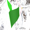
Could you explain the absolute sudden disconnect? literally 2 seconds, connection was gone. You would think you would get a degrading signal for at least a few minutes before full disconnect. I would of lifted the device a few hundred feet quickly to regain point-of-sight. As my flight records show I got the error message and literally no more data. If it's at the yellow pin I would of heard the drone 100%, I know where that cliff is, skied down the mountain where your green line is not more than 5 minutes after the disconnect.

I guess I expect the signal to be stronger for this type of drone for what I was doing. Thanks for the data thought thats super valuable.
 
Could you explain the absolute sudden disconnect? literally 2 seconds, connection was gone.
Sudden disconnects like this always happen when flying being a solid object -- like a mountain (in this case) or a building. The signal doesn't slowly degrade since it's never partially blocked at any point.
 
Sudden disconnects like this always happen when flying being a solid object -- like a mountain (in this case) or a building. The signal doesn't slowly degrade since it's never partially blocked at any point.
Appreciate the feedback
 
The sudden quick disconnect was caused by flying behind this solid structure:

View attachment 71582


Unfortunately, the RTH altitude was too low to clear that mountain. Your Mavic likely crashed around the yellow pin (61.003695, -149.547148) here:

View attachment 71583

Completely concur with your diagnosis for the loss of connection, as the computed viewshed from the last recorded point shows.

71595

But the RTH height of 100 m was more than adequate to get back to the home point. You would have to go around 500 meters further up the ridge line to find terrain more than 100 meters higher than the home point.

71596
 
Completely concur with your diagnosis for the loss of connection, as the computed viewshed from the last recorded point shows.

View attachment 71595

But the RTH height of 100 m was more than adequate to get back to the home point. You would have to go around 500 meters further up the ridge line to find terrain more than 100 meters higher than the home point.

View attachment 71596
Thanks for your post. So if 100M was adequate why didn't the aircraft make the flight to the home point?
 
But the RTH height of 100 m was more than adequate to get back to the home point. You would have to go around 500 meters further up the ridge line to find terrain more than 100 meters higher than the home point.
According to Google Earth:
  • The home point was marked at 3,702 feet
  • The remote controller disconnected at 3,388 feet
The aircraft was flying at about 31 MPH when the remote controller signal disconnected. It would have continued to fly for at least 3 more seconds (since RTH initiates 3 seconds after the remote controller disconnects). So, I'm estimating it traveled another 136 feet beyond the last recorded point in the flight log. That would put the last known location closer to this point:

71599


From that point, the aircraft would have ascended 328 feet (100 meters) before returning home. That means it would have returned home at about an altitude of 3,717 feet. Since the mountain was about 3,743 feet high at the highest point along my estimated RTH flight path, the aircraft would not have cleared the ground.

71600
 
From that point, the aircraft would have ascended 328 feet (100 meters) before returning home. That means it would have returned home at about an altitude of 3,717 feet. Since the mountain was about 3,743 feet high at the highest point along my estimated RTH flight path, the aircraft would not have cleared the ground.

I could be wrong but would it not ascend to 100M above the Launch Point rather than just 100M above the point RTH was engaged?
 
  • Like
Reactions: msinger
According to Google Earth:
  • The home point was marked at 3,702 feet
  • The remote controller disconnected at 3,388 feet
The aircraft was flying at about 31 MPH when the remote controller signal disconnected. It would have continued to fly for at least 3 more seconds (since RTH initiates 3 seconds after the remote controller disconnects). So, I'm estimating it traveled another 136 feet beyond the last recorded point in the flight log. That would put the last known location closer to this point:

View attachment 71599


From that point, the aircraft would have ascended 328 feet (100 meters) before returning home. That means it would have returned home at about an altitude of 3,717 feet. Since the mountain was about 3,743 feet high at the highest point along my estimated RTH flight path, the aircraft would not have cleared the ground.

View attachment 71600

The RTH height is above the home point, not above the altitude at which RTH is initiated. The RTH height AMSL in this case would have been 3702 + 328 = 4030 ft, not 3717 ft.

I could be wrong but would it not ascend to 100M above the Launch Point rather than just 100M above the point RTH was engaged?

That is correct.
 
  • Like
Reactions: BigAl07
I could be wrong but would it not ascend to 100M above the Launch Point rather than just 100M above the point RTH was engaged?
You're correct. So, that makes the RTH elevation at about 4,030 feet (3388 + 314 + 328) instead of 3,702 feet.
 
  • Like
Reactions: BigAl07
So if 100M was adequate why didn't the aircraft make the flight to the home point?
These are the most likely possibilities:

1) Only the downlink dropped at the end of the flight log and the aircraft continued to fly beyond the last location (marked in post #11 above) since the remote controller could still command it in that direction. The aircraft crashed into the side of the mountain due to controlled flight into terrain.

2) The aircraft altitude (which is only an estimate) and/or the elevations in Google Earth are not 100% accurate and the aircraft crashed into the side of the mountain along one of the higher points on the estimated RTH path in post #11.
 
  • Like
Reactions: BigAl07
These are the most likely possibilities:

1) Only the downlink dropped at the end of the flight log and the aircraft continued to fly beyond the last location (marked in post #11 above) since the remote controller could still command it in that direction. The aircraft crashed into the side of the mountain due to controlled flight into terrain.

That seems unlikely. The aircraft was 270 m from hitting the mountain if it continued its descending course. Uplink would have been gone well before it got there.

2) The aircraft altitude (which is only an estimate) and/or the elevations in Google Earth are not 100% accurate and the aircraft crashed into the side of the mountain along one of the higher points on the estimated RTH path in post #11.

Don't like that either. The clearance, based on the home point elevation from either the flight log or the DEM, the aircraft's measurement of the RTH relative height of 100 m above the home point, and the terrain elevation from the DEM, is at least 90 m. That's too large to make up with altitude and DEM errors.

The wind didn't appear to be an issue over the ridge - it was variable out of the southeast quadrant, but there were no excessive pitch/roll excursions and vertical stability was fine:

71602

It's a bit of a puzzle.
 
In my opinion pilot error - RTH wasnt set high enough - did u have collision avoidance turned off - the drone will go up and over the object of it can but maybe you were down too far - at some point it probably forced landed into the mountain - what's odd is another member said you were -312 feet - why didnt the drone fly up to the rth then home - it is possible you backed it in to rhe mountain too.
 
In my opinion pilot error - RTH wasnt set high enough - did u have collision avoidance turned off - the drone will go up and over the object of it can but maybe you were down too far - at some point it probably forced landed into the mountain - what's odd is another member said you were -312 feet - why didnt the drone fly up to the rth then home - it is possible you backed it in to rhe mountain too.

That's incorrect - RTH was set high enough, as discussed above.
 
That seems unlikely. The aircraft was 270 m from hitting the mountain if it continued its descending course. Uplink would have been gone well before it got there.


Don't like that either. The clearance, based on the home point elevation from either the flight log or the DEM, the aircraft's measurement of the RTH relative height of 100 m above the home point, and the terrain elevation from the DEM, is at least 90 m. That's too large to make up with altitude and DEM errors.

The wind didn't appear to be an issue over the ridge - it was variable out of the southeast quadrant, but there were no excessive pitch/roll excursions and vertical stability was fine:

View attachment 71602

It's a bit of a puzzle.

In spite of the barrier of the mountain, is it possible the uplink continued well into the approximate 20 second time frame (until impact) of the last trajectory, and simply did not have sufficient time to effect RTH? Time to impact is based on last known speed and distance to the mountain side you cite.
 
Lycus Tech Mavic Air 3 Case

DJI Drone Deals

New Threads

Forum statistics

Threads
131,125
Messages
1,560,084
Members
160,099
Latest member
tflys78