- Joined
- May 14, 2019
- Messages
- 4
- Reactions
- 16
Hello all,
My name is Philip. I work for Trout Unlimited, a non-profit that focuses on habitat enhancement and conservation for salmonid species. I general do field hydrology work(flow measurements and creek/river monitoring), but have been asked to do some work with my drone (Mavic Air 1).
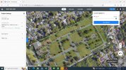
What I would like to do is create a preset flight path at 300’ taking pictures of a designated area and then stitch those pictures together to create one large image. Is this possible with my drone?
Any help would be greatly appreciate.
Thank you,
My name is Philip. I work for Trout Unlimited, a non-profit that focuses on habitat enhancement and conservation for salmonid species. I general do field hydrology work(flow measurements and creek/river monitoring), but have been asked to do some work with my drone (Mavic Air 1).
What I would like to do is create a preset flight path at 300’ taking pictures of a designated area and then stitch those pictures together to create one large image. Is this possible with my drone?
Any help would be greatly appreciate.
Thank you,