DJI Mavic, Air and Mini Drones
Friendly, Helpful & Knowledgeable Community
Join Us Now

Sphere-POV to choose

Red_Pyro

Well-Known Member
Joined
Mar 8, 2020
Messages
156
Reactions
65
Location
Basel, Switzerland
Hello everyone,

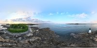
I'm always a little confused when shooting spheres with my MP3. The lower part of the picture is distorted, which is fine unless it's the main focus in the picture.

Therefore, when I wish to shoot a 360 and let's say a ship in a harbor has to be the point of center, where in relation to the ship should I start the capture so that it won't be distorted respectively in the middle of the shot ?

Thanks a lot

EDIT: I found the answer myself, I forgot it shows like this in softwares that do not support 360 pictures...
 
Last edited:
  • Like
Reactions: New England Droning
The sphere is an equirectangular projection, which will distort both zenith and nadir. Like the Mercator map projection, you will get minimal distortion at the middle (probably the horizon).

However, the image can be remapped. I usually shoot spherical panoramas, and often remap them so I have a wonderful undistorted shot straight down. Affinity Photo does this well, but so do other image editing programs.


This shot, for example, was remapped from a spherical panorama. It's a straight-down view.

 
It sounds like you've merely taken 4 or more images and merged them into one image... stitched them together or I guess you can say mapped them... (sound more technical)
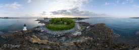
I was wondering if you changed the numbers of the files would it change the order that the images were processed in and slide the landscape one way or the other? this one was processed in the drone
DJI_20230521190141_0135_D.jpg
this one is processed in Lightroom
PANO0001-Pano.jpg
The 2nd one is more pleasing than the first one... I think...
 
It sounds like you've merely taken 4 or more images and merged them into one image... stitched them together or I guess you can say mapped them... (sound more technical)
I was wondering if you changed the numbers of the files would it change the order that the images were processed in and slide the landscape one way or the other? this one was processed in the drone
View attachment 164656
this one is processed in Lightroom
View attachment 164657
The 2nd one is more pleasing than the first one... I think...
I don't do anything I let the drone takes the shots and open it with FSP Viewer, it's free and works perfectly.
 
  • Like
Reactions: New England Droning
I don't do anything I let the drone takes the shots and open it with FSP Viewer, it's free and works perfectly.
I want it to run without their "engine" and I am primarily getting the full 360 pano with the 25 images. I will make a tiny planet from the 360 in Photoshop but I will grab concentric images and create small panos from those images (4-6 images) I just made a 9-panel pano for the 360 images and it's a big boy at 370MB and a 12-panel pano is 426 MB.
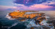
So I can create panos that focus on my subject... As seen in this image 12 panels and 3.5GB as the final image... I guess this is why we don't measure HD space in GB any more but TBs...
 

Attachments

  • Radiant Colors of the Dawn above Nubble Lighthouse.jpg
    Radiant Colors of the Dawn above Nubble Lighthouse.jpg
    164.5 KB · Views: 4
I want it to run without their "engine" and I am primarily getting the full 360 pano with the 25 images. I will make a tiny planet from the 360 in Photoshop but I will grab concentric images and create small panos from those images (4-6 images) I just made a 9-panel pano for the 360 images and it's a big boy at 370MB and a 12-panel pano is 426 MB.
So I can create panos that focus on my subject... As seen in this image 12 panels and 3.5GB as the final image... I guess this is why we don't measure HD space in GB any more but TBs...
That's interesting, guess I should also consider this method for wallpapers or printing
 
Last edited:
I want it to run without their "engine" and I am primarily getting the full 360 pano with the 25 images. I will make a tiny planet from the 360 in Photoshop but I will grab concentric images and create small panos from those images (4-6 images) I just made a 9-panel pano for the 360 images and it's a big boy at 370MB and a 12-panel pano is 426 MB.
So I can create panos that focus on my subject... As seen in this image 12 panels and 3.5GB as the final image... I guess this is why we don't measure HD space in GB any more but TBs...
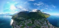
All I manage is to create fake places lol. It's here : St Gingolph · 1898 Saint-Gingolph, SwitzerlandVFP_Chillon_2.jpeg
 

DJI Drone Deals

New Threads

Members online

Forum statistics

Threads
131,131
Messages
1,560,135
Members
160,100
Latest member
PilotOne