DJI Mavic, Air and Mini Drones
Friendly, Helpful & Knowledgeable Community
Join Us Now

Virtual Litchi Mission

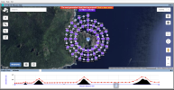
@namirda , I'm trying to use the Grid mission tool to create a mission to gather photos & later stitch them together, made simple one to try out for real but it fails when trying to start it, Litchi throws an error like "invalid waypoint curve ... something" & refuse to start.

Then saw this funny value for every waypoint in the Curve size section ... NanM, can't be correct, a bug, shouldn't it say 0m?

1696526449062.png
 
@namirda , I'm trying to use the Grid mission tool to create a mission to gather photos & later stitch them together, made simple one to try out for real but it fails when trying to start it, Litchi throws an error like "invalid waypoint curve ... something" & refuse to start.

Then saw this funny value for every waypoint in the Curve size section ... NanM, can't be correct, a bug, shouldn't it say 0m?

View attachment 168932
Just a follow-up regarding the grid mission tool error...

Exported the test mission described in post #1161 to a .csv... there I could see the strange NaNm value for the curve size, could also see that another value "Rotation direction" was set to "Undefined".

In a first step I tested to just re-import the exported .csv... & that failed, VLM throwed some errors regarding both the Curve size & the Rotation direction. So VLM didn't want to have anything to do with what it had created by using the grid mission tool.

In a second step I edited the .csv by batch replacing the NaNm curve size value to 0m... & again tried to re-import the .csv into VLM. Didn't work, but now it only complained about the rotation direction that was set to undefined in the .csv.

Edited the .csv again & batch replaced all "Undefined" with one of the 2 possible values (0=CCW & 1=CW) as nothing should rotate during the grid mission I just chose "0".

Re-imported the .csv again... & this time VLM swallowed the .csv & I could test run the mission in GE. Went then out to try the mission for real, & it worked without any problems.

So it seems that the grid mission tool doesn't work properly & is missing out for the "Curve size" & the "Rotation direction"

Anything that can be fixed @namirda ?
 
  • Like
Reactions: RodPad and BigAl07
Just a follow-up regarding the grid mission tool error...

Exported the test mission described in post #1161 to a .csv... there I could see the strange NaNm value for the curve size, could also see that another value "Rotation direction" was set to "Undefined".

In a first step I tested to just re-import the exported .csv... & that failed, VLM throwed some errors regarding both the Curve size & the Rotation direction. So VLM didn't want to have anything to do with what it had created by using the grid mission tool.

In a second step I edited the .csv by batch replacing the NaNm curve size value to 0m... & again tried to re-import the .csv into VLM. Didn't work, but now it only complained about the rotation direction that was set to undefined in the .csv.

Edited the .csv again & batch replaced all "Undefined" with one of the 2 possible values (0=CCW & 1=CW) as nothing should rotate during the grid mission I just chose "0".

Re-imported the .csv again... & this time VLM swallowed the .csv & I could test run the mission in GE. Went then out to try the mission for real, & it worked without any problems.

So it seems that the grid mission tool doesn't work properly & is missing out for the "Curve size" & the "Rotation direction"

Anything that can be fixed @namirda ?
Hi Slup - sorry I missed this one.

For some reason I am no longer getting alerts when a post is made to this thread.

I will look into it asap.

N
 
VLM Version V2.8.3 is available for download.

Recent versions of VLM should download the update automatically - if not then the link is available in the first post of this thread as usual.

Only very minor changes from 2.8.2 :

1) Bug where certain wp properties were undefined in grid option as reported by @slup is now fixed. I don't understand why this bug suddenly showed up because it was previously OK. Perhaps litchi have changed something in the way they handle wp defaults in the mission hub. Anyway I think it is fixed now.

2) The mission name is now checked to ensure it is also a valid windows file name.
 
Hi Namirda, I've noticed with V.2.8.3 when sending to Google Earth there will be a Waypoint added that appears also in GE, the coordinates in this added WP depends on were the last WP were. In the picture the position is in left upper corner left of the litchi logo. Any time you repeat a "send to GE" a new WP is added. Not nice because the appearance in GE. I hope you'll have a remedy. Litchi says, it could be your part to solve.
regards, Peter
 

Attachments

  • 2023 11 22, Waypoint added on -send mission to Google Earth-.jpg
    2023 11 22, Waypoint added on -send mission to Google Earth-.jpg
    661.4 KB · Views: 7
VLM version 2.8.4 is now available.

Download link can be found in the first post of this thread as usual.

Recent versions of VLM should automatically download the update.

This release fixes the bug reported in #1165 above which was due to a change in the page layout of the Litchi Mission Hub.

Also fixes the bug reported in #1166 which was just a silly error of mine!

Thanks
 
Hi Namirda, I'm impressed about the speed you reacted, the VLM 2.8.4 works and it looks again a bit different, more convenient. At the moment I don't have a copter, will pay air 3 only after DJI has released the MSDK. Meanwhile I Iove to create missions as pastime.
Take care, Peter
 
Hello. I cant seem to make this work. On a clean map, I add 4 waypoints doing a square of 1km each side, then I click on the "Create a Grid Mission starting at POI1" and it says "Too many Waypoints", this grid requires 4802. There is obviously some param wrong, but which one? Where?
What I want to do is cover this field and send the images to OpenDroneMap to build 3D map etc...
Thank you and have an excellent new year!
Hi,

To create a grid, you need to add 3 POIs to your map which will define the area to be covered by the grid.

The number of waypoints in the grid is largely determined by the altitude which you choose to fly and the desired overlap between photos. Right click on the grid button to change these. The higher you fly, the larger the area covered by each photo and so fewer waypoints will be required to cover a given area. Similarly, the smaller the overlap between each photo, the fewer waypoints will be required.

Hope that helps

N
 
  • Like
Reactions: OzoneVibe
"Too many Waypoints", this grid requires 4802
Even at 120m altitude and 75/75 overlap, you will need ~1100 to 1200 waypoints to cover an area that size.
I would suggest to break it up into more manageable blocks, if possible.
If you want to build a 3D map, you'll need at least 85/85 overlap which will be even more waypoints.
 
Hi,

To create a grid, you need to add 3 POIs to your map which will define the area to be covered by the grid.

The number of waypoints in the grid is largely determined by the altitude which you choose to fly and the desired overlap between photos. Right click on the grid button to change these. The higher you fly, the larger the area covered by each photo and so fewer waypoints will be required to cover a given area. Similarly, the smaller the overlap between each photo, the fewer waypoints will be required.

Hope that helps

N
Awesome, thank you! Didnt know I could right-click the grid icon!
Does the app consider the location altitude, I mean, is the altitude I set relative to the ground, or to level 0?
 
I have this error, how can I change the parameter? "The path mode must be set to Straight lines"
 
Ok, so I have set up my field, which is about 1km x 1km. I set altitude 200m, overlap 70%, in order to make good photogrammertry and at then end a good elevation map (should I set AGL for an accurate elevation map?). I click to create the grid and it does, but with 448 points/photos and 51 minutes of flight! How can it be 51 minutes? I have put wait time to 0s. Anything else I can do to be able to finish the mission with one battery?
 
Again ... under Mission Settings (the 'gear' at the bottom). Then change Cruising Speed for the entire mission..

Also, you might have to make sure that the Speed for each Waypoint is set to 'Cruising'.
 
  • Like
Reactions: kpoman

DJI Drone Deals

New Threads

Forum statistics

Threads
131,129
Messages
1,560,124
Members
160,099
Latest member
tflys78