DJI Mavic, Air and Mini Drones
Friendly, Helpful & Knowledgeable Community
Join Us Now

3 Week Old Mavic 2 Pro Flew Away seconds after take off

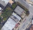
Here's another viewpoint:
- copy the KMZ and load it into Google Earth to see the plot here.

The GPS altitude could be off, VPS is only showing 18 feet when the log stops, so check the trees and alley between the two buildings.
Capture.JPG

ps: sar104 is much more experienced at this - so use his interpretation of events.


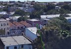
That's a view of the tree from Google Earth...
Capture.JPG
 
Last edited:
On another note - looking at where the drone was launched - did you launch the drone from the sidewalk near any steel plates? Or did you have it sitting on the hood or trunk of your car?
 
On another note - looking at where the drone was launched - did you launch the drone from the sidewalk near any steel plates? Or did you have it sitting on the hood or trunk of your car?
wow you guys are incredible. i’m on my way out towards this location now to check again. I launched it from the middle of the street actually, about 4-5 feet away from my car.
 
wow you guys are incredible. i’m on my way out towards this location now to check again. I launched it from the middle of the street actually, about 4-5 feet away from my car.
Where it ended up is fairly clear, but if you want to dig deeper into the cause of the heading error then see if you can retrieve the controller DAT file ending FLY034.DAT.
 
Can gfieldsr or sar104 explain why the first pic yellow line shows the end point on the roof and the second shows end point at a tree? did you guys use two different analysis tools? Vagaries of GPS? Inquiring minds beg to know!
 
Welcome to the forum from the beautiful woods of Maine!
You’ll find that we have an awesome membership who are willing to take the time to help as much as they can! I learn something new with every search and recovery!
 
Can gfieldsr or sar104 explain why the first pic yellow line shows the end point on the roof and the second shows end point at a tree? did you guys use two different analysis tools? Vagaries of GPS? Inquiring minds beg to know!
I'm hazarding a guess - even though I am not invited to this party :( - the differences might be due to the maps being used. Google Maps (gfieldsr) versus Google Earth (sar104). There could be minor variations due to map datums, too.
 
I'm hazarding a guess - even though I am not invited to this party :( - the differences might be due to the maps being used. Google Maps (gfieldsr) versus Google Earth (sar104). There could be minor variations due to map datums, too.

Actually it is just the difference between the flight track produced by AirData vs. PhantomHelp. The AirData track is slightly truncated for some reason, and the final recorded position at 19.3 s elapsed time is over the building. There are no obvious deviations in pitch or roll up to that point, which probably rules out the tree.

1632689353493.jpg

It was in a gradual descent, and appears to have been heading directly at the antennas on that building:

1632689443716.jpg

The telemetry latency is a few tenths of a second, so that would be about right. I doubt it went much further than that but if it's not there then I'd look at the buildings across the street:

grab317.jpg
 
  • Like
Reactions: Rpeeps
I'm still thinking the GPS altitude in the log is off and the drone crashed into the side of the building, hence the abrupt stop, and fell between the buildings. But, sailing over the building is also a possibility, in which case loss of signal might explain the abrupt data stop.
 
I'm still thinking the GPS altitude in the log is off and the drone crashed into the side of the building, hence the abrupt stop, and fell between the buildings. But, sailing over the building is also a possibility, in which case loss of signal might explain the abrupt data stop.
It's not GPS altitude - it's relative barometric altitude and it's going to be pretty accurate over 20 meters in just 20 seconds. My first guess would be the antennas, then the building the other side of the street. I wouldn't expect that building to block signal abruptly that close to the home point.
 
  • Like
Reactions: Rpeeps
LMAO definitely depressed. & definitely just got home and I'm pretty beat from driving in traffic/ looking and climbing things all day. I'll look into/ upload the flight data tomorrow morning. Again, you guys all seem so warm and welcoming. There's always a cool nostalgic vibe to niche forums like this, and it's very clear in this case! I'm happy to be here, and although I didn't have a successful find today, I am grateful for finding you all & your willingness to help!!!

- Have a great night!
There's nothing like this forum, the guys here are always willing to offer their expertise
 
  • Like
Reactions: Bradders71
In the log the visual altimeter was saying 18 feet. Perhaps it was railed? None the less, I hope the guy (or the lucky recipients) find the drone and get it back.
 
  • Like
Reactions: McGanksta
The camera pointed at the sky sounds like a rear prop came off or motor failure. A failing prop may also explain the immediate drift.
There's no mention of the camera pointing at the sky, but how would that have anything to do with a lost prop?
The obvious indication of a lost prop, is the drone losing height and spiralling to the ground.
 
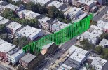
The final recorded pitch was stable at 25°, which is well within the performance envelope of the aircraft, and since the log ended abruptly that was most likely caused by collision with the tree as shown in the GE 3-D flight track shown below:
When data stops, the drone is flying at 47 mph and there is no change to pitch, roll and yaw to indicate a collision.
It could be that signal was lost and the drone kept flying on?
 
When data stops, the drone is flying at 47 mph and there is no change to pitch, roll and yaw to indicate a collision.
It could be that signal was lost and the drone kept flying on?
It’s possible, but loss of signal is rarely that sudden. A collision is more likely, since the few tenths of a second telemetry latency on 10 Hz data means that sensor indications of the collision are not transmitted.
 
You definitely have to be careful when you’re around buildings and rebar under the concrete usually the drone will tell you to re-calibrate and red top corner left screen can you remember if you have a green light when you took off, just giving you a heads up I hope you find the drone I’ve had my Mavic two pro from release date out of three DJI drones she is solid as a rock usually it is pilot error, just a reminder I hope you do find it but if you have to purchase a new drone I would suggest going out to open field until you learn all the ins and outs there is a lot to learn and good luck, and yes there are some very intelligent flyers here they may help you pin down where the drone is located
 
  • Like
Reactions: gerag
Wondering if OP has had any luck finding the drone?
 
  • Like
Reactions: McGanksta
Lycus Tech Mavic Air 3 Case

DJI Drone Deals

New Threads

Forum statistics

Threads
134,442
Messages
1,594,814
Members
162,978
Latest member
dojin23