

So just check it on your phone before even setting up to fly.Darn. Dark Sky like many other apps that require location, aka, Google services, will not run on the Smart Controller. I guess it can be installed on a cell phone.

You are using an out of date browser. It may not display this or other websites correctly.
You should upgrade or use an alternative browser.
You should upgrade or use an alternative browser.
How serious is a high speed wind warning?
- Thread starter wco81
- Start date
Which Dark Sky app---there's several listed?
Nevermind....I found Dark Sky Hyperlocal which I think is the right one?
If it is, I personally don't like it. No winds aloft, no sat info, etc. Maybe this is the wrong app or maybe, if it is, I have to go the premium (pay) route?
Nevermind....I found Dark Sky Hyperlocal which I think is the right one?
If it is, I personally don't like it. No winds aloft, no sat info, etc. Maybe this is the wrong app or maybe, if it is, I have to go the premium (pay) route?
Last edited:
paulatkin73
Well-Known Member
yes, and as it was during quite a strong wind - i conclude it was a default reaction of this flight controller to a wind that overcomes strength of the motors. essentially, if it senses that it gets drifted away by the wind - it goes into autolanding.Oh yes - that was an unusual event.
so, if that happens over water - it will become a submarine.
yes, and as it was during quite a strong wind - i conclude it was a default reaction of this flight controller to a wind that overcomes strength of the motors. essentially, if it senses that it gets drifted away by the wind - it goes into autolanding.
so, if that happens over water - it will become a submarine.
Maybe, but the pitch and roll data don't suggest that it was having any problem holding against that wind.
raylo32
Well-Known Member
I had my first high wind warning yesterday. Winds were ~ 15-20 with higher gusts, maybe to 30... maybe even higher aloft above the tree line. I had 2 distinct warnings. First one after some particularly big gusts said to land ASAP, then the other said to "fly safely". The M2 never seemed to be even close to struggling and I could easily control it in P mode. The warnings seem very conservative.
m0j0
Well-Known Member
Does it calculate windspeed above the ground? That is actually what you need to know. I use UAV forecast it estimates the windspeed above the ground. I am pretty conservative with my Go no GO wind speeds.If you buy a small hand-held anemometer it will read wind speed in miles or k per hour or metres per sec or knots to suit all flyers. Very useful to assess whether to fly or not.

Bob4131
Well-Known Member
I check wind speeds before flying but I do fly in winds / max gusts up to 35 mph at attitude. I do plan my flight ahead of time so I am not returning into the wind at 400ft with little battery. I get orange warnings all the time but never a red that I can remember. What wind speed / gusts delta would generate a red? Thanks if anyone knows.
PS The comment about m/s by the OP was as opposed to km/hr not a request for Imperial measurements - for those that do not read all comments....
PS The comment about m/s by the OP was as opposed to km/hr not a request for Imperial measurements - for those that do not read all comments....
Sorry for bringing this back to live. I’m just curious. I’ve read through the whole thread now, and it seems like auto-land in high winds is so far unconfirmed, correct? It seems a pretty dangerous thing to program anyway. I would reckon DJI is more interested in keeping things safe and an auto-land due to high winds seems more dangerous for anything below than keeping the drone airborne in order to land it at a safe place (anywhere in the open downwind in case it can’t return to home point due to the wind).
Sorry for bringing this back to live. I’m just curious. I’ve read through the whole thread now, and it seems like auto-land in high winds is so far unconfirmed, correct? It seems a pretty dangerous thing to program anyway. I would reckon DJI is more interested in keeping things safe and an auto-land due to high winds seems more dangerous for anything below than keeping the drone airborne in order to land it at a safe place (anywhere in the open downwind in case it can’t return to home point due to the wind).
It will not autoland due to wind conditions. What may happen is that it is unable to maintain position or go back to the home point, and end up being blown away. It will eventually autoland due to low battery.
It will not autoland due to wind conditions. What may happen is that it is unable to maintain position or go back to the home point, and end up being blown away. It will eventually autoland due to low battery.
That seems reasonable! Thanks!
It won't auto land because of winds. It will fight against them to the best of its ability, finally autolanding when the battery gets low enough. Of course, it might be 2 miles downwind by then. Or, it might hit something first, while being blown down wind if your altitude wasn't sufficient to clear the down wind obstacles .
Last edited:
Kick it into Sport mode and fight the autoland with full left stick, while flying as low as possible to get under the wind, until you can safely ditch land it in an accessible dry spot, or even her all the way back! Mine ended up on a Navy Base on a holiday weekend. It was either that, or in the ocean, and Mavics were not in stock, and had a 3 month waiting list everywhere! In my defense, I didn't know it was on a Navy Base until I tried to get to it's known location, and found a perimeter fence! Had lots of '"splaining" to do! This was before GEO, and their only concern was the video recording. Nice lady Commander, whose husband had wanted one himself for that Christmas, so she knew how hard they were to get and replace, because she couldn't buy him one! Would have been quite different today!It will not autoland due to wind conditions. What may happen is that it is unable to maintain position or go back to the home point, and end up being blown away. It will eventually autoland due to low battery.

SoCalDude
Well-Known Member
I agree. It should be in km/h.Why DJI uses m/s is ridiculous.
Perhaps because m/s (or knots) is the worldwide meteorological standard when talking about windspeed? Just a thought.I believe the manual says avoid flying at wind speeds exceeding 10 m/s {22 mph.}
Why DJI uses m/s is ridiculous.
Siri on the Apple Watch does a great job of converting the m/s for me into mph!Perhaps because m/s (or knots) is the worldwide meteorological standard when talking about windspeed? Just a thought.
"Hey, Siri, what is 1 meter per second in miles per hour?" She says 2.24 mph!
Translate accordingly!

jacquespa
Well-Known Member
Perhaps because m/s (or knots) is the worldwide meteorological standard when talking about windspeed? Just a thought.
Actually 1 m/s is 1.94384449 knots.
(A knot is a nautical mile per hour. A nautical mile is based on the circumference of the planet Earth. You divide the circumference into 360 degrees and then divide a degree into 60 minutes. A minute of arc is 1 nautical mile. This unit of measurement is used by all nations for air and sea travel.)
Sorry, retired Navy had to jump in
")
Lapeer20m
Well-Known Member
Actually 1 m/s is 1.94384449 knots.
(A knot is a nautical mile per hour. A nautical mile is based on the circumference of the planet Earth. You divide the circumference into 360 degrees and then divide a degree into 60 minutes. A minute of arc is 1 nautical mile. This unit of measurement is used by all nations for air and sea travel.)
Sorry, retired Navy had to jump in
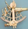
More fun facts about navigation. The sextant can be used to measure the angle between the North Star (Polaris) and the horizon. This angle equals your latitude (distance from equator) anywhere on earth in the northern hemisphere. It is accurate enough to measure within 1/60th of a degree which as mentioned above is one nautical mile.
More
Fun facts.....none of the early sailors like Columbus and Magellan could accurately measure distance east/west (longitude.) up to 2,000 Royal Navy sailors died in a single incident in 1707 due to navigational error. This prompted England ??????? among other nations to spend vast resources trying to solve the longitudinal problem. This is pretty much why the great astronomers of the era existed like Galileo and newton and why Observatories were being constructed. They thought the answer existed in the stars.
Some peasant clock maker named Harrison finally solved the problem by inventing a clock that could tell time accurately while at sea. Calculating longitude requires knowing what time it is where you are now, and knowing what time it is at some fixed location, like Greenwich England. If, for instance, you are 12 hours away, you know that you are exactly halfway around the globe from
Greenwich. This can be broken down into smaller and smaller increments until you can measure longitude within a few nautical miles. This wasn’t until 1730. This invention allowed the Britian through its navy and merchant marine to become the worlds foremost superpower.
Attachments
manowar_gub
Well-Known Member
I want to share my notes. Last time in strong wind drone shows "Extra payload detection, aicraft ....". But time ago I got an "High wind velocity, fly with caution ...".
Can someone share his things why drone started to write about payload instead of high wind velocity?
Can someone share his things why drone started to write about payload instead of high wind velocity?
Shon
Well-Known Member
- Joined
- Mar 8, 2019
- Messages
- 306
- Reactions
- 306
My bet is that you hit land instead of RTH in the G04app. Those features are right beside each and I could easily see that happening (almost did it myself). Please post what you find when you figure it out it.
I did that once... over the ocean. What’s even worse... is I wasn’t even trying to hit RTH, I was trying to get Into the special shooting modes.
“Are you sure you want to land”?
Uh... NO!!! Thank goodness the controller asked first!
globetrotterdrone
Well-Known Member
Great book (among many others) about this:Some peasant clock maker named Harrison finally solved the problem by inventing a clock that could tell time accurately while at sea. Calculating longitude requires knowing what time it is where you are now, and knowing what time it is at some fixed location, like Greenwich England. If, for instance, you are 12 hours away, you know that you are exactly halfway around the globe from
Greenwich. This can be broken down into smaller and smaller increments until you can measure longitude within a few nautical miles. This wasn’t until 1730. This invention allowed the Britian through its navy and merchant marine to become the worlds foremost superpower.

Longitude: The True Story of a Lone Genius Who Solved the Greatest Scientific Problem of His Time: Amazon.co.uk: Sobel, Dava: 9780007214228: Books
Buy Longitude: The True Story of a Lone Genius Who Solved the Greatest Scientific Problem of His Time by Sobel, Dava (ISBN: 9780007214228) from Amazon's Book Store. Everyday low prices and free delivery on eligible orders.
www.amazon.co.uk
Similar threads
- Replies
- 19
- Views
- 1K


DJI Drone Deals
New Threads
-
-
DJI Fly 1.5 keeps crashing on new OS Android 13, if I update will I lose CJD and DH?
- Started by phad
- Replies: 1
-
 4 Pro STILL doubting if the Mavic 4 Pro combo upgrade is worth it?
- Started by christangey
- Replies: 0
-

-
DJI Mini 5 Pro: Which Color Profile Should You Actually Use?
- Started by trisen1981
- Replies: 0
Members online
Total: 3,810 (members: 15, guests: 3,795)
Forum statistics
