DJI Mavic, Air and Mini Drones
Friendly, Helpful & Knowledgeable Community
Join Us Now

Mavic Mini "Flyaway" - forensic help requested

Is that the original mini? or 2 or 3? Just curious how the different satellites might affect these counts.
The Mavic Mini is the original mini. DJI dropped the "Mavic" for the mini 2 and mini 3 .

For my mini 2 flights I have 61 outdoor flights, all (UK). (seems low lol)
The average maximum number of satellites is 22.6, the average "average" number of satellites is 17.86.
The maximum number of satellites recorded is 29.
No flights had maximums less than 10.
Very interesting stats - the mini 2 has better sat coverage than the original.

I also looked at the sats that the mini 2 uses vs the mini3 - they changed a bit:

Mini 2: GPS+GLONASS+Galileo
Mini 3: GPS + BEIDOU + GALILEO

So with the 3, they dropped GLONASS and replaced it with BEIDOU. At any rate, it appears with more choices, it is getting better coverage, which would make sense.
 
A bit of out of date playing lol and ...from the problematic flights of what may be (Mini 3 Pros)
19 flights
ave max 24.45
ave ave max 22.5
Max max 32

Those are from all over the world

For the up to date Mini 3 list I would need to get onto a Linux machine and it will probably contain few more mini 3 logs but it will be a couple of hours before I am on that computer.

Now you are just giving me more reason to go out and buy a mini 3......🤣

Seriously, I'm having a hard time justifying spending $$$ on my existing mini when I could be getting a new one that seems to be much much better for what I want to use it for.
 
I've had a Mini 1 for a few years, and have just upgraded to a Mini 3 Pro - but my reason is mainly for the improved wind resistance and FocusTrack functionality. I've never had any GPS related issues - but I generally fly in wide open spaces.

The Mini 1 got me started with a small drone with decent camera that I can take with me easily. Previously I was flying a bigger Hubsan H501 with a poor quality, fixed camera. The Mini served me well but I'm now at the point where I want to do things that it can't. But I'll keep it as a backup, should anything happen to the M3P, as it's still a superb little drone. :)

The improved wind resistance would be a big plus for me as well - I've had times where I wanted to fly but it was too windy - the mini 1 can't tolerate much wind at all.

I've really loved my mini 1, but there are quite a few benefits to upgrading at this point. I'm trying to "repair" my gimbal that broke in the crash so I can still use my mini to some degree, but I'm pretty sure I will be upgrading to a mini 3 pro here pretty soon. I also like the new controller rather than having to use my phone (which I have to take out of the case).
 
Whilst I have no experience of flying the Mini 3, I have flown the Mavic Mini and the Mini 2 in wind and to be honest when the wind gives the Mavic Mini problems I have tended to call it a day and I have the Mavic 2 Pro/Zoom and a Phantom 3 I have seen both Minis and the Phantom 3 blown away, temporarily, by gusts, the P3 blowaway was scarey.
The M2P/Z is/was too expensive to fly in gusty weather lol, though it can probably handle more than the others especially the Mavic Mini.
If you must upgrade then since you are a newbie I'd suggest a second hand Mini 2 rather than a Mini 3. It's cheaper and has the added advantage that you can use the batteries from the Mavic Mini in it. You could always sell the Mini 2 later on.
 
I took my Mavic Mini hiking to a waterfall last weekend. Getting a good GPS lock is difficult in a waterfall amphitheater, so I got it flying and hovered it as high as it would let me (hoping that would be more likely to get a signal up higher). I let it sit there for several minutes while it attempted to find satellites. When I thought it had a good lock, I started the video and started moving up the waterfall. When it got to the top of the waterfall, it did a corkscrew turn and flew into a tree. I was able to get it out of the tree, however it fell and broke the gimbal.

I've spent hours trying to figure out what happened so that I can learn from this crash, but I'm still a little perplexed. As best I can tell, my guess is that due to the poor GPS signal it had, it encountered some kind of wind vortex at the top of the waterfall (which made it do the corkscrew) that blew it into the tree.

I've viewed the flight log using airdata.com and I've attempted to process the .DAT file from the SDCard using both CSVView and DatCon, but due to the extremely large size of that file I've been unable to glean any insights from it. I was trying to just cut out the last portion of the .csv file it produced but have been unable to figure out exactly where to cut it. I've followed the steps in the sticky post and continue to try and glean useful information but feel like I'm not making much progress at this point.

Any tips or hints or insights from the flight log would be appreciated. Thank you!
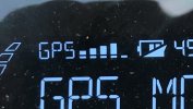
At about 306 secs the gpsLevel increased from 3 to 4 which means the FC had enough confidence in the location solution to start using it. It can sometimes be tricky when this transition occurs and it appears it didn't go well. Satellite count, spread, etc probably contributed to the problem. Not sure what you were using to indicate "GPS lock". The problem with these criteria is that there is no well formulated method to decide if it's safe to launch.

Best to wait until gpsLevel gets to 4 before launch and the FC won't have to transition to using the location solution in flight. Here is what it looks like on one of my controllers, I forgot which one.
GPS.jpg
There is a similar indicator in the Fly and Go 4 apps.
 
I took my Mavic Mini hiking to a waterfall last weekend. Getting a good GPS lock is difficult in a waterfall amphitheater, so I got it flying and hovered it as high as it would let me (hoping that would be more likely to get a signal up higher). I let it sit there for several minutes while it attempted to find satellites. When I thought it had a good lock, I started the video and started moving up the waterfall. When it got to the top of the waterfall, it did a corkscrew turn and flew into a tree. I was able to get it out of the tree, however it fell and broke the gimbal.

I've spent hours trying to figure out what happened so that I can learn from this crash, but I'm still a little perplexed. As best I can tell, my guess is that due to the poor GPS signal it had, it encountered some kind of wind vortex at the top of the waterfall (which made it do the corkscrew) that blew it into the tree.

I've viewed the flight log using airdata.com and I've attempted to process the .DAT file from the SDCard using both CSVView and DatCon, but due to the extremely large size of that file I've been unable to glean any insights from it. I was trying to just cut out the last portion of the .csv file it produced but have been unable to figure out exactly where to cut it. I've followed the steps in the sticky post and continue to try and glean useful information but feel like I'm not making much progress at this point.

Any tips or hints or insights from the flight log would be appreciated. Thank you!
If you want you could provide the fc_log.log file using Dropbox or GoogleDrive. I'll probably be able to extract the incident flight - some industrial grade hacking is required.
 
  • Haha
Reactions: Yorkshire_Pud
At about 306 secs the gpsLevel increased from 3 to 4 which means the FC had enough confidence in the location solution to start using it. It can sometimes be tricky when this transition occurs and it appears it didn't go well. Satellite count, spread, etc probably contributed to the problem. Not sure what you were using to indicate "GPS lock". The problem with these criteria is that there is no well formulated method to decide if it's safe to launch.

Best to wait until gpsLevel gets to 4 before launch and the FC won't have to transition to using the location solution in flight. Here is what it looks like on one of my controllers, I forgot which one.
View attachment 161883
There is a similar indicator in the Fly and Go 4 apps.

If it does not have a GPS lock it will not allow you to fly higher than 5m (I think that is what it is). I hovered as high as I could in the hope that would help get a better signal. At the point it allowed me to fly higher is what I was considering a "GPS Lock" which is obviously totally wrong. I'm not sure I ever heard the "The Home Point has been updated" which seems to be the definitive answer to a good GPS lock.

I appreciate the offer to process the fc_log.log, but it is a 32 GB file and I don't think I have a public place that I have that much space available. From all the comments I think I understand where I went wrong on this flight. I think I've been lucky in some other scenarios - but I haven't done a ton of waterfalls which are incredibly difficult to get a GPS lock due to the geography.
The fc_log.log file should only be 512 Mb. But I don't think much will be learned that we don't already know.

Instead of trying to understand "GPS lock" you are better off if you wait until gpsLevel gets to 4.

It may be possible to modify the parameters of the Mini to allow Atti mode. Take a look at
Drone-Hacks, the best way to hack your DJI Drone - Hacks
 
I appreciate the offer to process the fc_log.log, but it is a 32 GB file
F*&^ that's big, just looked at the one on my Mavic Mini's mSD card and it is 539MB (by Linux), near enough that stated by BudWalker and 512Mb does come to mind when I have looked at them via Windows.

@BudWalker, would a GPS level of 4 be indicated by a change in the colour of the GPS icon?
 
F*&^ that's big, just looked at the one on my Mavic Mini's mSD card and it is 539MB (by Linux), near enough that stated by BudWalker and 512Mb does come to mind when I have looked at them via Windows.

@BudWalker, would a GPS level of 4 be indicated by a change in the colour of the GPS icon?
I've not seen a change in GPS icon color. But, I've been mostly flying my FPV and Avata using the goggles. Usually don't use the Fly app, just the goggles.
 
  • Like
Reactions: Yorkshire_Pud
I’ve sold many drones on craigslist rather than eBay, because I like to demo the drone at the time of sale. If a novice, I always start off with instruction to wait for the voice saying “Home point has been updated, Please check it on the map”. Only 1 buyer ever mentioned a crash, the reason was..you guessed it, they didn’t wait. It usually happens at 8 or 9 satts acquired. Few novice pilots can handle atti mode (no gps). Without brakes, Practice required. Best of luck on your next bird of choice. Enjoy
 
F*&^ that's big, just looked at the one on my Mavic Mini's mSD card and it is 539MB (by Linux), near enough that stated by BudWalker and 512Mb does come to mind when I have looked at them via Windows.

@BudWalker, would a GPS level of 4 be indicated by a change in the colour of the GPS icon?

My apologies - I was looking at the fc_log.csv file that DatCon created from the fc_log.log file. My actual fc_log.log file is 512MB. The CSV file is 32GB. The CSV file has almost 8 million rows in it!

If you want to try and extract that flight from it, here is a copy of the fc_log.log file:


The flight occurred on 3/18/2023 at 9:38am (ish). I will leave it up for a week or so and then remove it. That web host doesn't have a ton of free space available.
 
Now you are just giving me more reason to go out and buy a mini 3......🤣

Seriously, I'm having a hard time justifying spending $$$ on my existing mini when I could be getting a new one that seems to be much much better for what I want to use it for.
Having access to more satellite systems won't help you in poor GPS environments.
If the skyview is blocked, you still won't see all those extra satellites.
Your problem isn't that there aren't enough sats in the syk.
It's that your drone can't see enough of the sky.

No matter whether you have a drone that uses two or three satellite systems, and no matter where or when, there will always be more satellites available than your drone needs.
But can your drone see enough sky to receive signals from them?
 
  • Like
Reactions: Yorkshire_Pud
Having access to more satellite systems won't help you in poor GPS environments.
If the skyview is blocked, you still won't see all those extra satellites.
Your problem isn't that there aren't enough sats in the syk.
It's that your drone can't see enough of the sky.

No matter whether you have a drone that uses two or three satellite systems, and no matter where or when, there will always be more satellites available than your drone needs.
But can your drone see enough sky to receive signals from them?

I get all that - I use GPS every time I hike for both tracking and also communicating (Garmin communicator). I guess I'm just thinking that having more satellites to choose from (3 different types rather than just 2) might help get more coverage. The stats from @Yorkshire_Pud seem to show that is the case (his averages with the mini2 were higher than with the mini).

There are other reasons a newer drone would be better as well - I am just trying to learn from my prior mistakes and not repeat them.
 
Seriously, I'm having a hard time justifying spending $$$ on my existing mini when I could be getting a new one that seems to be much much better for what I want to use it for.
I have a Mavic Mini. I was debating getting a Mini 2 and was almost ready to pull the trigger when the Mini 3 Pro came out. Really glad I tend to dither a lot! ;)

Haven't flown my Mavic Mini since I got the Mini 3 — really only keeping it as a backup. Things I like:
  • much better wind resistance and stability
  • automatic panorama shooting
  • the RC controller, which is much better than the original controller and my iPad Mini
  • possibly linked to above, much more responsive than the Mavic Mini
  • much better range and tolerance for obstacles like trees
  • gets GPS lock a lot faster
  • better battery life
 

DJI Drone Deals

New Threads

Forum statistics

Threads
130,586
Messages
1,554,118
Members
159,586
Latest member
DoubleBarS