


You are using an out of date browser. It may not display this or other websites correctly.
You should upgrade or use an alternative browser.
You should upgrade or use an alternative browser.
Official DJI Response to the GPS Issue
- Thread starter ZoneAerial
- Start date
It's based on number of satellites locked, not any of the DOP calculations.LOL. Technically, you are correct in stating they don't rise and set with the sun - they (generally) rise and set relative to a location TWICE a day. Almost every GNSS satellite orbits the Earth over a period of approximately 12 hours. They are not geostationary. The satellite positions, and the specific satellites in view, changes pretty drastically over just a couple of hours, and if you look up HDOP and GDOP, you'll see why this is very important to accepting the accuracy of a reported position. It's likely that the "GPS Signal Strength" reported by the Fly app is based on HDOP or GDOP, too; that's a guess, but plausible.
Wade L.
Part 107 Certified
Interesting. I posted this a while back:Message from dji regarding GPS delay, nothing to do with HW or glonass
How i am Handling the GPS Waiting Game!
and was quickly refuted. Guess DJI agrees with me.


There's no technical reason why the FC couldn't try to speed up its cold start GNSS lock by getting location data from the mobile device via the control app but, assuming that the mobile device itself has a GNSS lock, that wouldn't be AGPS. It would simply be the location of the device, which doesn't rely on any data networks (wifi or cellular) to know where it is.Interesting. I posted this a while back:
How i am Handling the GPS Waiting Game!
and was quickly refuted. Guess DJI agrees with me.
Either way, you would expect that to significantly speed up a cold start, not cause it to take longer. There must be more going on here. The DJI responses quoted earlier in this thread don't really say anything useful, although reading between the lines it sounds like a firmware problem.
Where you are on the earth won't make any difference to GPS acquisition, unless it's due to physical blocking of the skyview.Hi, partial built up area. Previous on one flight it took over two minutes, other two flights longer.
Although overall satellites count was still low flux between 11 and 13 it still acquired lock in seconds compared to my visit last week.
It's not like some places get poor satellite coverage and others don't.
If that communication from DJI which included this:Wow. Looks like DJI does use A-GPS
Didn’t the experts here flat out say they don’t?
RC N1 [best] < RC PRO (with network) < RC PRO (without network)
... is correct, that would suggest that DJI uses A-GPS to slow down satellite acquisition times !!
1) How do you know this for a fact?It's based on number of satellites locked, not any of the DOP calculations.
2) If you watch the Fly App in progress, I've seen it change the GPS Signal Strength description when the satellite count increased from, say, 9 to 10, but when the satellite count flicked back to 9 a moment later, it didn't change the GPS Signal Strength description back. If it is as you said, a straight lookup of satellite number = message, then how do you explain that? Watch it yourself and see. I just did earlier, to verify, and I saw it again, where there isn't a direct correlation between the displayed satellite count and the GPS Signal Strength message. It even changed the message without changing the satellite count. How do you explain that, if it's just based off satellite count? Don't forget, a count of satellites isn't indicative of the specific satellites. If it has 10, drops 1, picks up another that also has better geometry, the count is *still* 10, but the position is likely more accurate.
DJI want an accurate home point. In the GNSS-receiver world, pure satellite count is NOT the only measure of accuracy of the position - 10 satellites clustered together can have considerable error potential compared to 10 spread out.
DJI have used the uBlox GNSS chips before, to provide them with the positioning data; rumour, conjecture and chip footprint analysis have lead people to believe they are still using the M8 or M9. While this isn't known for a fact for the M3, it's valid for other DJI drones, and this is from the uBlox specification:
"Where a fix has been achieved, a check is made to determine whether the fix should be classified as valid or not. A fix is only valid if it passes the navigation output filters as defined in UBX-CFGNAV5. In particular, both PDOP and accuracy values must lie below the respective limits.....The UBX-CFG-NAV5 message also defines TDOP and time accuracy values that are used in order to establish whether a fix is regarded as locked to GNSS or not, and as a consequence of this, which time pulse setting has to be used. Fixes that do not meet both criteria will be regarded as unlocked to GNSS"
The uBlox GNSS chip itself doesn't say the fix is valid until DOP criteria are met; this is typical of any GNSS receiver spec that I've read.
Last edited:
I should have been clearer - my point was that it isn't a DOP calculation, not that it only uses satellite count. I explained further in another thread earlier today:1) How do you know this for a fact?
2) If you watch the Fly App in progress, I've seen it change the GPS Signal Strength description when the satellite count increased from, say, 9 to 10, but when the satellite count flicked back to 9 a moment later, it didn't change the GPS Signal Strength description back. If it is as you said, a straight lookup of satellite number = message, then how do you explain that? Watch it yourself and see. I just did earlier, to verify, and I saw it again, where there isn't a direct correlation between the displayed satellite count and the GPS Signal Strength message. It even changed the message without changing the satellite count. How do you explain that, if it's just based off satellite count? Don't forget, a count of satellites isn't indicative of the specific satellites. If it has 10, drops 1, picks up another that also has better geometry, the count is *still* 10, but the position is likely more accurate.
DJI want an accurate home point. In the GNSS-receiver world, pure satellite count is NOT the only measure of accuracy of the position - 10 satellites clustered together can have considerable error potential compared to 10 spread out.
DJI have used the uBlox GNSS chips before; rumour, conjecture and chip footprint analysis have lead people to believe they are still using the M8 or M9. While this isn't known for a fact, this is from the uBlox specification:
"Where a fix has been achieved, a check is made to determine whether the fix should be classified as valid or not. A fix is only valid if it passes the navigation output filters as defined in UBX-CFGNAV5. In particular, both PDOP and accuracy values must lie below the respective limits.....The UBX-CFG-NAV5 message also defines TDOP and time accuracy values that are used in order to establish whether a fix is regarded as locked to GNSS or not, and as a consequence of this, which time pulse setting has to be used. Fixes that do not meet both criteria will be regarded as unlocked to GNSS"
The uBlox GNSS chip itself doesn't say the fix is valid until DOP criteria are met; this is typical of any GNSS receiver spec that I've read.
#52
Where does it define that the fusion between IMU and GNSS is actually a measure of the GPS Health? Also, what data from the IMU is utilized in this, and what would be dynamic enough from the IMU for a stationary drone, to materially impact GPS Health? In other words, even if there is a fusion of DOP, satellite count and IMU data, what is the relative bias of each in the overall result?I should have been clearer - my point was that it isn't a DOP calculation, not that it only uses satellite count. I explained further in another thread earlier today:
#52
Why do you say that? RC-Pro without network will take the “largest” amount of time. Not the “best”.If that communication from DJI which included this:
RC N1 [best] < RC PRO (with network) < RC PRO (without network)
... is correct, that would suggest that DJI uses A-GPS to slow down satellite acquisition times !!
Hallmark007
Active Member
- Joined
- Jan 24, 2017
- Messages
- 25
- Reactions
- 16
- Age
- 64
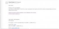
It seems that the RC pro does have a GPS Module. Response to a follow up question to DJI .Interesting. I posted this a while back:
How i am Handling the GPS Waiting Game!
and was quickly refuted. Guess DJI agrees with me.
Attachments
The fusion solution itself doesn't measure GPS health - it's the level of agreement between the fusion solution and the GNSS solution that determines GPS health. That's not defined, at least in any documentation that I've seen, but it's clearly apparent from looking at logged data in cases where a position mismatch arises between the fusion solution and the GPS solution.Where does it define that the fusion between IMU and GNSS is actually a measure of the GPS Health?
The primary flight control data in flight are the IMU data - the accelerometers and rate gyros, with the starting position initialized by the GNSS location, the magnetometer heading, and the barometric altitude. So on start up, while the aircraft is stationary, there are no IMU data to feed the fusion solution and the GPS health can be seen to increase just with the number of locked satellites. There could be a DOP component to that calculation but, since the health number at that stage appears to be just a function of number of satellites, there is nothing to indicate that.Also, what data from the IMU is utilized in this, and what would be dynamic enough from the IMU for a stationary drone, to materially impact GPS Health? In other words, even if there is a fusion of DOP, satellite count and IMU data, what is the relative bias of each in the overall result?
Once in the air the fusion solution is dominated by the fast IMU data, with the GNSS, magnetometer and barometer providing lower gain corrections for IMU drift and bias. One caveat here - it's also clear that the more recent models are increasingly including VPS data but exactly how those are incorporated and with what weighting is unknown as far as I'm aware. In flight you will see GPS health vary primarily with the deviation of the fusion solution from the absolute GNSS/magnetometer/barometer data. If the fusion solution is unable to hold agreement with the absolute values then the GPS health starts to drop, which is why regarding it as a measure of confidence in the fusion solution is more appropriate.
There's some further discussion of this topic in section 1 of the guide linked in my signature.
D
Deleted member 51434
Guest
Well, hopefully people will go to town on DJI for this disaster (see attached). Good ol’ “DJI Santa”. They asked for logs and had people run around in circles. Then they issue this.

You even get the same app from the toy drone. I’m a hard pass on the M3. Shopping for a couple of backup M2P’s now.I 100% agree mazdaman323lx; If the acquisition is 6 minutes then that is a deal breaker. You'd have to subtract 6 minutes of flight time (or battery usage) from every battery you have. That greatly reduces your flight time to just better than the Mavic Mini . . .! This has to improve . . .
John Locke
Well-Known Member
If this problem could have been fixed with a firmware mod, it would have been in the last big firmware release. They've known about this from the day it was released. It's very possible it's a hardware problem, and they selected a bad chip, potentially because other chips were not readily available. Since we know DJI doesn't test their drones adequately before production, this GPS lock issue could have very well gone unnoticed by DJI. Now they have a pig to put some lipstick on. It will be interesting to see how this ends up. I hope I'm wrong.
SandCrabDave
New Member
I think it was Jeven Dovey on YouTube said that DJI had chosen not to use GLONASS and that was the reason for slow and low satellite acquisition issues, can any one confirm this? Slow and low is best for smoked pork...
trotline
Member
- Joined
- Jun 4, 2018
- Messages
- 10
- Reactions
- 1
- Age
- 75
I just now for the first time read this thread.
Lost my M2s when it landed in a lake on RTH. Me, an unsuspecting regular pilot, looked away doing something and it landed about 25 yards west of landing site. Thankful the Find Drone in the app has the last 15 seconds or so. The camera was facing shore when it went under. I referenced 3 of those points where they converged, went out in boat and there in was 12 feet under. DJI insurance replaced it.
Took me about 2 seconds to question the GPS operational status. Now I know.
Well, hopefully people will go to town on DJI for this disaster (see attached). Good ol’ “DJI Santa”. They asked for logs and had people run around in circles. Then they issue this.
Ramar43
Member
The only thing I have to say is this is a consumer drone. It’s about $500 overpriced if it worked well.
Similar threads
- Replies
- 16
- Views
- 658
- Replies
- 12
- Views
- 1K
- Replies
- 205
- Views
- 23K
- Replies
- 2
- Views
- 632


DJI Drone Deals
New Threads
-
 Simulators with the DJI RC N1 controller.....
- Started by Dan'sUavTech
- Replies: 0
-

-
 UAS Nexus (By Chris 'The Drone Geek' Fravel)
- Started by The Droning Company
- Replies: 0
-
A Guide to Posting Drone Footage on Social Media.
- Started by The Droning Company
- Replies: 0
-
Members online
Total: 4,828 (members: 9, guests: 4,819)
Forum statistics
