DJI Mavic, Air and Mini Drones
Friendly, Helpful & Knowledgeable Community
Join Us Now

Updated place to fly in SF Bay Area/East Bay/South Bay

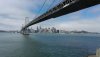
I have a Mavic 2 pro. I flew across from the parking lot of the market. It’s the way that leads up to the pier.
I wonder why I had signal problem. Now I am scared to fly close to the bridge again.

What market?

You took off from TI and then flew up and over to YBI and near the bridge? So 2-3,000 feet at least and probably several hundred feet up in altitude?

Do you guys have videos from your flights?
 
What market?

You took off from TI and then flew up and over to YBI and near the bridge? So 2-3,000 feet at least and probably several hundred feet up in altitude?

Do you guys have videos from your flights?
The Island Market is in the first building you see as you drive down to Treasure Island. If you’d like, we could plan to meet up (along with my flying buddies) and show you flying spots. It’s perfectly legal to fly from there, so onlookers can drive right on by...no worries.

I flew about 3000 feet away from the Yorba Buena spot I walked up to and previously pin-pointed. Since we’re not allowed to fly “several hundred feet up,” I kept it to 380 feet.

Yes, I have video from the flight, but I’m a couple months behind in editing, as I’m still working on the SF City Hall and Palace of Fine Arts flyover from late March.
 
Last edited:
That's on the SW corner of TI right?

But it sounded lick catmeowcat also parked around there and the marina and flew from there rather than hike up as you did.
 
  • Like
Reactions: pelagic_one
The Island Market is in the first building you see as you drive down to Treasure Island. If you’d like, we could plan to meet up (along with my flying buddies) and show you flying spots. It’s perfectly legal to fly from there, so onlookers can drive right on by...no worries.

I flew about 3000 feet away from the Yorba Buena spot I walked up to and previously pin-pointed. Since we’re not allowed to fly “several hundred feet up,” I kept it to 380 feet.

Yes, I have video from the flight, but I’m a couple months behind in editing, as I’m still working on the SF City Hall and Palace of Fine Arts flyover from late March.
You can fly from the palace of fine arts and city hall?
 
  • Like
Reactions: pelagic_one
Current Take Off Spots:
*Brisbane Marina
(37.6771792, -122.3844974) / Brisbane, CA
- Good views of the Marina and parallel shots of cars on 101.
- Lots of folks fishing off the pier so I avoid flying low/near the pier avoid loitering over the Marina its self
- I request LAANC approval for 200ft

*Port Richmond Santa Fe Railroad Terminus
(37.9093029, -122.3900791) / Richmond, CA
- Great waterway views, lots of kite surfers.
- Can get pretty windy
- There is an RV/homeless Lot in the vicinity, it’s a generally safe spot but I did have an RVer vocalize his concern about being watched from the sky...

*Middle Harbor Shoreline Park- Chappell Hayes Tower
(37.8001563, -122.3299014) / Oakland, CA
- lots of Goose Poop everywhere
- Decent spot to fly, it can be a few shady folks
- great place to get shots of merchant ships going through the canal
- there can Be lots of interference due to the metal from ships and the Gantry cranes
 
Current Take Off Spots: ...
Many thanks! I enjoy reading about local spots here in the Bay Area, because I usually try them out within a week. You’ll find me in Brisbane for the first time this weekend!

I was stopped at Middle Harbor Park by a security guard as there’s apparently a No Drone rule, so I fly just north at the west end of Burma Road (37.8215619, -122.3204533). There are currently two inactive cruise ships that make for great flyovers.

Your Point Richmond spot is great, too. When it’s busy there, I have alternatively flown from this spot (37.9060661, -122.3698576), which has a great vantage point over the tugboats and fairly new waterfront houses.
 
Last edited:
  • Like
Reactions: Hauptmann
Has anyone flown around Monterey recently?

Airmap shows the coastal areas around the peninsula are beyond the restrictions of the airport. So for instance Point Panos Lighthouse, Asilomar Beach and Spanish Bay appear to be in the clear.

Also understand that you can't fly over the water along the coast south of Carmela nd Monterey. But can you fly over the land along the coast and still get good shots of the water and terrain or you can't even be say within a mile or few miles of the coast? The Airmap map shows the red zone only from the coastline outwards to the water.

Are there good places to launch and land along the coastal highway (not to mention park) or does it get too windy?
 
  • Like
Reactions: Hauptmann
Have you try flying to the left side of the bridge (facing SF), so you can get a shot under the bridge and facing sf?

I got this shot from the fishing pier at Middle Harbor Shoreline Park. I'd like to get the same shot earlier in the AM, when lights are on in the Financial District and on the bridge. I'd probably pan up slightly, to get more bridge and less bay. The gate doesn't unlock 'til 6:00 AM or so. Never seen a ranger at fishing pier.
 

Attachments

  • Under the Bridge.jpg
    Under the Bridge.jpg
    3.5 MB · Views: 23
I was stopped at Middle Harbor Park by a security guard as there’s apparently a No Drone rule, so I fly just north at the west end of Burma Road (37.8215619, -122.3204533). There are currently two inactive cruise ships that make for great flyovers.

I’ve wanted fly on the opposite side of Burma road by Toll Plaza Beach. Pretty windy and lots of Kite Boarders.
 
I’ve wanted fly on the opposite side of Burma road by Toll Plaza Beach. Pretty windy and lots of Kite Boarders.
Great call! I always forget about that little beach, until I’m passing it on the way to the toll plaza. I really want to capture the kite boarders, but will need to pull out the bigger Mavics for that kind of wind.
 
  • Like
Reactions: Hauptmann
Hi all,

new in drones and learning where to fly legally. Thank you all for your tips!

Since AirmapsKittyhawk do not show all NFZ in the bay area, I have been thinking on getting an atlas to be sure to avoid any kind of state park, county park etc... Then I realized the app alltrails gives all that info! So I am planning on using that method to check and fly in some areas around bay area and Cailfornia in general. Do you guys see any inconvenient on this?

I live in San Jose btw.
 
[
Hi all,

new in drones and learning where to fly legally. Thank you all for your tips!

Since AirmapsKittyhawk do not show all NFZ in the bay area, I have been thinking on getting an atlas to be sure to avoid any kind of state park, county park etc... Then I realized the app alltrails gives all that info! So I am planning on using that method to check and fly in some areas around bay area and Cailfornia in general. Do you guys see any inconvenient on this?

I live in San Jose btw.

I checked it out, but I saw no mention of NFZ areas.
 
It's legal to fly over parks. Only FAA controls airspace per se. Local jurisdictions can and do restrict certain uses within their parks--carrying of firearms, possession of alcohol, etc. In all SF city parks (and in many other Bay Area cities), one cannot take off, land, or operate a UAV within park boundaries. Seattle is stricter. I've heard that one cannot take off, land, or operate UAVs from any public place, including streets and sidewalks.
 
  • Like
Reactions: pelagic_one
It's legal to fly over parks. Only FAA controls airspace per se. Local jurisdictions can and do restrict certain uses within their parks--carrying of firearms, possession of alcohol, etc. In all SF city parks (and in many other Bay Area cities), one cannot take off, land, or operate a UAV within park boundaries. Seattle is stricter. I've heard that one cannot take off, land, or operate UAVs from any public place, including streets and sidewalks.
Yes, All parks that I have checked on bay area are NFZ, that's why I want to avoid them and I thought the mentioned app could help.
 
Yes, All parks that I have checked on bay area are NFZ, that's why I want to avoid them and I thought the mentioned app could help.
I think San Jose is a tough spot, with all of the helicopter LZs in that area.
Based on my searches all Santa Clara County parks are NoDrone unless you have a permit. But the permit requires active AMA membership, liability insurance, and some other hoops to jump.
You might have to venture out a bit to Campbell or Los Gatos.
 
With AMA membership(which is reasonable) you get liability insurance and other bennies, including discounts at hobby stores.
 
With AMA membership(which is reasonable) you get liability insurance and other bennies, including discounts at hobby stores.
I’ve considered an AMA membership but I feel like a lot RC clubs tend to turn up their noses at drone operators.
There is an AMA club in Half Moon Bay with a niece field that I’ve been eyeing but their dues are $250 on top of the AMA cost.
 
  • Like
Reactions: pelagic_one
I applied for permission to SCC parks.

they didn't say anything about AMA.

They did ask about insurance.

But the forms they use are more generic, asking about whether you will serve alcohol, which hours are you event, etc.

They denied permission.
 
Lycus Tech Mavic Air 3 Case

DJI Drone Deals

New Threads

Forum statistics

Threads
130,976
Messages
1,558,498
Members
159,964
Latest member
swigmofa