DJI Mavic, Air and Mini Drones
Friendly, Helpful & Knowledgeable Community
Join Us Now

30m-60m Altitude gain over a 15min mission flight time

Joined
Feb 9, 2021
Messages
13
Reactions
2
Age
44
Location
New Zealand
Hi all

Just wondering if anyone else has this issue with their mavic enterprise? We have 5 for use over a vineyard (flat land) and after a 15 minute mission all 5 seem to gain 30 - 60m in altitude by the time they have finished the run.
Is there any way to improve the accuracy so it can maintain the 15m programmed altitude? Worried given we have high tension power lines nearby.
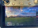
RegardsIMG_0555.jpg
 
  • Like
Reactions: ZUCSTA
Hey Bro,
if your having the same issue across the 5 drones and I'm assuming five different controllers then I would be looking for outside/external interference.
Regards
 
Thanks, I don't think there is any interference around, the vineyard is a wide open expanse of land with only some high tension pylons in a distant corner.
 
Mate when the sun comes up in the other part of the world, hopefully you will have more helpful responses. it may be helpful to have flight date available.
Regards
 
If you want pinpoint accuracy, the new M2 Enterprise Advanced just came out... upgradable to accept an RTK GPS module... the claimed accuracy is in centimeters...
 
  • Like
Reactions: WaitaDroneOperator
If you can post the flight log in the smart controller, may be more insight can be obtained. One thing I am very sure is that interference canNOT cause any drift in altitude.

You may upload the flight log to this site and post the link here. Instructions are given at the bottom of that webpage.
 
  • Like
Reactions: SkyeHigh
Interference cannot cause the problem. Barometric pressure is used from the altimeter in the drone. Shifts in the air temperature will cause the altimeter readings to change. Going from cold to warm the altimeter will show an increase of altitude from that change alone.
 
  • Like
Reactions: Zbip57
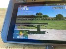
Pretty hard to see in the shot with the sun over my shoulder, but the screen says 19.8m as the drone is returning home. The windmills in the shot are 13m high and they are miles beneath the drone, so I'm assuming it is actually at 70m altitude based on the -50m reading on landing plus the 20m return to home altitude...
15m but windmill in shot is 13m.jpg
 
Turn of all sensors and the downward sensor on one of the drones and see if it makes any difference.
You might even put black tejp over them to be sure. Supervise the whole flight.

Interesting case :)

I'm very keen to know why! Please post the result!

How much wind is it?
 
Turn of all sensors and the downward sensor on one of the drones and see if it makes any difference.
You might even put black tejp over them to be sure. Supervise the whole flight.

Interesting case :)

I'm very keen to know why! Please post the result!

How much wind is it?
Thanks for the idea. I downloaded the DJI assistant and recalibrated all sensors but again after a 6 minute flight the result was a 43m error in altitude. Have lodged reports with the place of purchase who is contacting DJI on our behalf... They're not particularly trustworthy in their current state!
 
Hi all

Just wondering if anyone else has this issue with their mavic enterprise? We have 5 for use over a vineyard (flat land) and after a 15 minute mission all 5 seem to gain 30 - 60m in altitude by the time they have finished the run.
Is there any way to improve the accuracy so it can maintain the 15m programmed altitude?
Your flight data confirms that there is a problem as you described.
Having an issue with one drone would be believable.
But having the same issue with 5 drones is baffling.

The issue has nothing to do with your downward facing sensors.
Your data shows that they are working properly.
It's the altitude data from the barometric sensor in the IMU that's the problem.
And wind has no effect on altitude measurement.

Normally recalibrating the IMU would be the thing to do to sort out altitude issues, and I'd recommend trying that first.
But as all 5 are showing the same issue and the error is greater than usually seen, I suspect something else is at play.

I'm wondering what would cause the same problem for 5 drones.
Have the drones been modified in some way?
 
  • Like
Reactions: Gagey52
Just to eliminate it as a possibility ... do you see the same issue in free flight as flying a waypoint mission?
 
Thanks for the idea. I downloaded the DJI assistant and recalibrated all sensors but again after a 6 minute flight the result was a 43m error in altitude. Have lodged reports with the place of purchase who is contacting DJI on our behalf... They're not particularly trustworthy in their current state!
Is it a waypoint mission you're running?

If I were you I would fly the exact same mission, manually in p-mode.

The thing is that the altitude is fused between imu, sensor and air pressure, but I never seen such a big missalignment.

Calibrate the IMU as well, but I don't think it will help.
 
Thanks for all the replies, recalibrated the IMU and compass and flying the same mission it also came back with a 43m error on landing...
That's fine .. but do you get the same issue when you aren't flying a waypoint mission?

ps .. the compass has nothing at all to do with altitude
 
Just tried the same mission at 15m indicated on the controller, the error on landing was 8m, so much less than the automatic mode but still well over what I thought the GPS altitude could maintain given it was locating 17 satellites at any one time.
 
Just tried the same mission at 15m indicated on the controller, the error on landing was 8m, so much less than the automatic mode but still well over what I thought the GPS altitude could maintain given it was locating 17 satellites at any one time.
Gps is not used for altitude.
 
  • Like
Reactions: Thomas B
Just tried the same mission at 15m indicated on the controller, the error on landing was 8m, so much less than the automatic mode but still well over what I thought the GPS altitude could maintain given it was locating 17 satellites at any one time.
Altitude is barometer driven above 20 or so feet altitude.
GPS is position in 2 dimensions as looking at a map.
 
  • Like
Reactions: ZUCSTA
Lycus Tech Mavic Air 3 Case

DJI Drone Deals

New Threads

Forum statistics

Threads
131,121
Messages
1,560,028
Members
160,095
Latest member
magic31