Today’s first flight went well. I flew on nothing but manual mode, did some figure 8’s, circles around me, high-speed passes and took a few pics. I used RTH to see how it works but cancelled in enroute home and kept flying. I even put it in sports mode for a little while and enjoyed flying the machine.
Questions:
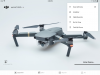
1. The map on the iPad 4 located in the lower right hand corner the the DJI app does NOT have any map info. I realize I do not have wifi out on the flying field. Is there any way to populate this map with data?
2. The lower left hand corner of the DJI app has a round circle with “N” noted on the circle, a dot and the red drone symbol in the middle. I can’t for the life of me figure out how to interpret that data in entirety. I know “N” is North, but I don’t understand how that information is used to fly the drone back to me when it’s so far out and the orientation is hard to see. Is there some sort of tutorial or explanation?
Thanks again for all the help.
Questions:
1. The map on the iPad 4 located in the lower right hand corner the the DJI app does NOT have any map info. I realize I do not have wifi out on the flying field. Is there any way to populate this map with data?
2. The lower left hand corner of the DJI app has a round circle with “N” noted on the circle, a dot and the red drone symbol in the middle. I can’t for the life of me figure out how to interpret that data in entirety. I know “N” is North, but I don’t understand how that information is used to fly the drone back to me when it’s so far out and the orientation is hard to see. Is there some sort of tutorial or explanation?
Thanks again for all the help.