It's a good news! I think the mavic air will be the next "Mavic Pro" until the next
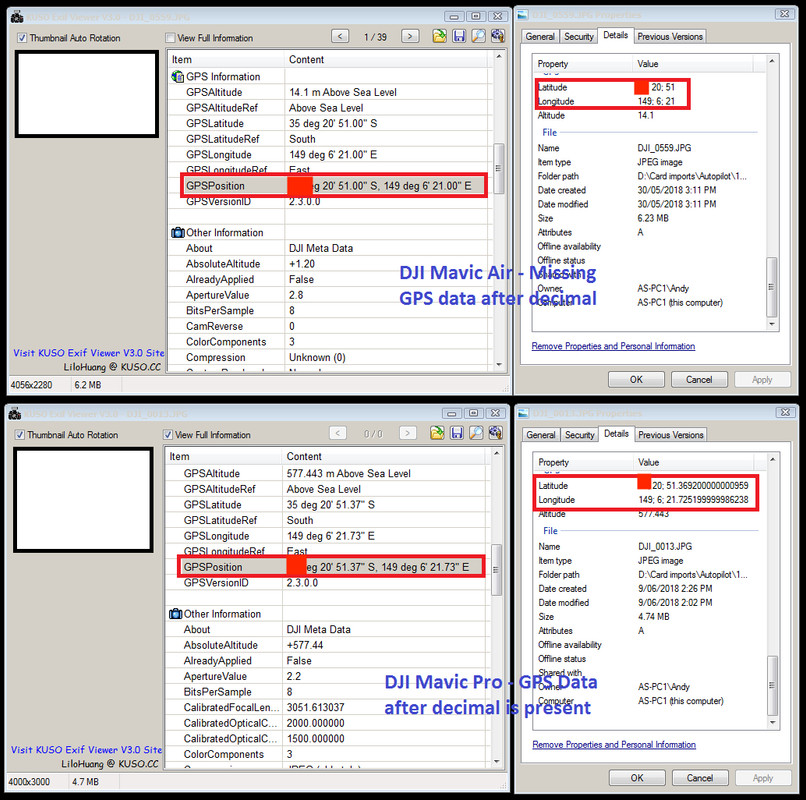
Pro 2. Build like a tank, Very compact, better camera and all the safety around the fly help is very superior. Just what I think. The pressure about this problem from the customers will be hard to ignore. It's only to copy the integrity of the gps coordinates. Because the mavic air is very precise... able to land almost at the same place from the launch.