

Just got the new mini 4 Pro and i was wondering if the max altitude that DJI has incorporated can be bypassed? I live in a very mountainous area and I can easily be at the max height restrictions used by DJI and still be way under the 400’ AGL the FAA requires. Is there any chance that DJI might use AGL rather than height above takeoff as a parameter?

You are using an out of date browser. It may not display this or other websites correctly.
You should upgrade or use an alternative browser.
You should upgrade or use an alternative browser.
Max altitude
- Thread starter Rocket 3 GT
- Start date
Your drone has two Height limits.Just got the new mini 4 Pro and i was wondering if the max altitude that DJI has incorporated can be bypassed? I live in a very mountainous area and I can easily be at the max height restrictions used by DJI and still be way under the 400’ AGL the FAA requires.
One is baked into the firmware and won't allow your drone to ho higher than 1640 feet (500 metres).
The other is a user configurable limit which you can adjust to whatever you choose (up to 1640 ft).
By default the drone comes with this set to 400 ft.
No .. there is no way for the drone to measure AGL height.Is there any chance that DJI might use AGL rather than height above takeoff as a parameter?
Last edited:
The drone will hit 1640 feet in the USA. It’s crippled to 400 feet overseas.

There are a few hack sites that will allow you to remove the 500 meter limit. I have done what you are looking to do for the same reason that you describe. Certainly is beneficial in mountain areas but you will need to pay attention to battery level in those areas when flying up the hills.
Firmware levels will be a part of what can be added or removed in this process. There are some DJI products that may not allow hack installation. I have not seen that the mini4 pro has made it to any hack list.
Firmware levels will be a part of what can be added or removed in this process. There are some DJI products that may not allow hack installation. I have not seen that the mini4 pro has made it to any hack list.
Last edited:
waynorth
Well-Known Member
- Joined
- Aug 28, 2018
- Messages
- 865
- Reactions
- 948
At least in EU countries. Some non-EU countries are members of EASA, and there is some confusion whether the height limit also applies in those countries. In other words, is the max 120m at take-off point only for EU-countries, or for all EASA countries?The drone will hit 1640 feet in the USA. It’s crippled to 400 feet overseas.
dan.utinske
Well-Known Member
The drone can very easily measure above the ground height using GPS; it's quite accurate. If what everyone is say were true you could not sell DJI drones in mountain areas.Your drone has two Height limits.
One is baked into the firmware and won't allow your drone to ho higher than 1640 feet (500 metres).
The other is a user configurable limit which you can adjust to whatever you choose (up to 1640 ft).
By default the drone comes with this set to 400 ft.
No .. there is no way for the drone to measure AGL height.
dan.utinske
Well-Known Member
Good explanation of drone altitude measuring: How Accurate Are Drone Altimeters? - Pilot InstituteJust got the new mini 4 Pro and i was wondering if the max altitude that DJI has incorporated can be bypassed? I live in a very mountainous area and I can easily be at the max height restrictions used by DJI and still be way under the 400’ AGL the FAA requires. Is there any chance that DJI might use AGL rather than height above takeoff as a parameter?
No ... it cannot.The drone can very easily measure above the ground height using GPS; it's quite accurate.
GPS has no way to tell the elevation of the ground below your drone.
Whatever it is that you are suggesting here is unclear.If what everyone is say were true you could not sell DJI drones in mountain areas.
Last edited:
Huh? I fly in Mountainous Areas 100% of the time and the aircraft has no knowledge of AGL only Height Above Takeoff Point. The UAS doesn't vary height when the ground below it changes unless it's using something like Terrain Awareness which pulls GPS DATA but you have to remember, we are talking about flying at 200' and well clear of terrain variances etc. HUGE difference between that and what you're suggesting.The drone can very easily measure above the ground height using GPS; it's quite accurate. If what everyone is say were true you could not sell DJI drones in mountain areas.
Good explanation of drone altitude measuring: How Accurate Are Drone Altimeters? - Pilot Institute
Did you read the article you posted? This is but one portion copied directly from that article:
"GPS triangulation can also be used to determine the flight altitude of a drone. However, it is considered less accurate and even more prone to drifting compared to barometry."
GPS Data is good for a reference point for non-critical things but with GPS drift etc you don't want to rely on Consumer Grade GPS for anything precise.
Unless you're flying very low and the UAS is using VPS it has no DATA to know how far it is from the actual ground below. None of us would want to pay the $$ for the equipment needed to get accurate AGL sensors into our drone. To make it more complicated, it's too heavy and bulky to fit in anything remotely the size of a "consumer drone". At least for now, we are stuck with "Height Above Take Off Point".
My understanding is the 400 feet or 120m above take off point is not yet in effect in the EU and will not go into effect until 2024. And when it does go into effect, it does not apply to drones in the UK and for drone that are greater than 249g. I could be wrong....The drone will hit 1640 feet in the USA. It’s crippled to 400 feet overseas.
Mine will go to 1640, but in mountainous terrain it isnt enough. I could still be perfectly legal and still go higher.The drone will hit 1640 feet in the USA. It’s crippled to 400 feet overseas.
My thought is that DjI with todays technology could make monitoring the AGL a thing. Maybe in a future model.Your drone has two Height limits.
One is baked into the firmware and won't allow your drone to ho higher than 1640 feet (500 metres).
The other is a user configurable limit which you can adjust to whatever you choose (up to 1640 ft).
By default the drone comes with this set to 400 ft.
No .. there is no way for the drone to measure AGL height.
- Joined
- Oct 12, 2016
- Messages
- 29,994
- Reactions
- 33,788
- Location
- Harrisburg, PA (US)
- Site
- mavichelp.com
Today's technology still isn't great if you're referring to relying on DEM data to estimate the AGL.My thought is that DjI with todays technology could make monitoring the AGL a thing
If you have that kind of space and time, is it possible you can land and reset the altitude? That’s pretty high maybe you want to start a bit higher than at the base of your mountains perhaps?Mine will go to 1640, but in mountainous terrain it isnt enough. I could still be perfectly legal and still go higher.
That would work but it would require about half a day to get where the drone can go in a few minutes, very steep.If you have that kind of space and time, is it possible you can land and reset the altitude? That’s pretty high maybe you want to start a bit higher than at the base of your mountains perhaps?
Almost any airplane on the planet can tell the AGL, it would seem not terribly difficult to incorporate that into drones. But I do admit I am not very knowledgeable on this. I am so ignorant I dont even know what DEM is, lol.Today's technology still isn't great if you're referring to relying on DEM data to estimate the AGL.
waynorth
Well-Known Member
- Joined
- Aug 28, 2018
- Messages
- 865
- Reactions
- 948
Airplanes use radar altimeters like the one shown here.Almost any airplane on the planet can tell the AGL, it would seem not terribly difficult to incorporate that into drones. But I do admit I am not very knowledgeable on this. I am so ignorant I dont even know what DEM is, lol.
I would like to see that mounted on a mini 4
")

Probably will look a bit odd and may need some form of upgraded landing gear.like to see that mounted on a mini 4
Most light aircraft don't have the ability to tell AGL height because a radar altimeter is expensive and not particularly necessary.Almost any airplane on the planet can tell the AGL, it would seem not terribly difficult to incorporate that into drones. But I do admit I am not very knowledgeable on this. I am so ignorant I dont even know what DEM is, lol.
They use a barometric sensor just like your drone does.
But if you want to get a nice economical radar altimeter for your drone, here's a good deal on a secondhand unit.
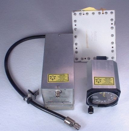
KRA-10 Radar Altimeter System
We are used avionics specialists for General Aviation.
 www.bennettavionics.com
As I already stated I plead ignorance. But somehow I think a smaller one could be managed. The old computers used to take up warehouses, now a micro SD card can hold the equivalent data. But I guess that might be why drones don’t have that capability.Airplanes use radar altimeters like the one shown here.
I would like to see that mounted on a mini 4
View attachment 169536
Similar threads
- Locked
- Replies
- 36
- Views
- 3K
- Replies
- 21
- Views
- 1K
- Replies
- 3
- Views
- 4K


DJI Drone Deals
New Threads
-
 Drones Leading Revolution in Big Data Cloud Services. (Scary Thoughts)
- Started by The Droning Company
- Replies: 0
-
Doordash and Flytrex debut Drone Delivery.
- Started by The Droning Company
- Replies: 0
-

-

-

Members online
Total: 7,382 (members: 10, guests: 7,372)
Forum statistics
