You are using an out of date browser. It may not display this or other websites correctly.
You should upgrade or use an alternative browser.
You should upgrade or use an alternative browser.
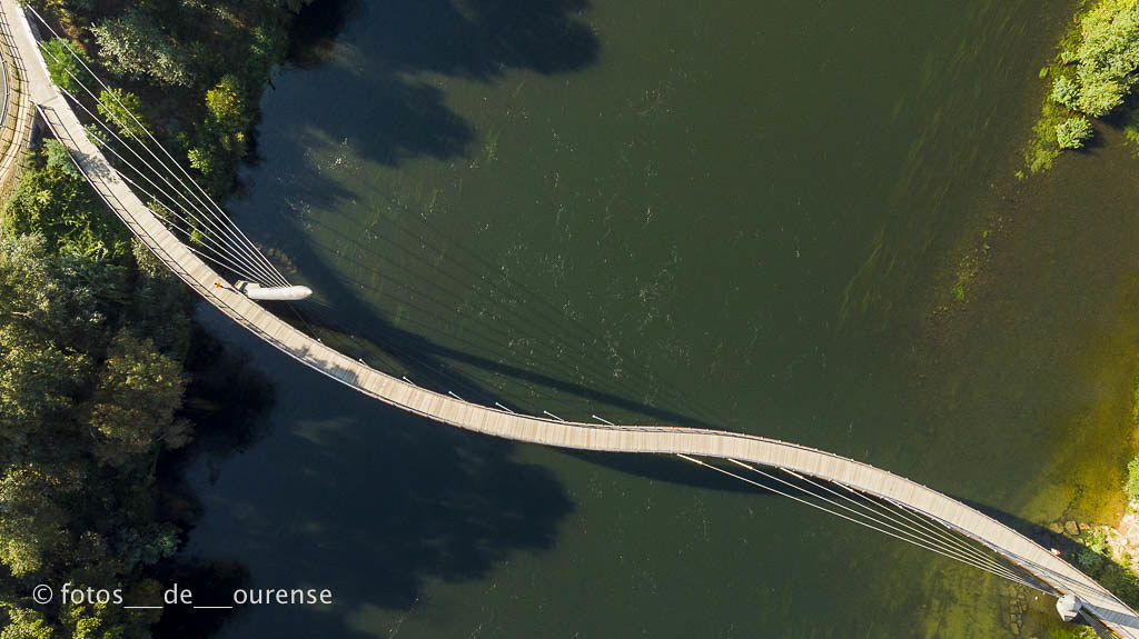
Share your best vertical drone photos
- Thread starter The realdazzler
- Start date
CamoGreg
Well-Known Member
- Joined
- Jul 7, 2017
- Messages
- 1,091
- Reactions
- 506
- Age
- 45
Melor
Well-Known Member
- Joined
- Sep 27, 2018
- Messages
- 48
- Reactions
- 14
- Age
- 63
LOVE THESE....
Back in the day you would need to rent a helicopter flight and hope they would let you take the door off...
I love geometric patterns and these 90 degree down shots are fun and easy with a drone. Now to find the perfect subjects as you have.
Paul
Back in the day you would need to rent a helicopter flight and hope they would let you take the door off...
I love geometric patterns and these 90 degree down shots are fun and easy with a drone. Now to find the perfect subjects as you have.
Paul
turkish
Member
Kevin Cooke
Active Member
- Joined
- Aug 29, 2018
- Messages
- 28
- Reactions
- 36
- Age
- 68
Bledsoe1qb
Active Member
- Joined
- Dec 16, 2017
- Messages
- 34
- Reactions
- 13
- Age
- 45
Melor
Well-Known Member
- Joined
- Sep 27, 2018
- Messages
- 48
- Reactions
- 14
- Age
- 63
I love this image. Color, composition, everything. If this were mine, I would print and hang it...
I am trying to figure out the three black figures at the top left.
Nice work.
Paul
I love this image. Color, composition, everything. If this were mine, I would print and hang it...
I am trying to figure out the three black figures at the top left.
Nice work.
Paul
Thanks! It was a random shot, (I was actually out taking pictures of the sunset, but I flipped the camera straight down to help me get back to base and liked what I saw). When I got it back home it turned out to be the shot from the evening I liked the most. I wish I'd played around with it a bit more, but since it's only 5 minutes from the house, I suspect I'll be back there soon enough
The highway is Interstate 40, so I suspect the three black marks are probably a tire (for the one closest to the center of the frame) and the marks where it either blew out or otherwise bounced/scraped on the ground before final destruction.
Seakayaker
Active Member
- Joined
- Sep 30, 2018
- Messages
- 34
- Reactions
- 9
- Age
- 74
Seakayaker
Active Member
- Joined
- Sep 30, 2018
- Messages
- 34
- Reactions
- 9
- Age
- 74
Fantastic!
BD0G
Well-Known Member

Emerald Bay - Lake Tahoe, NV -
Directly above Fannette Island
Geography Location Lake TahoeCoordinates


Fannette Island is the only island in Lake Tahoe, California/Nevada, United States. It lies within Emerald Bay, on the California side of the lake. Over a long period of time, it was called many different names, including Coquette, Fanette, Baranoff, Dead Man's, Hermit's, and Emerald Isle. Fannette Island is a part of Emerald Bay State Park. It is accessible by boat, canoe, or kayak. Swimming to the island is not allowed, due to hazards including extremely cold waters and boat traffic in the area.
The ruins of a small stone building stand on the island. This ruin is the "Tea House", constructed by Mrs. Lora Josephine Knight, the owner of Vikingsholm.
Fannette Island was the home of Captain **** "Them's my toes" Barter from 1863 to 1873. The eccentric captain had moved from England and built his own tomb and chapel on the island. He enjoyed sailing but almost died when caught in a sudden storm rowing back to the island. He survived by tying himself to his dinghy and riding out the storm. Unfortunately he got frostbite in two toes and earned his nickname from his penchant of showing his self-amputated toes to guests. Ironically, he was never interred in the chapel he built, as he was lost in a storm off Rubicon Point in 1873.
JDawg
Well-Known Member
Thanks very much to those who take the few seconds to let the viewer know the general area where the picture was taken.
Similar threads
- Replies
- 6
- Views
- 3K
- Replies
- 3
- Views
- 1K
- Replies
- 3
- Views
- 1K
- Replies
- 0
- Views
- 533
- Replies
- 1
- Views
- 427


 MIÑO-1


