Former Member
Well-Known Member
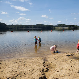
Our meeting will focus on water search and rescue. The mission will be almost entirely over water. If you have never flown over water before, this is a great opportunity to do it with others who have. I will have a couple of Gettrbacks available to lend out.
Here is the fictional scenario

 flylitchi.com
I was out there today, and made sure the area is clear of obstacles in our flight paths, so there will be no problems flying at 150'.
For safety reasons, here are some ground rules:
Here's the plan:
Here is the fictional scenario
- A boaters family reported that he failed to return home after a day at the lake
- Boater was last seen in this Litchi search area
- Boat color not yet known
- Boat was a small, 1 person craft
- Boater was wearing a bright green tee shirt
- Boater is a middle aged male
- Boater is a diabetic, so might be unconscious and unable to communicate
- Boater is wearing a white life jacket
Mission Hub - Litchi
Litchi's Mission Hub lets you plan waypoint flights and later execute them using the mobile Litchi app.
flylitchi.com
- Please download it.
- Set up your grid.
- Make your mission a maximum of 13 minutes from take-off to being back on the ground.
- Based on the speed you choose to use, you might want to add, subtract, or edit your waypoints to fit into the 13 minutes. You can also increase your cruise speed to cover more area. I have found the ideal DSAR cruise speed to be around 4-7 mph.
- Save your mission to the Mission Hub and /or your device.
I was out there today, and made sure the area is clear of obstacles in our flight paths, so there will be no problems flying at 150'.
For safety reasons, here are some ground rules:
- Please keep your aircraft flying in front of you at all times.
- Please dont fly over the parking area in front of the pavilion.
- Please do not start your motors under the pavilion or on a table.
- Before spooling up your motors please shout out "taking off" and try to make sure everyone has your attention. If someone else is taking off, please let them get airborne.
- Before landing: at least 1 minute before landing please call out "landing" and try to make sure everyone has your attention. If someone else has called out "landing" please let them land and get their drone before you land.
- Takeoff and climb to waypoint 1 at 30' to make sure the drone is flying well. If your drone is not flying well, you are still over land, so it will be possible to abort or land vertically. WP 1 is already set up in the mission.
- Search altitude is set to approx 150', no lower. We might assign different higher altitudes to help aircraft separation if multiple drones are in the air, we will let you know way before the meeting.
- Maximum of 3 SAR drones at any one time flying this mission. We might assign flight departure times based on what time you are ready to fly. Please wait at least 1 minute for any departing drones to clear the area.
- Please stay within the search area. Dont fly over the golf course or beach, and try to stay over the water except when departing and landing.
Here's the plan:
- Start off at Pavilion 4.
- Dont walk out to the LZ unless you are ready to fly.
- Nobody should be on the flight line unless they are getting ready to fly, or have just landed.
- Call out "taking off" but also use your common sense.
- If there is someone fiddling with their drone on the LZ, ask them if they are going to takeoff. If not ask them to take their drone off the LZ.
- Walk out the back of the pavilion and put your drone on a landing pad.
- Execute the mission in Litchi.
- Drone will spool up, take off, and head to waypoint #1. Altitude set at 30'
- Drone will then climb to 150' AGL and begin its mission.
- Upon completion, drone will end up at WP #9, and hover at 150'.
- If it is clear to land bring it back to the homepoint.
- You could also hit RTH after you have arrived at WP 9 if the LZ is clear.
Last edited: