

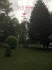
I have a lot of very tall pine trees in Georgia plus some interesting structures like antenna towers, water tanks, etc. I was wondering what the best and safest method would be to use my Mavic Pro to measure the AGL of these things. Can the camera horizon line or the cross hatch display be used for alignment of the top even if your flying a safe distance away like from 30-60 feet? It would seem logical since the drone is level and the altitude reading in the DJI app is pretty accurate +/- a foot I would think. What advice do you experienced pilots have to share?

Using a Mavic Pro to measure height of structures and trees?
- Thread starter MavicMikeK
- Start date


Similar threads


DJI Drone Deals
1. Mini 2
2. Mini 3 Pro
3. Mini 4 Pro
4. Air 2s
5. Air 3
6. Avata 2
7. Mavic 3 Pro
8. Mavic 3 Classic
2. Mini 3 Pro
3. Mini 4 Pro
4. Air 2s
5. Air 3
6. Avata 2
7. Mavic 3 Pro
8. Mavic 3 Classic
New Threads
-
Mini 4 Not Mine but amazing drone video beautiful crazy penguins
- Started by Daytona500
- Replies: 0
-
 Why is there not a Mini 3 pro section? Seems like it's ignored.
- Started by Shuttersky597
- Replies: 4
-
Air 2s Salt Lakes of the Mallee, Victoria, Australia
- Started by RobinM
- Replies: 2
-
 Mini 4 Moose On The Loose In Eastern Canada
- Started by Jug's Life
- Replies: 0
-
Forum statistics
