DJI Mavic, Air and Mini Drones
Friendly, Helpful & Knowledgeable Community
Join Us Now

Virtual Litchi Mission

Hi,

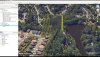
You can already change the transparency of the curtain in the VLM Setup. In "Change Mission Settings" , select the Google Earth tab and then set the curtain opacity to zero. You can also change the colours of the curtain if you don't like my default choice!

I'm glad you are finding VLM useful.

N


Worked like a charm.

Thanks for the quick response.

You have been busy between 2.0 and 2.1! Added a few more setup options have we?!
 
Namirda, I have a spiral Litchi mission set up with the mission settings set to Auto (TNW) in Litchi so the heading is always toward the flight direction.
Looks good in Mission Hub but when I export it, I'm guessing that VLM doesn't handle this (on purpose?) because the virtual flight is spiral but facing the same direction (north I think).
For every waypoint that is exported I see "Warning no heading specified for waypoint xx". Is this by design?


CaptureVLM.JPG
 
Namirda, I have a spiral Litchi mission set up with the mission settings set to Auto (TNW) in Litchi so the heading is always toward the flight direction.
Looks good in Mission Hub but when I export it, I'm guessing that VLM doesn't handle this (on purpose?) because the virtual flight is spiral but facing the same direction (north I think).
For every waypoint that is exported I see "Warning no heading specified for waypoint xx". Is this by design?


View attachment 39242

Hi,

Not really by design - but by necessity! It is a bug in Litchi

When the TNW setting is used in Litchi, they give all waypoints a heading of zero in the csv file rather than using the calculated bearing to the next waypoint. Sadly there is no way for VLM to know if that is what the user intended or if the TNW mode was selected.

VLM therefore simply gives a warning that no heading has been specified.

I think I wrote something to the effect in the help files - you need to explicitly specify the heading at each WP.

N
 
Hi

After my problem whith opening Litchi, today was better for me !!! But what is a solution for don't have this two black band ?

Thank you

Litchi_LI.jpg
 
I have been searching for an answer but wound up here asking namirda... I have most likely tried all the wrong ways to do this...

In Google Earth am I supposed to be able to fly the mission in 'Terrain' mode and see my actual picture and video views?
I always seem to be at ground zero and have a distorted 3d view. I have tried all methods of raising the Way Point altitude; setting start way point as msl. Doing 'Above Ground' on each way point, etc. I have never seen a correct flight.
Do you have a sample flight I could use as a reference?
 
This is something to do with the display resolution settings on your PC.

Please see post #365 on this thread where another user posted a solution.

N

Amazing !!! It's ok now !

Thank you very much for your attention !!!

Another question : Between two Waypoint, i would like that my Air Cam was oriented to see the ground :Heading value is 180° ?
 
Amazing !!! It's ok now !

Thank you very much for your attention !!!

Another question : Between two Waypoint, i would like that my Air Cam was oriented to see the ground :Heading value is 180° ?

If you want your camera pointed straight down towards the ground between two waypoints, you need to set the gimbal pitch to "Interpolate" and set the value to -90 degrees at both waypoints.

Is that what you mean?

N
 
  • Like
Reactions: zigzag84
I have been searching for an answer but wound up here asking namirda... I have most likely tried all the wrong ways to do this...

In Google Earth am I supposed to be able to fly the mission in 'Terrain' mode and see my actual picture and video views?
I always seem to be at ground zero and have a distorted 3d view. I have tried all methods of raising the Way Point altitude; setting start way point as msl. Doing 'Above Ground' on each way point, etc. I have never seen a correct flight.
Do you have a sample flight I could use as a reference?

Hi,

Yes - the virtual mission should look very much like the final video when you fly your mavic.

Please go into Google Earth/Tools/Options/3DView and check that Elevation Exaggeration is set to 1.

If that does not fix your problem then please post an image which demonstrates your issue.

There are many excellent public missions on the Mission Hub which you can open and fly using VLM - it's a good way to see the world! See for example "The Priory and Estuary - ChristChurch" by Taurus35.

N
 
  • Like
Reactions: Hauptmann
One short question:

In VLM the plot of the hight profil (black graph) will shown correctly. As Google Earth Misson, only the max Altitude is shown. Any ideas?

View attachment 40047

View attachment 40046
Hi Joe,

The elevation profile in VLM shows the elevation of the ground (black) and also the elevation of the mission (red). The profile in Google Earth only shows the elevation of the mission which in your case does not have much elevation change.

Take a look at this picture taken from one of my own missions which has quite a lot of elevation changes - you can see that the Google Earth profile matches the VLM one nicely but it does not show the ground elevation. Does that explain it?

N
Capture.JPG
 
Hi,

Yes - the virtual mission should look very much like the final video when you fly your mavic.

Please go into Google Earth/Tools/Options/3DView and check that Elevation Exaggeration is set to 1.

If that does not fix your problem then please post an image which demonstrates your issue.

There are many excellent public missions on the Mission Hub which you can open and fly using VLM - it's a good way to see the world! See for example "The Priory and Estuary - ChristChurch" by Taurus35.

N
The GE exaggeration setting got me up in the air. Looks better. But drone does not fly from WP1 to WP5 at correct elevations and along the path. It does not do POV. It does not fly all the way to the end. Using metric all the way from Litchi to GE. Saving and uploading from your app.
Flying a P4P. Does that make a difference?I am using a plugin called DJI Cameras- Field of View- selected P4P.
Also: I was hoping to find a Litchi mission I could load and see the setup in the mission, export it to my GE and fly it. I can't find the one you mention except on YouTube
 

Attachments

  • upload_2018-6-14_13-5-18.jpeg
    upload_2018-6-14_13-5-18.jpeg
    2.1 MB · Views: 29
Last edited:
The Litchi Mission... I lowered the altitude going over the trees. Got same results as above.
 

Attachments

  • Untitled-2.jpg
    Untitled-2.jpg
    3.5 MB · Views: 23
Hi,

You are using the wrong export option in the Mission Hub.

Please choose "Export as CSV" and NOT "Export as KML 3D Path"

The public mission I mentioned is only one of many you can fly with vlm - you will certainly find it if you scroll down a bit. However, almost any will work fine.

N
 
Last edited:
Perfect!
Hi,

You are using the wrong export option in the Mission Hub.

Please choose "Export as CSV" and NOT "Export as KML 3D Path"

The public mission I mentioned is only one of many you can fly with vlm - you will certainly find it if you scroll down a bit. However, almost any will work fine.

N
Perfect!!! Thank you. The app is very useful.
 
@namirda first off THANK YOU for taking the time to create this and then to SUPPORT it!!

Do you have a "Contribution" path to where we can donate some $$ to you for your efforts and support?

I have downloaded and installed the latest version (I think... Ver 2.1.0) of VLM and it seems to load just fine but when I click on Virtual Mission in GE it suddenly seems to elevate up a couple of thousand feet above where I'm supported to be located and "appears" to fly the mission from that elevation as opposed to the 175' I have for my waypoints.

If I export the 3D path to see what the flight should look like it looks what I would expect but as already stated when I launch the Virtual Flight it ZOOMS sky high automatically. I'm sure it's something simple and painfully obvious but I can't find the solution easily.

Thank you in advance.
Allen
 
First of all, nice app, and thanks for your effort! Do you know if anyone has done a translation for MacOS? If there isn't a Mac version available, is the source code for the Windows version available? I might tackle the translation myself.
 
Lycus Tech Mavic Air 3 Case

DJI Drone Deals

New Threads

Forum statistics

Threads
131,076
Messages
1,559,559
Members
160,055
Latest member
tariqstudio