D
Deleted member 94047
Guest
I would suggest contacting the Litchi development team, they are very responsive usually.
Would you mind sharing Contact information? I must have missed that.I would suggest contacting the Litchi development team, they are very responsive usually.
Would you mind sharing Contact information? I must have missed that.

I haven't used VLM for about a year. I have the latest versions of VLM and GE. It worked fine before now I get this message. I get the same error on two different computers. I always used CSV If I use KML, it goes to GE ok but shows a flightpath that looks like a roller coaster that won't play. Before when I used CSV, it showed a little camera Icon that let me play it.
") and the counter will have been reset and we can now export to GOOGLE EARTH as usual.
and the counter will have been reset and we can now export to GOOGLE EARTH as usual.@namirda
[I will post this here and in the other thread]
Firstly, thank-you again for all the work that you do on this extension - it has made my drone experience far more enjoyable.
I did not have the difficulty with GoogleEarth messages that others have described in joeruby Virtual Litchi Mission, Google Earth Pro error? or post #825 of this thread. The difficulty experienced concerned missions that bumped along the ground.
I have tried my VLM following your re-subscription to Google, and the results are the same - the virtual drone stays at ground level whilst attempting to become a mole (or a submarine) as it moves around the flight path.
The sole difference in the .kml document generated is as reported in #4 of Virtual Mission in Google Earth Pro has stopped working correctly - the setting of altitude for each waypoint is changed:
from a gradually varying <altitude>315.6561584472656</altitude> to a continuous <altitude>40.0</altitude> (since I have set all my waypoints at 40m AGL).
I can see how the GoogleEarth subscription has fixed the problem for others, but when I generate a .kml file today I am experiencing:
View attachment 103739
whereas the same mission exported last week, and rendered by GoogleEarth today, gave:
View attachment 103737
Most importantly: thank you.
Thank you:Hi,
Please provide a link to your mission in the Mission Hub (remember to set it to public viewing) and I will take a look at it.
N

 flylitchi.com
It works now! Thank you! Does a "hit" mean every time I export a file into GE? If so I would limit how much I use it to not hog hits. This is something I never knew about (the google cloud thing). If I have my own account, is it free up untill 1,000 hits ?OK - Problem seems to be solved.
I have "upgraded" my account with Google Cloud Services from a free account to a normal paid account - so the old API key should now work.
I have set a quota on this key of 1000 hits per day which should keep the bills at zero - at least I hope so!
For your info, there are now more than 6000 VLM users and the number of daily hits on the API runs at between 600 and 1000. So at current usage levels, we should not hit the daily limit very often.
View attachment 103727
If you get an error message in the VLM Activity Log saying that the daily limit has been exceeded then you will either have to wait until the next day or else provide your own API key.
Thanks
N
Your Field-of-View setting in VLM is probably wrong
Users of VLM may want to calculate the true field-of-view for their drone, so that simulated framing and composition more closely match the actual result.
For example, the Mavic Air camera is advertised with an 85° FoV, but when it's shooting video, the true FoV is only 74.5°. I expect other models suffer a similar mismatch between specification and video reality.
This post explains the problem and the (fairly simple) solution: Calculating the Video Field-of-View
Neither does mine.I was so excited to see that there was an answer to this problem of VLM's, but alas, mine still does not work, even using the same KML file that used to work.
I have taken a look at your mission and I really can't see much wrong with it. When I open it in VLM I see the following:Thank you:
Mission Hub - Litchi
Litchi's Mission Hub lets you plan waypoint flights and later execute them using the mobile Litchi app.

And next, I dare to consult a couple of matters.
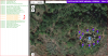
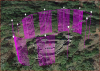
One corresponds to the attached image. It usually happens to me in some of the routes that I am creating but I don't know how to solve it, no matter how much I change heights, delete WP, the problem persists.
And the second, also attached image, is that they comment that they think the route created in relation to the height. Do not you think the drone would go too high? Perhaps it is an optical effect, since the image of the castle is not in 3D
Greetings and thank you very much
Hi,
1) The messages about curve size are not an error - just a warning to inform you that no smoothing of your mission will occur at Waypoints 6, 7 and 8. If you want to remove the message then simply increase the curve size at those waypoints.
2) I don't completely understand your question here - but from your screenshot it does indeed look like the elevations in GE are rather higher than your intended 20m or so. You can check this by clicking on the WP lollipops in GE and check that the elevation values displayed in the tooltip are as you expect.
Hope this helps
N


We use essential cookies to make this site work, and optional cookies to enhance your experience.